Ensuring Utility Line Integrity Through Cutting-Edge Excavation Techniques
In urban infrastructure management, safeguarding existing utility lines during excavation projects is paramount. The integration of advanced methods such as hydrovac, vacuum excavation, borehole drilling, and trenching not only minimizes damage risks but also enhances project efficiency. This article explores the nuanced approaches professionals employ to maintain soil and utility integrity, emphasizing the significance of these techniques in complex urban environments.
Synergizing Hydrovac and Vacuum Excavation for Precision and Safety
Hydrovac technology, characterized by high-pressure water and suction systems, revolutionizes traditional excavation. Its ability to perform non-destructive, pinpoint digging reduces the likelihood of utility strikes. Experts leverage soil stratification insights and sensor-fused mapping to optimize hydrovac operations, especially in congested zones with overlapping lines (source). Vacuum excavation complements hydrovac by providing rapid soil removal while preserving line integrity, making it indispensable in sensitive projects.
Innovative Borehole Strategies for Targeted Ground Penetration
Boreholes serve as critical probes for underground utility detection, supporting real-time assessments. State-of-the-art borehole drilling employs precision-guided systems that adapt to heterogeneous soil conditions, enabling targeted investigations of suspected voids or anomalies (source). By integrating geophysical data and soil analytics, engineers can design borehole strategies that mitigate collapses and avoid accidental utility damage in complex subsurface networks.
Optimizing Trenching for Rapid, Safe Site Preparation
Modern trenching techniques focus on reducing excavation time and limiting soil disturbance. The adoption of mechanized trenchers equipped with real-time soil monitoring sensors allows for adaptive excavation, ensuring trench walls remain stable and utilities are not compromised. Advanced shoring systems, coupled with soil reinforcement compounds, further enhance safety margins under high water tables and unstable strata (source). These innovations exemplify the evolving landscape of trench safety and efficiency.
Integration of Soil Mapping and Remote Sensing in Utility Location
Accurate detection of underground utilities demands sophisticated soil and subsurface imaging technologies. High-resolution ground-penetrating radar (GPR) and electromagnetic locators, combined with soil moisture sensors, enable detailed mapping that guides excavation axes while avoiding critical utility lines (source). These methods are pivotal in urban settings where utility congestion is dense and misidentification can lead to costly damages or service outages.
How Can We Further Minimize Utility Damage in High-Density Urban Zones?
Advancements in subterranean imaging, coupled with machine learning algorithms analyzing soil heterogeneity, promise to elevate safety standards. Continual professional training in emerging technologies and data interpretation remains essential. For ongoing insights, explore this comprehensive guide on integrated borehole and excavation strategies.
Professionals are encouraged to share their field experiences and stay updated on technological developments by engaging with industry forums and specialized publications. The evolving landscape of underground utility management demands a proactive, knowledge-driven approach for safe and effective excavation practices.
Embracing Soil Behavior Insights for Safer Excavations
Understanding soil dynamics is crucial for preventing unexpected collapses and ensuring utility line protection. Advanced soil testing methods, including cone penetrometer testing and shear wave velocity profiling, allow engineers to predict soil response during excavation activities (source). Incorporating this data into excavation planning helps tailor support systems to specific soil conditions, minimizing risks and enhancing project safety.
Deploying Real-Time Soil Monitoring Technologies
Innovative sensor networks embedded within the ground provide continuous feedback on parameters like moisture content, compaction levels, and lateral earth pressures. These real-time insights enable operators to adjust excavation parameters dynamically, preventing trench wall deterioration or utility damage. This approach aligns with the principles of soil-structure interaction and offers a proactive means of soil management in complex urban environments (source). Implementing such technology requires interdisciplinary expertise, blending geotechnical engineering with robotic sensing systems.
Challenging Assumptions: Is Over-Using Soil Stabilizers Beneficial or Detrimental?
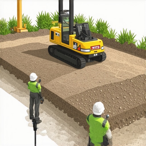
While soil stabilization agents like chemical binders and foam injections are common, their indiscriminate use can sometimes impair the natural drainage and lead to long-term ground weakening. Recent research suggests a nuanced application tailored to specific soil profiles yields better stability without compromising soil integrity (source). Experts advocate for a balanced strategy that combines soil physics understanding with eco-friendly stabilization practices.
Can Data-Driven Soil Models Revolutionize Urban Utility Excavations?
Absolutely. The integration of machine learning algorithms with extensive soil and utility datasets holds promise for predictive modeling that can forecast potential failure zones before excavation begins. This proactive planning significantly reduces unexpected incidents, saving time and costs. Professionals leveraging these models can anticipate challenges and prepare targeted mitigation measures, transforming traditional reactive strategies into predictive, precision-focused operations. To explore cutting-edge modeling techniques, review the comprehensive guide on advanced borehole and excavation planning.
Engagement from practitioners sharing their experiences with soil behavior monitoring and modeling enriches the collective expertise, fostering safer and more efficient excavation standards across the industry.
Embracing AI-Powered Subsurface Imaging for Unparalleled Accuracy
Harnessing artificial intelligence (AI) in geophysical imaging marks a turning point in underground utility detection. By integrating machine learning algorithms with high-resolution GPR and electromagnetic surveys, engineers can decipher complex subsurface patterns with remarkable precision (source). These systems analyze massive datasets to predict utility line locations, orientations, and potential hazards—reducing dependency on manual interpretation and minimizing the risk of utility strikes.
How does AI refine utility detection accuracy beyond traditional methods?
AI algorithms identify subtle anomalies and patterns in geophysical data that human analysts might overlook, especially in urban areas with dense utility congestion. By continuously learning from new datasets, these models improve their predictive capabilities, leading to faster decision-making and safer excavations. As this technology evolves, it promises to become an indispensable tool in the arsenal of underground infrastructure management, prompting professionals to consider investing in AI-integrated survey systems for future projects.
To stay ahead in underground utility detection, industry leaders should explore collaborations with geophysical data scientists and invest in training programs that demystify AI applications within geotechnical engineering.
Redefining Soil Stabilization for Sustainable Excavations
Traditional soil stabilization techniques often deploy chemical agents that, while effective temporarily, risk long-term environmental and ground stability issues. Recent advances advocate for bio-based stabilizers derived from natural polymers and microbial processes, which enhance soil cohesion without adverse ecological impacts (source). These eco-friendly solutions not only meet regulatory standards but also align with sustainable infrastructure development.
Can natural soil stabilization methods outperform chemical options?
Emerging research indicates that bio-stabilization can match or surpass chemical counterparts, especially in sensitive environments requiring minimal chemical intrusion. Microbial-induced carbonate precipitation (MICP), for example, promotes calcium carbonate formation, cementing soil particles seamlessly. Implementing such methods demands a nuanced understanding of local soil microbiology and environmental conditions, making multidisciplinary expertise essential for success. For project managers committed to sustainability, pilot programs integrating bio-stabilizers should be a strategic priority.
Interested professionals should consult recent case studies demonstrating successful bio-augmentation in urban venues to assess feasibility and long-term benefits.
The Role of Real-Time Data Analytics in Dynamic Excavation Control
As excavation equipment becomes smarter, real-time data streams from embedded sensors provide continuous feedback on soil conditions, utility proximity, and equipment performance (source). These insights empower operators to make immediate adjustments, optimizing trench stability, utility safety, and operational efficiency. Predictive analytics identify early warning signs of soil instability or potential utility damages, enabling preemptive actions rather than reactive repairs.
What are the challenges in implementing comprehensive real-time monitoring systems?
While the benefits are substantial, obstacles include sensor integration complexity, data management, and the need for specialized training. Ensuring sensor durability in harsh excavation environments and designing intuitive interfaces for field personnel are critical considerations. Overcoming these hurdles requires a collaborative effort among geotechnical experts, software engineers, and field technicians. Progress in rugged sensor technology and user-centered design continues to make these systems more accessible and reliable, paving the way for fully adaptive excavation operations.
Readers interested in deploying such systems should evaluate emerging technological platforms and pilot their integration on controlled projects to gauge ROI and performance gains.
Unlocking the Potential of Machine Learning in Ground Penetrating Radar Analysis
The integration of machine learning algorithms with ground-penetrating radar (GPR) data stands to transform underground utility mapping. By training models on vast datasets of subsurface images, engineers can discern complex utility line patterns with unprecedented accuracy, especially in interference-heavy urban landscapes (source). This convergence of geophysics and artificial intelligence offers a scalable solution that surpasses traditional interpretation methods, minimizing costly utility strikes and excavation delays.
How Can Deep Learning Techniques Differentiate Between Utility and Non-Utility Anomalies?
Deep learning models, particularly convolutional neural networks (CNNs), excel at pattern recognition within complex datasets. When trained on labeled subsurface images, these algorithms can distinguish true utility lines from soil anomalies or debris, even under high noise conditions. Such precision stems from their ability to learn hierarchical feature representations, effectively filtering out false positives and highlighting critical hazards before drilling commences (source). Embracing these technologies empowers professionals to adopt a predictive, data-driven approach, rather than reliance on subjective interpretation or limited sensor data.
Expert Insights & Advanced Considerations
Leverage Multidisciplinary Approaches for Zero Damage
Integrating geotechnical engineering, geophysics, and data analytics enhances accuracy in utility detection, reducing costly errors and project delays.
Prioritize Real-Time Adaptive Technologies
Real-time soil monitoring and sensor networks enable immediate adjustments during excavation, fostering safer and more efficient operations.
Invest in Personnel Training on Emerging Tools
Continual education ensures field teams effectively utilize advanced equipment like AI-augmented GPR systems and soil sensors, maximizing their benefits.
Adopt Eco-Friendly Soil Stabilization Techniques
Bio-stabilizers and microbial treatments offer sustainable alternatives that improve ground stability without environmental compromise.
Advance Subsurface Imaging with Machine Learning
Machine learning-driven analysis of geophysical data can predict utility line locations with remarkable precision, minimizing strikes.
Curated Expert Resources
- Hydrovac Technology and Soil Safety: Essential reading for understanding how hydrovac systems optimize safe excavation in complex soils; source.
- Advanced Borehole Strategies: A comprehensive guide to precision-guided drilling techniques supporting utility detection; source.
- Soil Mapping and Remote Sensing Applications: Cutting-edge methods for underground utility localization in urban terrains; source.
Final Expert Perspective
Synthesizing insights from advanced excavation techniques underscores the critical importance of a proactive, technology-driven approach to underground utility management. Embracing innovations like AI-enhanced soil imaging and sustainable stabilization not only elevates safety standards but also maximizes project efficiency. As the industry pushes forward, professionals are encouraged to deepen their expertise through curated resources and active dialogue, shaping a safer and more precise future in underground civil works. Engage with industry peers, contribute your field experiences, and stay at the forefront of this dynamic evolution—your expertise shapes the landscape of safe excavation practices.