Redefining Subsurface Diagnostics: Why Ground Penetrating Radar-Generated False Positives Undermine Trenching and Borehole Accuracy
In the realm of modern excavation and subsurface assessment, ground penetrating radar (GPR) stands out as an indispensable tool, offering non-invasive insights into soil composition and buried utilities. However, the reliability of GPR is often compromised by false positives, which can lead to costly delays and safety concerns. Recognizing the underlying causes of these inaccuracies is critical for groundwater and civil engineering professionals aiming for precise trenching and borehole excavation.
Deciphering the Complexity of Soil Conditions and Material Interference
One predominant factor influencing false positive rates in GPR detections relates to soil heterogeneity and moisture content. Wet soils, especially clay-rich layers, can produce high dielectric contrasts that mimic the signals of man-made utilities, thereby confusing detection algorithms. Moreover, soil stratification and mineral deposits further complicate the electromagnetic wave propagation, leading to ambiguous reflections that are mistaken for utilities or voids. This challenge is well-documented in academic studies such as those published in the Measurement journal, highlighting the importance of contextual soil analysis for field accuracy.
Material Overlaps and Signal Ambiguity: The Hidden Culprits
Beyond soil conditions, the presence of non-metallic utilities, plastic pipes, and fiber optics contribute to the phenomenon of false positives. These materials can produce weak or misleading electromagnetic reflections, especially if buried close to metallic objects or within complex underground networks. Additionally, debris, rocks, or roots can reflect signals similar to subsurface anomalies, leading to misinterpretations. Expert practitioners must therefore leverage advanced signal processing techniques and multi-sensor integration to distinguish genuine targets from misleading clutter.
Why Do Ground Penetrating Radar False Positives Persist Despite Technological Advances?
This persistent issue emerges from limitations in current GPR resolution and the inability to adapt dynamically to highly variable subsurface conditions. While innovations such as ultra-wideband frequencies and machine learning algorithms enhance detection, they are not foolproof across all soil types and utility configurations. Consequently, hybrid methodologies combining GPR with other diagnostic tools like electromagnetic inductive surveys or borehole correlators are often employed to validate findings, highlighting the importance of a multi-modal approach in critical underground projects. For further insights into integrated detection strategies, consult this comprehensive guide.
In the pursuit of trenching and borehole precision, field teams should prioritize rigorous soil testing pre-survey, calibrate GPR equipment meticulously, and always corroborate electromagnetic signals with physical inspections. The high stakes of utility strikes and environmental protection demand an expert-level understanding that goes well beyond surface-level readings.
If you are involved in advanced subsurface investigations, consider contributing your insights to our community or exploring tailored training modules on optimizing GPR deployment in complex soil profiles. Continuous professional development and rigorous field validation remain the pillars for overcoming the pervasive challenge of false positives in ground penetrating radar applications.
Adapting GPR for Unique Soil Profiles: The Key to Reducing False Positives
One of the most effective strategies to mitigate false positives in GPR surveys involves comprehensive pre-survey soil characterization. By conducting detailed soil analysis and moisture profiling, specialists can tailor the GPR settings—for example, adjusting frequency or pulse duration—to match specific subsurface conditions. Such calibration ensures the electromagnetic waves are optimally configured to penetrate anticipated soil layers without excessive reflections, thus improving the reliability of utility detections. Integrating data from soil sampling and geophysical surveys enhances the precision of these calibrations, establishing a more accurate underground utility map before invasive methods are employed.
Leveraging Artificial Intelligence to Differentiated Static and Dynamic Signals
Emerging AI-based processing techniques represent a significant advancement in interpreting complex GPR data, especially in challenging environments riddled with signals from debris or natural mineral inclusions. Deep learning algorithms trained on labeled datasets can identify subtle patterns distinguishing true utility reflections from false positives caused by soil heterogeneity. Platforms incorporating such AI-driven analytics have demonstrated promising results in real-world drills, maintaining high detection accuracy even in moist clay or gravelly substrates. For practitioners, embracing these tools means moving beyond traditional interpretation—adding a layer of algorithmic validation that supports decision-making and minimizes costly errors.
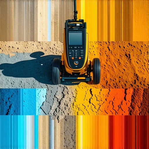
Are We Overselling GPR’s Capabilities in Complex Subsurface Settings?
This question challenges the assumption that technological sophistication alone guarantees accuracy. While state-of-the-art GPR systems and data processing techniques have certainly improved, their effectiveness hinges on accurate implementation, including calibration, environmental awareness, and operator expertise. Overreliance on technology without contextual validation can foster complacency, leading to overlooked anomalies. For optimal results, field teams should adopt a multi-method approach, combining electromagnetic surveys with controlled excavation or borehole verification, aligning with best practices outlined in this authoritative resource. In high-stakes projects, integrating diverse diagnostic methods ensures comprehensive safety and utility detection.
Engagement from professionals across disciplines—geophysicists, civil engineers, and environmental specialists—is essential for refining these techniques. Sharing insights, case studies, and innovations collectively strengthens the industry’s capacity to accurately interpret complex subsurface environments. For further reading on advancing your utility detection methods, explore this detailed guide to borehole techniques.
Integrating Multi-Modal Geophysical Surveys for Enhanced Reliability
To overcome the persistent challenge of false positives in ground penetrating radar (GPR) data, industry experts advocate for a holistic approach that combines multiple geophysical techniques. Electromagnetic induction (EMI), seismic refraction, and resistivity imaging can cross-validate GPR findings, significantly reducing the risk of misinterpretation. Cross-referencing these datasets allows for a more nuanced understanding of subsurface anomalies and helps distinguish between natural geological features and man-made utilities. Implementing such integrated surveys demands comprehensive planning and technical expertise but ultimately results in higher confidence levels—crucial for safeguarding infrastructure during trenching projects.
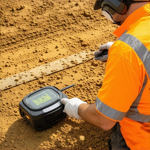
Technology-Driven Calibration: Customizing GPR Settings for Precision
The variability inherent in subsurface environments necessitates meticulous calibration of GPR equipment before deployment. Modern systems now enable real-time adjustability of parameters such as pulse repetition frequency, bandwidth, and antenna coupling based on preliminary soil assessments. Employing portable soil moisture sensors and dielectric constant measurements informs these settings, ensuring optimal signal penetration and clarity. This tailored calibration not only enhances utility detection accuracy but also minimizes false positives caused by overly sensitive or inadequate configurations. As calibration techniques evolve, so does the potential for deploying GPR in increasingly complex environments with confidence.
Mastering the Art of Subsurface Discrimination Through Advanced Data Fusion
In complex geological environments, relying solely on ground penetrating radar (GPR) can lead to ambiguous interpretations due to signal overlaps and environmental noise. To elevate accuracy, integrating multiple geophysical methods—such as electromagnetic induction, magnetic susceptibility, and seismic surveys—creates a composite image that filters out false positives, providing clarity in utility mapping. Combining these datasets requires sophisticated processing algorithms and an understanding of each method’s sensitivity profiles, enabling professionals to distinguish true utilities from natural artifacts with high confidence.
Harnessing Machine Learning for Real-Time Anomaly Classification
Recent developments in artificial intelligence have paved the way for on-the-fly analysis of complex GPR datasets. Machine learning models, trained on extensive labeled data, can now classify reflections, flagging plausible utilities while disregarding benign geological features. This technology reduces operator bias and accelerates decision-making processes. For optimal deployment, datasets should encompass diverse soil types and utility configurations, ensuring models generalize well across varied environments. Further, continuous learning frameworks allow for adaptive improvements as new data becomes available, tightening the gap between detection and verification.
Does Soil Microstructure Significantly Influence GPR Signal Fidelity?
Subsurface soil microstructure, including pore size distribution, mineralogy, and organic content, plays a crucial role in shaping electromagnetic wave propagation. Fine-grained clay particles with high surface area can trap moisture, creating dielectric contrasts that mimic utility signatures. Conversely, granular soils with high porosity may attenuate signals, obscuring targets. Understanding these microstructural variations aids specialists in calibrating equipment more precisely and interpreting anomalous reflections more accurately. For extensive projects, integrating microstructural analyses with geophysical surveys enhances predictive models, streamlining trenching operations and reducing costly misinterpretations.
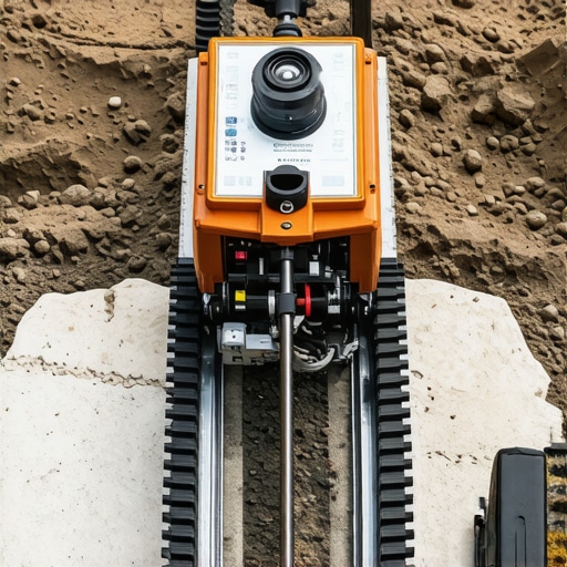
What Are the Impacts of Frequency Selection on Detection Precision and False Positives?
The choice of GPR operating frequency profoundly affects the resolution and depth of penetration. Higher frequencies (>1 GHz) offer greater detail but are more susceptible to signal attenuation and surface clutter, increasing the likelihood of false positives in heterogeneous soils. Conversely, lower frequencies (<100 MHz) penetrate deeper with less detail, which can lead to ambiguous signals. Selecting an optimal frequency band involves balancing depth requirements against resolution sensitivity, tailored to site-specific conditions. Advanced systems now feature multi-frequency antennas, enabling dynamic adjustment during surveys, which enhances utility identification accuracy in complex subsurface landscapes.
Collaborative Standards: Elevating Accuracy via Industry-Wide Protocols
Consistent, high-quality subsurface detection hinges on standardized procedures and shared best practices. Industry organizations like the American Society of Civil Engineers (ASCE) advocate for rigorous calibration protocols, operator certification, and comprehensive site assessments before survey initiation. Developing unified data formats and interpretation frameworks fosters interoperability between different sensor systems and streamlines cross-project validations. These standards empower practitioners to produce reliable, comparable results, facilitating decision-making and minimizing the incidence of false positives stemming from methodological inconsistencies. Engaging with these standards ensures continuous improvement and trustworthiness within the field.
Unveiling the Role of Subsurface Pathologies in Signal Anomalies
Unusual subsurface features such as voids, collapses, or contamination zones can generate atypical electromagnetic reflections, complicating utility detection. Cracks filled with moisture or biofilms may produce signals akin to metallic pipes, while buried debris piles can mimic utility lines. Recognizing the signatures of these pathologies demands expert interpretation and often necessitates supplementary investigation methods, including borehole logging or core sampling. Developing an in-depth understanding of local geological history and contamination profiles allows professionals to differentiate between genuine utility and pathological anomalies, thereby refining survey accuracy and project safety.
Beyond the Surface: Strategic Insights for Precision
Prioritize Multifaceted Validation Techniques
In high-stakes subsurface investigations, integrating GPR with complementary methods such as electromagnetic induction and resistivity imaging creates a layered verification process. This comprehensive approach significantly reduces false positives and enhances confidence in utility detection, especially in complex soil conditions. Experts recommend adopting a hybrid survey methodology to ensure accuracy before invasive procedures.
Tailor Calibration to Subsurface Realities
Dynamic calibration of GPR equipment based on detailed pre-survey soil analyses allows for optimized settings. Adjustments in frequency and pulse parameters, informed by soil moisture and stratification data, improve signal clarity and target discrimination. This customization is crucial for mitigating false positives caused by environmental heterogeneity.
Leverage Artificial Intelligence Thoughtfully
Deploying machine learning algorithms trained on extensive, labeled datasets enables real-time differentiation between true utilities and natural artifacts. Careful application of AI augments professional judgment and reduces misinterpretation risks, especially in challenging terrains with cluttered signals.
Incorporate Continuous Professional Development
Field practitioners should engage regularly in advanced training and knowledge sharing to stay abreast of technological innovations and best practices. Certification programs and industry standards serve as guides for maintaining high operational accuracy and reducing the incidence of false positives.
Valuable Knowledge From Leading Resources
- American Geophysical Union (AGU) Publications: Offers cutting-edge research on geophysical survey techniques and soil characterization methods, vital for understanding complex subsurface environments.
- International Society of Soil Science: Provides insights into soil microstructure and moisture content impacts, essential for tailoring GPR calibration.
- IEEE Geoscience and Remote Sensing Society: Publishes advancements in AI applications and data fusion strategies that improve detection reliability.
Reflecting on the Ground Penetrating Radar Frontier
In mastering the art of subsurface detection, expert professionals recognize that the synergy between technological innovation and methodical validation defines success. The challenge of false positives in ground penetrating radar underscores the necessity for an integrated, adaptive approach—one that combines cutting-edge AI, thorough soil analysis, and multi-sensor validation. For those committed to precision, continuous engagement with industry-leading resources and active knowledge sharing paves the way for groundbreaking advancements. Engage with the community, contribute your insights, and explore tailored training modules to elevate your expertise in complex underground environments.