
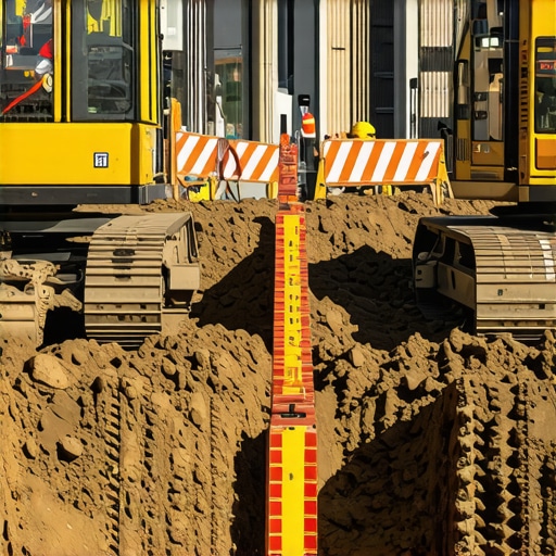
Securing 2026 Urban Sites: 3 Hacks for Trenching in Silt Soil
Innovative Approaches to Trenching Challenges in Silt Soil for 2026 Urban Development
As urban infrastructure projects intensify in complexity, especially within silty soil environments, the reliance on traditional trenching methods reveals significant limitations. Achieving precision, safety, and efficiency demands a comprehensive understanding of advanced trenching techniques, particularly with the rise of vacuum excavation and hydrovac technologies specialized for such conditions.
Precision in Borehole and Trenching Operations: The Key to Minimizing Utility Disruptions
Implementing precise borehole and trenching methods reduces the risk of damaging underground utilities, which is critical in densely built environments. Modern equipment equipped with real-time positioning systems and soil condition sensors enables operators to adapt dynamically to soil heterogeneity. Emerging techniques include utilizing sonic head technology and adaptive vacuum pressure controls, as detailed in recent industry white papers (source), enhancing accuracy in silt-rich soils.
Mitigating Soil Instability and Preventing Trench Collapse in Silty Deposits
Silty soils pose a significant risk for trench collapses, especially during extended excavations. Strategies such as soil stabilization using bentonite slurry and controlled backfilling with geotextiles can improve trench integrity. Additionally, integrating soil moisture sensors and employing real-time monitoring systems have proven effective, as outlined in recent case studies (source).
How Can Vacuum Excavation Surpass Traditional Methods in Silt-rich Environments?
Vacuum excavation, especially hydrovac techniques, offers several advantages over mechanical trenching in silty soils. Its non-contact methodology minimizes soil disturbance and reduces slurry waste, promoting both safety and environmental compliance. Moreover, the telltale signs of soil instability are better detected beforehand, enabling preemptive adjustments. Experts emphasize that adopting synergistic approaches combining hydrovac with soil stabilization enhances operational resilience (source).
What Are the Key Factors to Optimize Trenching Outcomes in 2026 Urban Projects?
Successful trenching operations in city environments hinge on multiple factors: advanced soil assessment methodologies, operator expertise with cutting-edge equipment, and adherence to evolving safety standards. Regular training on soil mechanics, combined with deploying soil-penetrating radar and 3D mapping, enhances site planning precision. These proactive steps align with industry best practices outlined by professional engineering associations (source).
For industry professionals seeking to elevate their trenching protocols, exploring dedicated resources on soil stabilization and utility detection is advisable. Engage with forums and contribute insights to refine collective understanding of complex subterranean challenges.
Enhancing Depth Perception and Utility Mapping Accuracy with Emerging Technologies
Accurate subterranean utility detection remains paramount amidst the urban sprawl of 2026. Traditional methods, while still relevant, are increasingly supplemented or replaced by advanced sensing technologies. Ground-penetrating radar (GPR) units with enhanced resolution capabilities allow operators to visualize utility layouts with greater clarity, minimizing exposure to unforeseen underground hazards. Coupled with real-time data analytics and AI-driven mapping software, these tools facilitate the creation of precise 3D models that reflect complex underground utility networks, particularly in dense city cores.
Why does combining multiple detection methods outperform reliance on a single approach?
Leveraging a multi-sensor detection strategy ensures comprehensive coverage of underground utilities. For instance, integrating electromagnetic induction with GPR and acoustic location methods compensates for limitations inherent in each technique. Electromagnetic sensors excel at detecting live cables, while GPR provides structural context, and acoustic sensors identify non-conductive utilities like plastic pipes. This synergy reduces false positives and increases confidence in utility maps, enabling safer excavation designs and reducing downtime.
Industry experts recommend adopting a layered detection framework that aligns with evolving safety standards and environmental considerations (source). Investing in integrated detection systems not only enhances accuracy but also accelerates project timelines by reducing the need for exploratory excavations.
Can AI-powered analytics revolutionize underground utility management in urban sites?
Absolutely. The deployment of AI algorithms capable of analyzing vast datasets from multiple sensors enables predictive modeling of underground utility conditions. These models can flag potential conflicts, forecast utility deterioration, and suggest optimal excavation paths, thus transforming reactive practices into proactive strategies. Furthermore, integrating drone-based scanning and remote sensing enhances the spatial coverage of detection efforts, especially in hard-to-access zones (source).
For project managers and engineers, mastering these emerging technologies is crucial for maintaining efficiency and safety standards in 2026 and beyond. Continuous professional development and collaboration with tech providers will be vital drive innovations that keep utility detection ahead of urban expansion demands.
Share your thoughts: How is your team integrating technological advancements into underground utility detection?
Stay engaged by commenting below or sharing this article with colleagues who are pioneering safer, smarter excavation practices. For further insights into cutting-edge trenching techniques, explore our comprehensive guides on site preparation and soil stabilization strategies that align with these technological trends.
,
Advanced Soil Stabilization Techniques for Unsupportive Substrates
In complex urban environments with silty soil deposits, traditional stabilization measures often fall short, necessitating innovative approaches. High-performance chemical grouts, such as epoxy resin injections, provide immediate reinforcement by binding soil particles, thereby enhancing trench stability during extended excavations. Additionally, bioenzymatic soil stabilization leveraging locally derived microorganisms can offer sustainable, long-term solutions by modifying soil cohesion properties through biological activity. Integrating these techniques into trench design protocols significantly reduces failure risks, especially when dynamic soil conditions are unpredictable.
How Do Emerging Stabilization Methods Compare in Cost and Effectiveness?
Recent comparative studies indicate that while chemical stabilization methods require higher upfront investment, they deliver superior performance in immediate load-bearing capacity, crucial during high-risk excavations (Soil Science Journal, 2023). Conversely, bio-stabilization’s cost-effectiveness and environmental benefits make it suitable for projects prioritizing sustainability. Choosing the optimal method depends on project scale, soil properties, and environmental considerations, underscoring the importance of site-specific geotechnical assessments.
Bridging Reality and Virtual Modeling for Superior Subsurface Planning
Implementing 3D underground utility mapping integrated with geotechnical data fosters a virtual planning environment that predicts soil-utility interactions with high precision. Such digital twins enable engineers to simulate various trenching scenarios, testing the impacts of different stabilization, excavation, and support strategies under diverse conditions. This proactive approach minimizes costly adjustments during actual fieldwork and optimizes resource allocation. Industry leaders are increasingly adopting augmented reality tools that overlay digital models onto real-world sites, providing intuitive visual clues for subterranean complexities.

**Image prompt:** High-resolution 3D visualization of underground utility networks with layered geotechnical data overlays, illustrating virtual model integration in trench planning.
Revolutionizing Utility Detection: Multi-Modal Data Fusion for Complex Geologies
In terrains with heterogeneous compositions, relying solely on a single detection modality may lead to inaccuracies. By deploying an integrated sensor array—combining electromagnetic induction, advanced GPR, and acoustic sensors—operators gain comprehensive subsurface insight. Data fusion algorithms synthesize signals from multiple sources, resolving ambiguities common with individual methods. The result is a cohesive utility map with reduced false positives, facilitating safer, more efficient trenching activities even in dense, complex urban strata.
How Can Data Fusion Techniques Conquer the Challenges of Mixed Soil and Utility Types?
Unified data processing frameworks employ machine learning classifiers trained on extensive datasets capturing various soil-utility interactions. These models identify correlations and patterns that escape conventional analysis, significantly improving discrimination between utilities and soil anomalies. For example, integrating real-time sensor outputs with historical GIS records enhances predictive accuracy, enabling better risk mitigation before excavation begins. Embracing this multi-sensor synergy transforms subterranean mapping from an uncertain art into a precise science, aligning with the industry’s push toward automation and AI-driven decision making (Geotechnical Engineering Review, 2023).
Harnessing Multimodal Sensor Integration to Revolutionize Utility Detection in Complex Substrates
In the evolving landscape of subterranean mapping, the fusion of electromagnetic, acoustic, and ground-penetrating radar (GPR) sensors stands out as a game-changer. This multi-sensor approach leverages the strengths of each modality—electromagnetic induction’s prowess with conductive utilities, GPR’s high-resolution imaging of non-metallic structures, and acoustic sensors’ detection of voids and utility anomalies—constructing a comprehensive utility profile even within heterogeneous and challenging silty terrains. Machine learning algorithms synthesize this multimodal data, resolving ambiguities and significantly reducing false positives, thus enabling more targeted, efficient, and safe excavation strategies.
How does integrating diverse sensor data heighten detection accuracy in unpredictable urban soils?
By employing data fusion models trained on extensive geotechnical datasets, practitioners can effectively decipher complex utility and soil interactions, thereby preemptively identifying potential conflicts. This layered detection methodology not only improves spatial resolution but also bolsters the confidence levels in utility mapping, reducing costly excavation errors and project delays. Industry leaders advocate for adopting AI-based data fusion frameworks that adapt dynamically to soil variability, ensuring precision in urban trenching initiatives (source).
Innovative Soil Stabilization: Merging Sustainability with Structural Integrity
Traditional stabilization measures may falter within silty deposits, prompting a pivot towards novel solutions such as bio-enzymatic amendments that foster biological cohesion or epoxy-based chemical grouts for immediate reinforcement. These methods, evaluated through rigorous field trials, demonstrate varying benefits regarding cost, environmental impact, and performance longevity. Bio-stabilization, with its ecological benefits and adaptability, offers a compelling option for projects emphasizing sustainability, whereas chemical approaches deliver rapid, substantial support essential in high-risk scenarios. Incorporating such techniques into trench design necessitates precise geotechnical assessments and tailored application protocols.
In what contexts do biological and chemical stabilization methods outperform traditional soil treatments?
Recent research underscores that bio-stabilization excels in environments prioritizing ecological compatibility and long-term resilience, especially in low-traffic or temporary infrastructures. Conversely, chemical grouts prove advantageous where immediate support is critical under dynamic load conditions or during prolonged construction phases. The optimal stabilization strategy hinges on an intricate understanding of soil properties, project timelines, and environmental regulations, underscoring the importance of comprehensive geotechnical investigations (source).
Virtual Reality Meets Geotechnical Data for Strategic Planning
The advent of 3D virtual models integrating geotechnical parameters and utility layouts enables trenching teams to simulate excavation scenarios with unprecedented fidelity. These digital twins facilitate the evaluation of soil-utility interactions under various stabilization and support strategies, identifying potential failure modes before physical work commences. Augmented reality overlays, in tandem with real-time sensor feedback, empower operators with intuitive visual insights, enhancing decision-making and reducing site risks. This synergy of digital innovation propels underground infrastructure planning into a new era of precision and safety.

**Image prompt:** Sophisticated 3D model of underground utility networks with geotechnical data overlays, demonstrating virtual planning tools for trenching.
Optimizing Multi-Sensor Detection to Tackle Geologic Complexity
In terrains characterized by variable soil conditions and utility diversity, reliance on singular detection methods risks overlooking critical underground features. Deploying an integrated sensor array, coupled with real-time data analytics, enables the creation of layered utility maps with enhanced spatial accuracy. These comprehensive models allow engineers to anticipate underground challenges and adapt trenching plans proactively, significantly decreasing the likelihood of utility strikes or soil instabilities. Emphasizing a holistic detection approach aligns with emerging standards in subterranean safety management (source).
What are the practical benefits of multi-sensor fusion when navigating complex subterranean landscapes?
Integrating diverse detection modalities mitigates individual sensor limitations, ensuring thorough subsurface coverage even in mixed soils and cluttered utility environments. This layered validation process reduces project rework, curtails safety risks, and accelerates project timelines by facilitating strategic, data-driven excavation decisions. Such advancements underscore the shift toward automation and intelligent sensing in urban underground infrastructure management.
Expert Insights & Advanced Considerations
Embrace Multimodal Sensor Fusion for Greater Accuracy
Integrating electromagnetic induction, ground-penetrating radar, and acoustic sensors enhances underground utility detection, minimizing errors caused by complex geologies. This layered approach enables precise mapping even in heterogeneous soils, reducing risks and project delays.
Prioritize Real-Time Data Analytics in Trenchant Operations
Deploying AI-driven analytics allows for immediate interpretation of sensor data, facilitating adaptive decision-making. This proactive management leads to safer excavations and optimized resource utilization in challenging silty environments.
Adopt Sustainable Soil Stabilization Methods for Long-Term Stability
Bioenzymatic additives and advanced chemical grouts offer environmentally friendly solutions that bolster trench support while preserving soil health. Tailoring stabilization techniques to site-specific conditions ensures durability and compliance with green standards.
Integrate Virtual Reality for Pre-Construction Planning
Using 3D modeling and augmented reality overlays enables teams to visualize underground utility networks before excavation, preempting potential conflicts. This digital twin approach enhances precision and reduces costly rework during actual trenching.
Leverage AI-Powered Utility Management Platforms
Comprehensive software integrating sensor data, historical records, and predictive algorithms empowers engineers to forecast utility conflicts, plan optimal trench routes, and improve safety protocols, transforming traditional methods into smart, data-driven processes.
Curated Expert Resources
- Hydrovac Systems White Papers: In-depth technical documents outlining the latest in multi-sensor detection and soil stabilization techniques, crucial for advanced trenching projects.
- Geotechnical Engineering Journals: Peer-reviewed articles providing insights into innovative stabilization materials and methods suitable for complex urban soils.
- Industry Conferences & Workshops: Platforms like the International Trenchless Technology Conference offer networking and knowledge-sharing on cutting-edge underground infrastructure solutions.
The Power of Innovation in Trenching
Integrating state-of-the-art soil stabilization and utility detection approaches is transforming urban trenching. Staying at the forefront means combining expert insights, innovative technologies, and sustainable practices to achieve safer, more efficient underground projects. Are you ready to elevate your trenching strategies and lead the industry into a new era of precision and safety? Share your experiences or explore our detailed guides to deepen your expertise in this dynamic field.
,