Unlocking Expert Strategies for Conduit Identification in Modern Excavation Projects
In the realm of vacuum excavation and trenching, the accurate identification of non-metallic conduits, such as plastic fiber optic or PVC pipes, remains a complex challenge that demands innovative solutions beyond traditional tracer wire methods. As underground utility networks grow increasingly intricate, excavation professionals must leverage advanced detection technologies to mitigate risks and ensure operational safety.
The Limitations of Conventional Tracer Wire Systems in Borehole Detection
While tracer wires have long served as the gold standard for utility mapping, their effectiveness diminishes when dealing with non-metallic conduits that lack electromagnetic signatures. These limitations often result in costly damages, service disruptions, and safety hazards. Modern hydrovac and vacuum excavation operations increasingly require alternative approaches that combine precision with non-invasive techniques.
Electromagnetic and Acoustic Methods: The New Standard in Utility Detection
Can GPR and Low-Frequency Induction Replace Traditional Tracing?
Ground Penetrating Radar (GPR) has emerged as a pivotal tool in non-metallic conduit detection. By emitting electromagnetic signals capable of reflecting off dielectric materials, GPR provides detailed subsurface imaging even in challenging soil conditions, such as saturated clay or high-mineral environments (source). Complementing GPR, low-frequency electromagnetic induction tools detect the presence of conductive anomalies, including metallic or semi-conductive plastics, enhancing the accuracy of underground utility mapping.
Expert operators also utilize acoustic locators, which analyze sound waves transmitted along conduit walls, facilitating identification without physical contact. These technologies, when integrated into a layered detection approach, substantially improve the reliability of locating non-metallic pipelines during hydro excavation or trenching.
Soil Composition: The Critical Variable in Detection Accuracy
The success of electromagnetic detection hinges heavily on soil conditions. Saturated or mineral-rich soils attenuate electromagnetic signals, leading to false negatives or loss of signal. Therefore, experts often perform soil testing and calibration before deploying GPR or induction devices. Innovations such as multi-frequency systems allow operators to adapt to diverse soil profiles, thereby maintaining detection fidelity across challenging environments.
Emerging Detection Methods and Future Directions
The integration of machine learning algorithms with geophysical data promises a new frontier in utility detection, enabling real-time interpretation of complex subsurface signals. Additionally, non-invasive techniques like infrared thermography, when conducted from surface control points, offer supplementary insights in specific contexts. As research progresses, best practices are likely to evolve towards multi-modal detection systems that combine electromagnetic, acoustic, and visual data for comprehensive underground mapping.
Ensuring Safety and Accuracy in Hydro Excavation Without Tracer Wires
Effective identification of non-metallic conduits is paramount for safe and efficient trenching, especially when employing hydrovac techniques that minimize surface disturbance. Leveraging advanced geophysical methods, combined with meticulous soil assessment, can mitigate the risk of utility strikes, reduce project delays, and uphold regulatory compliance.
How can industry professionals optimize detection strategies for complex underground utility networks?
Engaging in continuous training, investing in multi-sensor detection equipment, and collaborating with utility owners for comprehensive mapping data are essential steps. For more detailed insights, explore this expert guide.
As the underground infrastructure landscape becomes more sophisticated, staying informed about emerging detection technologies and soil interaction principles is critical. Sharing field-tested strategies among professionals can elevate safety standards and operational efficiency in vacuum excavation and trenching projects.
Adapting Detection Techniques to Diverse Soil Conditions Redefines Safety Goals
Subsurface soil variability remains a significant factor influencing the efficacy of non-invasive utility detection methods. For instance, heavily saturated soils and mineral-rich terrains frequently weaken electromagnetic signals, complicating the identification of non-metallic conduits. To overcome this, professionals are now integrating multi-frequency GPR systems designed to adjust dynamically to soil profiles, thereby enhancing detection accuracy in challenging conditions. Such innovations align with the latest industry standards, ensuring that safety and efficiency are not compromised even in the most demanding environments (source). 💡
The Potential of Integrated Multi-Modal Sensing for Complex Utility Mapping
Emerging detection methodologies leverage a combination of electromagnetic, acoustic, and visual technologies to construct comprehensive underground utility maps. This layered approach helps distinguish between multiple existing infrastructure types—metallic, plastic, or composite—by correlating data points across sensing modalities. For example, combining GPR with acoustic wave analysis improves the recognition of semi-conductive plastics that traditionally evade electromagnetic detection. Such integrative strategies exponentially decrease the likelihood of utility strikes during vacuum excavation, particularly in densely populated urban areas with overlapping infrastructure layers (source).
Is Your Team Ready To Innovate with Cutting-Edge Detection Systems?
Staying ahead of the curve demands continuous professional development and a proactive approach to technology adoption. By investing in training and multi-sensor detection equipment, teams can significantly mitigate risks associated with underground utility misidentification. For actionable guidance, refer to this expert resource that details best practices in modern trenching safety protocols.
Groundbreaking advancements in geophysical sensing and data analytics will continue to redefine what is possible in underground mapping. Engagement with these tools, combined with collaboration among industry professionals, fosters a safer, more efficient excavation environment—especially crucial as urban infrastructure complexity escalates.
Innovating Beyond Detection: Embracing Multi-Sensor Synergy for Maximum Accuracy
In the relentless pursuit of precision, industry experts increasingly recognize that relying on a single detection technology often falls short in complex subsurface environments. Instead, integrating multiple sensing modalities—such as electromagnetic, acoustic, and thermal imaging—can create a comprehensive underground utility profile. This holistic approach enables operators to cross-verify data points, reducing false positives and enhancing the confidence in conduit localization. For example, pairing GPR with surface infrared thermography allows detection of ambient heat differences caused by buried utilities, providing an additional layer of confirmation in challenging soil conditions.
The Nuances of Soil Conductivity and Its Impact on Detection Fidelity
The interaction between soil properties and electromagnetic signals is intricate. Soils with high mineral content or moisture saturation tend to attenuate electromagnetic waves, posing significant hurdles for GPR and induction methods. To navigate this, professionals employ sophisticated soil characterization techniques to model conductivity profiles. By understanding soil dielectric constants and permittivity, detection systems can be calibrated dynamically, tailoring their frequency and power settings accordingly. Additionally, emerging algorithms utilize real-time soil data to adapt signal parameters, thereby maintaining high detection fidelity even in adverse conditions.
What are the latest computational advancements revolutionizing underground utility detection?
Recent developments in machine learning and artificial intelligence have begun transforming how geophysical data is interpreted. Deep learning models, trained on extensive datasets of subsurface images and sensor outputs, can discern subtle anomalies that escape conventional analysis. These AI-driven systems can predict utility types, depths, and orientations with remarkable accuracy, expediting decision-making processes. An example is the utilization of convolutional neural networks (CNNs) to enhance GPR signal interpretation, dramatically improving detection rates in densely populated urban landscapes. For an in-depth exploration of these innovations, see the comprehensive review by ScienceDirect.
Adopting such cutting-edge computational tools requires integrating hardware with intelligent software platforms, encouraging a paradigm shift towards proactive and predictive utility management. Operators should consider ongoing training and collaboration with data scientists to leverage these advancements fully.
Overcoming Subsurface Challenges with Adaptive Technology Frameworks
The diversity of soil environments and utility configurations necessitates adaptable detection systems capable of responding to unpredictable underground scenarios. Modular sensor architectures, capable of swapping or tuning components based on real-time feedback, exemplify this adaptive philosophy. For instance, if initial electromagnetic readings are compromised by soil mineralization, the system can automatically switch to acoustic or thermal sensing modes to continue the survey seamlessly. Such intelligent platforms are under active development, aiming to provide resilient detection regardless of environmental variability.
Encouraging Industry-Wide Adoption Through Standardization and Training
While technological innovation is crucial, widespread industry adoption depends heavily on establishing standardized protocols and comprehensive training programs. Initiatives that foster shared best practices, certification standards, and collaborative data-sharing platforms accelerate the adoption curve. With the right educational framework, field personnel can develop nuanced understanding of multi-sensor systems, improving operational safety and efficiency. Conferences, workshops, and certification courses dedicated to emerging detection methodologies can serve as catalyst points for this transformative shift, ensuring that safety and innovation go hand in hand.
Curiosity about unlocking even more sophisticated underground detection solutions? Engage with specialized training programs or industry forums that focus on geophysical data integration—your next breakthrough could be just a knowledge exchange away.
Breakthroughs in Non-Invasive Detection Fit for Complex Subsurface Networks
The sophistication of underground utility networks in urban and industrial settings necessitates a paradigm shift from conventional tracer wire reliance toward integrated, multi-modal detection approaches. Modern methodology emphasizes combining electromagnetic, acoustic, and thermal sensing technologies, creating layered data profiles that substantially elevate detection reliability in environments fraught with soil variability and infrastructural congestion. By adopting these holistic systems, excavation professionals can maximize accuracy and safeguard against utility strikes.
Is Your Soil Testing Fully Maximized for Accurate Subsurface Imaging?
Base calibration of geophysical tools is fundamentally dependent on meticulous soil characterization. Expert practitioners leverage advanced soil analysis techniques, including dielectric profiling and in-situ permittivity measurements, to tailor detection parameters dynamically. This tailored approach mitigates signal attenuation issues prevalent in mineral-rich or saturated terrains, thus preserving the fidelity of electromagnetic and acoustic signals and ensuring precise conduit localization even in adverse conditions.
What Cutting-Edge Data Analytics Propel the Future of Utility Mapping?
The frontier of underground detection increasingly integrates artificial intelligence and machine learning algorithms that analyze complex sensor data in real-time. These systems parse subtle anomalies within geophysical signals, providing insights into conduit material composition, depth, and orientation. Cutting-edge neural networks trained on vast datasets enable predictive modeling that significantly reduces false positives and enhances decision-making efficiency. For an in-depth exploration, consult recent publications in the “International Journal of Remote Sensing and Geophysics”.
Professionals committed to operational excellence recognize that continuous technological adaptation—embracing AI, multi-sensor fusion, and adaptive calibration—is essential to navigate the intricacies of modern underground environments. Engage with industry forums and specialized training to remain at the forefront of this evolving landscape.
How Can Adaptive Sensor Networks Transform Trenchless Excavation?
The advent of modular and reconfigurable sensing architectures fosters robust, resilient detection even amidst fluctuating soil conditions and complex utility layouts. These intelligent systems can automatically switch sensing modes—electromagnetic, acoustic, or thermal—based on real-time feedback, guaranteeing persistent detection fidelity. Such adaptability is crucial for trenchless methods like hydrovac operations, where maintaining underground safety without surface disruption hinges on seamless, accurate utility identification.
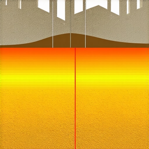
Illustration: Multi-sensor adaptive geophysical system overlaying underground utility maps in variable soil conditions.
Implementing Data-Driven Strategies for Optimal Detection Outcomes
Embedding comprehensive data management strategies enhances utility detection processes by enabling traceability, pattern recognition, and predictive analytics. Developing centralized databases that consolidate historical detection data, soil profiles, and GIS mapping allows teams to identify potential problem zones proactively. Such integration supports risk mitigation during complex excavations and fosters consistent adherence to safety standards.
Leveraging Virtual Reality for Enhanced Team Training and Planning
Advanced simulation platforms equipped with virtual reality (VR) enable excavation crews to rehearse scenarios based on detailed geophysical data. These immersive tools facilitate better understanding of subsurface complexities and sensor deployment strategies, leading to improved operational preparedness and reduced risks. As VR technology becomes more accessible, its integration into standard training protocols promises to elevate industry safety and precision standards.
How Will Industry Standards Evolve to Incorporate Multi-Modal Detection Results?
Regulatory frameworks and best practice guidelines are progressively shifting towards endorsing multi-sensor data integration as a standard in utility detection. Establishing universally accepted protocols for sensor calibration, data fusion, and reporting formats will enhance consistency and reliability. Stakeholders must participate in collaborative efforts—such as those led by the National Utility Mapping Association—to define these evolving standards. Embracing such regulations will streamline operations and foster stakeholder trust in underground utility identification.
To stay ahead in this complex field, professionals should pursue specialized certifications in integrated geophysical detection systems and actively contribute to industry standardization initiatives. Embracing technological innovation not only enhances safety outcomes but also positions organizations as leaders in underground infrastructure management.
Expert Strategies That Reshape Utility Detection
Leverage Multi-Modal Detection Systems
Integrating electromagnetic, acoustic, and thermal sensors allows professionals to cross-verify underground utility locations, minimizing errors caused by soil variability and infrastructure complexity.
Prioritize Soil Characterization for Calibration
Accurate soil profiling informs system calibration, ensuring electromagnetic and acoustic tools operate at optimal frequencies and power levels across diverse environments.
Adopt Adaptive, Modular Technologies
Utilize modular sensor systems capable of switching detection modes in real-time, maintaining high accuracy even in unpredictable subsurface conditions.
Stay Abreast of Emerging AI Applications
Machine learning algorithms are now interpreting complex geophysical data swiftly, offering predictive insights and reducing reliance on manual analysis.
Trusted Resources to Deepen Your Expertise
- Modern Utility Detection Technologies — Essential for understanding cutting-edge sensor integration and data fusion strategies.
- Geophysical Soil Testing Methods — Critical for accurate calibration and successful detection in challenging soils.
- AI in Subsurface Imaging — Provides insights into how machine learning accelerates decision-making in utility mapping.
- Industry Standards for Multi-Sensor Systems — Guides best practices and helps in establishing standardized procedures for underground detection.
- Case Studies in Complex Utility Environments — Offer real-world examples of successful multi-modal detection implementations.
Harness Complexity to Elevate Safety and Precision
The evolution of conduit detection underscores a fundamental truth: embracing innovative, integrated approaches transforms challenges into opportunities for safer, more precise excavation. For industry professionals ready to push boundaries, engaging with advanced detection methodologies is not just recommended—it’s imperative. Dive into tailored training programs or collaborate with experts to hone these high-level strategies. Your expertise in sophisticated underground mapping will be the foundation for safer, more efficient projects, ultimately setting new standards in the industry. For ongoing insights, consider exploring more about innovative trenching techniques and expand your operational horizon.