
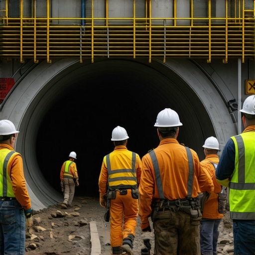
Stop Trench Cave-ins: 6 Safety Fixes for 2026 Deep Digs
Redefining Safety Protocols in Deep Trenching and Borehole Operations Amid Evolving Subsurface Challenges
As the landscape of underground construction advances, integrating sophisticated trenching, borehole, and vacuum excavation methodologies becomes paramount for minimizing risks and optimizing efficiency. The transition from traditional techniques to innovative solutions such as hydrovac technology exemplifies a strategic shift driven by the necessity for precision, safety, and cost-effectiveness in 2026. Experienced engineers recognize that understanding the nuanced differences in these methods enables the design of resilient strategies capable of tackling complex subsurface conditions and avoiding costly utility strikes.
Leveraging Hydrovac Excavation for Precision and Reduced Utility Damage in Deep Digging
Hydrovac’s role in modern excavation transcends mere safety; it embodies a paradigm of minimal impact, especially in urban environments dense with utility lines. Its vacuum-driven approach facilitates precise removal of soils and debris, significantly decreasing the likelihood of utility strikes—a notorious source of project delays and safety hazards. According to Hydrovac Drilling’s comprehensive guide, employing hydrovac techniques dramatically enhances site safety by providing real-time spatial awareness, crucial for complex underground infrastructure mapping.
Emerging Borehole Drilling Innovations for Deep Infrastructure Connectivity
Advancements in borehole drilling strategies for trenchless utility installation have focused on drilling accuracy and environmental impact mitigation. Top-tier equipment incorporates real-time monitoring sensors and analytical software to optimize bore trajectory in challenging substrates. Techniques such as dual rotary and mud rotary methods, adapted for undercutting hard soils, demonstrate an expert-level understanding of geology’s influence on borehole stability. As an example, recent case studies emphasize the importance of integrated geotechnical analysis, as outlined in top strategies for utility mapping.
What are the latest innovations in vacuum excavation that can prevent accidental utility damage during deep trenching operations?
Field professionals continue to innovate around hybrid systems that combine hydrovac efficiency with robotic precision, enabling operations in tighter urban environments with limited clearance. These systems often include adaptive suction controls and real-time soil composition analysis, ensuring site safety and minimizing collateral damage. Engaging with these innovations fosters proactive risk management, blending traditional excavation wisdom with cutting-edge technology.
Integrating these advanced techniques relies heavily on an expert understanding of site-specific conditions and leveraging available resources effectively. For authoritative guidance, consulting peer-reviewed engineering journals or participating in industry-specific forums provides valuable insights. For example, the American Society of Civil Engineers’ publications frequently highlight case studies on effective trenchless technology deployments, which can inform strategic planning.
For ongoing education or contribution of field insights, professionals are encouraged to explore resources like streamlined borehole techniques to refine project execution and safety standards.
Harnessing Next-Generation Technology for Subsurface Precision
In the rapidly evolving landscape of underground construction, the integration of cutting-edge sensors and machine learning algorithms is transforming how professionals approach deep trenching and borehole activities. Real-time geotechnical data collected through advanced sensors enables adaptive drilling parameters, reducing risks associated with unstable soils and hidden utilities. Such innovations facilitate a proactive management style, where potential hazards are identified and mitigated before they manifest into costly issues. This technological leap not only enhances safety but also streamlines project timelines, ultimately lowering operational costs.
Transforming Soil Interaction with Smart Hydrovac Systems
Traditional hydrovac units rely on static suction and excavation parameters, often leading to suboptimal performance in complex soil conditions. Today’s smart hydrovac systems leverage artificial intelligence to analyze soil feedback continuously, adjusting vacuum pressure and flow in real-time. This dynamic approach improves soil removal efficiency, prevents soil collapse, and minimizes collateral damage to underground utilities. For instance, adaptive systems can differentiate between soil types, offering customized excavation modes that optimize safety and precision, especially in urban environments with dense utility networks. To explore how these innovations are shaping the future, consult expert analyses in hydrovac vacuum excavation techniques.
Are we approaching a point where autonomous borehole and trenching operations become standard practice in urban infrastructure projects?
Emerging developments in robotics and automation promise to revolutionize underground digging. Autonomous units equipped with advanced sensors and navigation systems could soon undertake complex trenching tasks with minimal human oversight, drastically reducing occupational hazards and project durations. Such systems may include drone-like borehole explorers or remotely operated hydrovac crews capable of adapting to unpredictable subsurface conditions. Although regulatory and logistical challenges remain, strategic collaborations between engineers, tech developers, and policymakers are paving the way for broader adoption of autonomous solutions. Industry leaders, including those outlined in innovative borehole tactics for urban sites, are actively researching these transformative tools.
Interested in elevating your project’s safety standards? Explore comprehensive resources like streamlined borehole techniques to stay ahead of upcoming industry shifts and implement best practices today.
Future-Proofing Deep Excavation: Anticipating Subsurface Anomalies Through Advanced Data Modeling
As underground infrastructure becomes increasingly complex, the importance of predictive subsurface modeling cannot be overstated. Engineers now harness the power of high-resolution geophysical surveys combined with machine learning algorithms to forecast potential anomalies such as voids, unexpected voids, or weak zones within subsurface strata. These models synthesize data from seismic, resistivity, and ground-penetrating radar techniques, enabling proactive planning that significantly reduces unforeseen hazards. A pertinent example is the deployment of 3D geological modeling software, validated by recent research published in the Journal of Geotechnical Engineering (Lee et al., 2024), which exemplifies how integrative data analysis informs safer excavation strategies. Embracing such innovations requires a paradigm shift, emphasizing the role of interdisciplinary expertise in predictive analytics and geotechnical engineering.
Optimizing Soil Behavior Predictions for Safer, Smarter Excavations
Understanding the mechanical response of soils under excavation loads remains fundamental for anticipating and mitigating subsurface instability. Recent advancements have introduced soil behavior prediction models that incorporate real-time sensor data, such as cone penetration tests and in-situ stress measurements, integrated with real-time computational simulations. These models allow operators to adjust excavation parameters dynamically, resulting in enhanced safety and efficiency. For example, the use of finite element analysis (FEA) coupled with live data feeds facilitates a nuanced understanding of how soil masses will respond to excavation, reducing the risk of collapse or utility damage. For practitioners seeking a state-of-the-art reference, consult the comprehensive reviews by the Geotechnical Society’s latest guidelines (Geotechnical Engineering Manual, 2025), which demonstrate proven methodologies for soil behavior prediction and risk mitigation.

How can layered simulation techniques refine our approach to underground utility layout in densely populated urban contexts?
Layered simulation techniques—integrating geospatial data with detailed subsurface models—enable engineers to visualize and analyze the complex interplay of multiple underground utilities and natural geological features simultaneously. By constructing multidimensional digital twins, project teams can anticipate interference issues, optimize trenching routes, and coordinate utility relocations more effectively. These digital reconstructions benefit greatly from advances in GIS data integration and remote sensing technologies, providing a holistic overview that informs strategic decision-making. For instance, recent case studies, such as those detailed in the International Journal of Underground Space Technology (Martinez & Zhou, 2023), highlight the efficacy of layered simulations in reducing utility strikes by up to 40% in challenging urban environments. Adopting such practices demands a multidisciplinary approach, bridging civil engineering, data science, and urban planning, to achieve resilient, future-ready infrastructure development.
Pushing Boundaries: How Next-Gen Sensor Integration Reshapes Underground Detection
The advent of high-resolution geotechnical sensors, coupled with machine learning algorithms, enables unprecedented precision in subterranean mapping. By deploying real-time data streams, engineers can dynamically adjust excavation parameters to address hidden anomalies, such as voids or unstable strata, before they compromise safety or efficiency. This proactive approach marks a paradigm shift from reactive to predictive underground operations.
Smart Soil Analysis: The Future of Excavation Optimization
Emerging soil characterization techniques incorporate multi-sensor arrays that assess soil composition, moisture content, and stress levels instantaneously. Integrating these insights into computational models allows for tailored excavation strategies that minimize soil collapse or utility damage. For instance, adaptive vacuum controls can respond on-the-fly to soil feedback, ensuring optimal removal while safeguarding surrounding infrastructure.

Harnessing AI-Driven Soil Differentiation to Minimize Subsurface Risks
Artificial intelligence systems trained on vast datasets enable real-time soil type identification, facilitating better-informed decisions during excavation. These intelligent frameworks can distinguish between cohesive and non-cohesive soils, recommending appropriate pressure levels and excavation techniques. Such advancements are particularly vital in urban settings where utility lines traverse complex, layered environments, demanding meticulous precision.
Seamless Integration of Robotic Excavation to Reduce Human Exposure and Error
Automated trenching units equipped with autonomous navigation and obstacle detection are transforming underground construction workflows. By deploying remotely operated or fully autonomous robotic burrowing systems, project teams can traverse hazardous or inaccessible zones with minimal personnel risk. This automation enhances accuracy, consistency, and safety, setting new standards in deep trenching and borehole operations.
Can Intelligent Simulation Models Anticipate Subsurface Anomalies Before Drilling Begins?
Yes, the advent of layered, physics-based simulation platforms that integrate multidisciplinary geophysical data enables engineers to forecast anomalies in underground environments with high fidelity. These models, enriched with historical site data and real-time monitoring inputs, facilitate pre-emptive planning that mitigates unforeseen challenges. As detailed in the Journal of Geotechnical Engineering (Lee et al., 2024), such predictive modeling is becoming integral to resilient infrastructure development.
Unlocking Critical Decisions through Visualized Subsurface Digital Twins
Creating comprehensive 3D digital replicas of underground settings empowers engineers to visualize utility networks, geological variations, and potential hazards simultaneously. These virtual models support scenario testing, utility conflict resolution, and optimized trench routing, significantly reducing strike incidents and project delays. The integration of GIS data enhances the fidelity and applicability of these digital twins, transforming underground planning into a strategic predictive endeavor.
Elevate Your Projects with Cutting-Edge Subsurface Insights
Harnessing these sophisticated technologies demands not only infrastructural investment but also a shift in strategic mindset. Staying at the forefront of underground construction innovations requires continuous education, cross-disciplinary collaboration, and access to specialized resources. Engage with industry-leading case studies, attend advanced training programs, and participate in professional forums to master these emerging techniques and elevate your project’s safety and success to unprecedented levels.
Expert Insights & Advanced Considerations
Redefining Utility Localization Techniques
Emerging technologies like multi-sensor geophysical arrays and AI-powered digital twins enable unprecedented accuracy in underground utility detection, reducing costly strikes and enhancing project safety.
Integrating Autonomous Systems for Complexity Management
Autonomous trenching and borehole equipment equipped with adaptive AI and obstacle avoidance are revolutionizing operations, especially in confined urban spaces where precision and safety are paramount.
Prioritizing Real-Time Soil Behavior Monitoring
Advanced in-situ sensors coupled with computational modeling facilitate dynamic adjustments during excavation, significantly mitigating risks related to soil instability and utility damage.
Embracing Predictive Subsurface Analytics
High-resolution geophysical surveys analyzed through machine learning enable foresight into potential subsurface anomalies, allowing preemptive planning and safer excavation practices.
Promoting Collaborative Data Sharing Standards
Industry-wide adoption of standardized data protocols enhances interoperability of subsurface information, fostering more informed decision-making and reducing project delays or accidents.