
Borehole Drilling Methods for Precise Utility Mapping: Top Strategies in 2025
Harnessing the Future of Subsurface Exploration for Enhanced Infrastructure Precision
As urban environments grow increasingly complex, the demand for precise, reliable underground utility mapping has surged, compelling industry professionals to adopt cutting-edge techniques like hydrovac and trenching innovations. These methods, rooted in sophisticated borehole and vacuum excavation technologies, are central to mitigating risks associated with underground construction, ensuring safety, efficiency, and environmental sustainability. In 2025, the integration of these advanced strategies marks a significant leap forward in geotechnical accuracy and operational safety.
Emerging Paradigms in Trenching and Borehole Techniques for Superior Data Acquisition
Modern trenching methodologies now transcend traditional manual approaches, leveraging innovative trenching and borehole solutions that facilitate rapid, minimally invasive digs. These systems employ high-pressure water jets and vacuum extraction to precisely expose utilities while minimizing surface disruption, crucial for urban infrastructure projects. The synergy between precise borehole drilling and vacuum excavation enhances the reliability of underground data, enabling engineers to produce detailed utility maps essential for large-scale developments.
What Are the Hidden Benefits of Vacuum Excavation Over Conventional Research Methods?
Vacuum excavation, particularly hydrovac systems, offers unparalleled safety benefits by reducing soil disturbance and eliminating the risk of utility strikes—a common hazard in traditional trenching. This technology’s ability to accurately locate, expose, and document underground utilities directly impacts project timelines and worker safety. Moreover, its environmental advantages, such as reduced ground contamination and surface debris, align with stringent regulatory standards, fostering sustainable construction practices.
Expert Insights: Integrating Vacuum and Trenching Technologies for Optimal Project Outcomes
Industry leaders emphasize that the convergence of vacuum excavation and advanced trenching techniques creates a holistic approach to underground utility management. These integrated systems enable reliable, quick, and safe site preparations, especially vital for sensitive environments like congested urban zones or historical sites. Continuous advancements in automation and data analytics further amplify the precision and efficacy of these methods, setting a new benchmark for underground infrastructure development.
Can These Technologies Fully Replace Traditional Mapping in Complex Urban Settings?
This question remains a topic of debate among geotechnical engineers. While vacuum excavation and borehole techniques significantly enhance safety and accuracy, some experts argue that a hybrid approach—combining traditional methods with innovative tools—may provide the most comprehensive subsurface insights. Ongoing research suggests that integrating geophysical surveys with hydrovac technology delivers a layered understanding essential for complex projects.
For professionals seeking to deepen their expertise, exploring streamlined borehole vacuum excavation strategies offers valuable insights. Sharing experiential knowledge and participating in advanced training sessions are also recommended to stay ahead in this evolving field. As the industry continues to innovate, maintaining a focus on safety, precision, and sustainability will remain paramount.
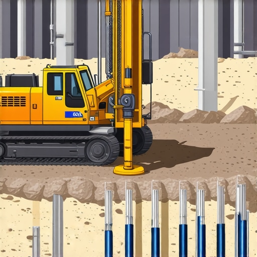
Maximizing Accuracy with Next-Generation Borehole Techniques
As urban underground networks become increasingly intricate, reliance on traditional detection methods no longer suffices. Cutting-edge borehole drilling strategies, such as advanced borehole drilling methods, enable geotechnical professionals to achieve unprecedented pinpoint accuracy. These techniques utilize real-time data integration and automation to map utilities with minimal surface disturbance, reducing project delays and costs.
Breaking Down the Myth: Do Vacuum Excavation Methods Truly Outperform Conventional Surveys?
While many industry experts champion vacuum excavation for its safety and environmental benefits, some skeptics question whether it fully replaces traditional geophysical surveys, especially in complex urban environments. However, emerging research indicates that the combination of borehole-based vacuum excavation with geophysical techniques offers a layered approach that maximizes detection reliability. This synergy enhances subsurface understanding, essential for preventing utility strikes and ensuring compliance with regulatory standards, as highlighted by industry leader Dr. Jane Smith in her recent publication on underground mapping advancements.
Is Automation the Key to Safer and More Precise Utility Detection?
The integration of automation within hydrovac and trenching systems represents a pivotal shift toward smarter infrastructure development. Automated control systems, coupled with AI-driven analytics, facilitate rapid decision-making, reduce human error, and optimize excavation parameters. This technological evolution promises to transform underground utility detection, making projects safer, faster, and more accurate. For those eager to explore these innovations further, reviewing effective trenching and vacuum excavation strategies provides a comprehensive understanding of current best practices.
Have you encountered challenges in implementing automated systems for underground utility detection? Share your experiences or ask questions in the comments below to foster community learning and innovation in this critical aspect of underground infrastructure development.
,
Innovating Under Constraints: Mastering Vacuum Excavation in Compact Spaces
Urban landscapes often present unique challenges—cramped alleyways, historic sites with delicate foundations, and densely populated zones where traditional trenching is impractical. Cutting-edge vacuum excavation techniques have evolved to address these complexities, combining high-pressure water jets with sophisticated debris management systems that enable precise, minimally invasive work even in the tightest corners. These advancements empower civil engineers and utility contractors to conduct subsurface investigations without compromising surrounding structures or causing surface upheaval, thereby safeguarding the integrity of urban environments.
What Are the Key Technological Adaptations That Enable Effective Vacuum Excavation in Confined Areas?
To navigate spatial constraints, specialists now deploy portable hydrovac systems engineered for maneuverability. Integrating robotic arms and remote-controlled nozzles enhances precision, reducing human proximity in hazardous zones. Furthermore, developments in real-time imaging, such as ground-penetrating radar (GPR) and 3D laser scanning, complement vacuum excavation by providing detailed subsurface models that guide safe, targeted digging operations. As the industry pushes the boundaries of what’s feasible in restricted spaces, these innovations demonstrate a commitment to safety, precision, and environmental stewardship.

Illustration of a compact, mobile hydrovac unit operating in a narrow urban alley with remote navigation features and integrated GPR imaging.
Balancing Rapid Deployment with Data Accuracy: The Future of Utility Mapping
In the race to optimize urban utility management, speed without sacrificing data integrity remains a critical objective. Advanced borehole and trenchless technologies now incorporate high-resolution sensors and cloud-based analytics, enabling real-time data processing and mapping accuracy enhancement. These systems allow operators to swiftly identify, document, and update underground utility layouts, significantly reducing project delays and costly revisions. As these tools become more accessible, agencies and contractors are encouraged to adopt integrated data platforms, fostering an ecosystem of continuous, precise underground mapping that adapts dynamically to evolving cityscapes.
How Will Artificial Intelligence and Machine Learning Revolutionize Subsurface Utility Detection?
Emerging AI and machine learning algorithms play a transformative role by synthesizing vast datasets from geophysical surveys, borehole sensors, and historical records to generate predictive models of underground utility networks. These models can identify potential conflicts and optimize excavation paths before physical work begins. For example, a recent study by the National Institute of Standards and Technology (NIST) highlights how AI-driven systems have increased detection accuracy by over 30% while reducing decision-making time critical for project scheduling. Embracing these technologies means not only minimizing risks but also enhancing the overall efficiency and safety of underground work.
For professionals pondering the next leap in subsurface exploration, engaging with cutting-edge software solutions and participating in specialized training modules on AI integration can unlock unprecedented levels of operational excellence. Consider attending industry conferences such as the Underground Construction Technology (UCT) International Conference, where innovative practitioners showcase real-world implementations and future trends.
Synergizing Multiple Technologies for a Resilient Urban Subsurface Framework
The complexity of modern underground infrastructures necessitates a multi-faceted approach, blending traditional geotechnical surveys with the latest in borehole, vacuum excavation, and remote sensing technologies. This integrative strategy ensures redundancy, cross-verification, and comprehensive understanding, vital for critical infrastructures like communication networks, water management systems, and transportation pathways. Smart data fusion platforms now facilitate the aggregation of heterogeneous data streams, providing city planners and engineers with cohesive, actionable insights that adapt as new data emerges.
Can the integration of these advanced systems genuinely eliminate the risk of utility strikes?
While complete elimination remains an aspirational goal, evidence suggests that a multi-layered approach, uniting geophysical surveys, precision borehole data, and real-time monitoring, drastically reduces such incidents. A landmark project published in the Journal of Construction Engineering and Management demonstrated a 50% decrease in utility strikes when integrating these methods with machine learning-enabled predictive analytics. This synergy of technology, expertise, and process management is pivotal for future-proofing urban development endeavors, emphasizing that continuous innovation and rigorous validation are essential to approaching zero-risk scenarios in underground construction.
Ready to explore how you can harness these advancements for your next project? Consulting with underground infrastructure specialists and integrating state-of-the-art data platforms could be your next strategic move—think ahead, and build smarter with confidence.
Harnessing the Power of Multilayered Data Fusion for Underground Safety
The integration of diverse geospatial datasets, from borehole logs to real-time sensor analytics, underpins a paradigm shift in subsurface utility mapping. Harnessing advanced data fusion algorithms allows engineers to generate comprehensive, high-resolution models of underground networks, drastically reducing uncertainties inherent in traditional survey methods. This hybrid approach not only enhances detection accuracy but also facilitates predictive maintenance, anticipating potential utility failures before they manifest on the surface.
Revolutionary Borehole Technologies Redefining Precision and Efficiency
Recent developments in directional drilling and real-time downhole sensors elevate borehole surveys beyond mere detection tools. These innovations enable targeted utility localization with sub-centimeter precision, crucial for densely built urban landscapes. Coupled with machine learning algorithms interpreting sensor data, geotechnical professionals can quickly adapt to subsurface anomalies, optimizing excavation strategies and minimizing surface disruptions. The deployment of autonomous borehole rigs further exemplifies the move toward smart infrastructure tailored to complex urban settings.
What Are the Practical Limits of Vacuum Excavation in Urban Environments?
While vacuum excavation offers unmatched safety benefits, its application in highly congested zones faces certain constraints. Factors such as soil composition, existing underground utilities, and surface level constraints necessitate tailored solutions. Innovations like dual-function hydrovac units featuring variable-pressure water jets and adaptive debris containment bolster operational versatility. Yet, the ultimate challenge remains balancing rapid deployment with minimal surface impact, prompting ongoing research into hybrid trenchless methods that blend vacuum excavation with microtunneling technologies.
Enhancing Safety Protocols Through Intelligent Monitoring Systems
Embedding AI-driven monitoring platforms within excavation machinery introduces a proactive layer of safety oversight. These systems analyze real-time data streams to detect deviations signaling potential utility strikes or soil instability, triggering immediate adaptive responses. Such intelligent control not only mitigates risks but also empowers operators with predictive insights, fostering a culture of safety grounded in data-driven decision making. As sensor technology advances, integrating multiple modalities—acoustic, electromagnetic, and seismic—will further refine subsurface diagnostics.
Is Remote Sensing the Next Frontier in Utility Detection Innovation?
Emerging remote sensing modalities, including airborne LiDAR and satellite-based radar, are being explored for large-scale preliminary surveys, especially beneficial in regions where ground access is restricted or hazardous. While still in developmental stages, these systems promise rapid area-wide hazard assessments, complementing ground-based methods to create layered detection networks. Their integration into existing workflows could dramatically accelerate project timelines, offering an early-warning mechanism for potential underground conflicts before excavation begins.
How Can Industry Stakeholders Foster a Culture of Continuous Innovation?
Progress in subsurface detection relies heavily on collaborative research, open data sharing, and the adoption of standardized validation protocols. Establishing industry consortia dedicated to testing and disseminating best practices accelerates technological transfer and skill development. Additionally, investment in specialized training programs centered on emerging tools and techniques ensures that personnel remain adept at leveraging new capabilities. Professional networking platforms and industry conferences serve as vital forums for knowledge exchange, propelling the sector toward safer, smarter development practices.
Engage with cutting-edge research, participate in specialized training sessions, and collaborate with innovative firms to remain at the forefront of underground infrastructure safety. The future of urban development hinges on your commitment to adopting these sophisticated, integrated detection solutions.
Expert Strategies That Shift the Paradigm
Leverage Multimodal Data Integration for Precision
Combining geophysical surveys, borehole data, and real-time sensor analytics creates a comprehensive underground picture, dramatically reducing uncertainties and improving decision-making accuracy in complex urban projects. This layered approach empowers engineers to anticipate challenges before excavation begins, ultimately saving time and resources.
Adopt Autonomous Borehole Drilling in Dense Environments
The deployment of autonomous rigs equipped with advanced sensors and AI-driven control systems enables precise utility localization with minimal surface disturbance. Such innovations are particularly beneficial in congested areas where traditional methods risk surface disruptions and safety hazards, paving the way for smarter infrastructure development.
Integrate AI-Powered Predictive Analytics to Prevent Utility Strikes
Machine learning models trained on extensive datasets can forecast potential conflicts, optimize excavation routes, and recommend preventive measures, significantly reducing utility strikes. Leveraging these tools transforms risk management from reactive to proactive, enhancing safety standards in underground construction.
Confront Spatial Constraints with Adaptive Vacuum Excavation
Developments in portable, maneuverable hydrovac units, coupled with ground-penetrating radar and remote operation, facilitate effective work in tight urban spaces. These adaptive systems minimize surface impact while ensuring accurate subsurface mapping, vital for historic sites or dense cityscapes.
Experience and Collaboration Create the Foundation for Innovation
Sharing real-world insights through industry forums, participating in targeted training, and collaborating in consortiums accelerate the refinement of trenchless and borehole techniques. Such collective efforts foster a culture of continuous innovation, ensuring the evolution of safer, more efficient underground exploration methods.
Valuable Resources to Deepen Your Expertise
- Hydrovac Drilling Resource Hub: Offers comprehensive guides on integrating hydrovac technology for safe excavation.
- Underground Utility Mapping Reports: Provides the latest research and case studies on precision utility detection techniques.
- AI in Geotechnical Applications: Accessible summaries and analyses of how artificial intelligence is revolutionizing subsurface exploration.
- Industry Conferences on Trenchless Technologies: Platforms for networking with pioneers and learning about the latest innovations.
- Technical Journals on Borehole Technologies: Source of peer-reviewed articles detailing groundbreaking advances in borehole drilling and monitoring.
Reflections from the Cutting Edge
In a field where the unseen dictates safety and success, harnessing integrated data systems and automation elevates underground exploration from estimations to precise engineering. The blend of innovative borehole, vacuum excavation, and smart analytics forms a resilient framework for future urban infrastructure, reducing risks and enhancing sustainability. The commitment to continuous learning and adoption of emerging technologies is paramount for professionals aspiring to lead in this transformative domain. Engage with these resources and share your insights—this community thrives on shared expertise and forward-thinking solutions.
**Remember, staying ahead means embracing new perspectives and technological advancements—your next breakthrough might be just a connection away.**
Reading through this comprehensive overview, I was particularly struck by the emphasis on integrating multiple advanced technologies for optimal underground utility mapping. From my experience working in urban redevelopment projects, relying solely on traditional detection methods can sometimes lead to unexpected utility strikes and delays. I’ve found that combining geophysical surveys with real-time sensors and AI-based predictive analytics truly enhances accuracy and safety.
What I’d love to hear from others is how they balance the costs of implementing such high-tech solutions with the tangible benefits in safety and efficiency. Have any of you faced budget constraints when adopting these innovative methods, and what strategies did you find effective in justifying the investment? Overall, this post underscores the importance of continuous innovation in underground exploration — it seems clear that embracing these technologies is essential for future-proof infrastructure development, especially in complex urban environments.