Mastering Plastic Conduit Identification Amid Tracer Wire Failures in Trenching and Vacuum Excavation
In the realm of modern utility installation, the reliance on tracer wires to locate underground plastic conduits has long been standard practice. However, persistent challenges arise when these wires fail due to corrosion, mechanical damage, or aging, complicating site layout and risking costly errors. As an expert in hydro-vacuum excavation and trenching technology, understanding alternative identification methodologies is crucial.
Evaluating the Impact of Tracer Wire Degradation on Accurate Conduit Detection
Tracer wire failures significantly impede detection accuracy, especially under complex soil conditions where electromagnetic interference from metals or mineral content hampers conventional methods. Such failures necessitate the deployment of advanced geophysical sensing techniques, including ground-penetrating radar (GPR) and soil moisture sensors, which can detect non-metallic conduits without reliance on wired signals. Recognizing the signs of tracer wire deterioration and choosing appropriate detection strategies ensure the integrity of excavation workflows and stakeholder trust.
Innovative Electromagnetic and Soil-Based Alternatives to Tracer Wires
Emerging technologies like pulse-induction sensors and resistivity imaging offer promising avenues for identifying plastic conduit pathways. Moreover, non-invasive methods such as seismic reflection and electromagnetic induction, when combined with meticulous site analysis, facilitate precise localization even when traditional tracer wires are compromised. These approaches require specialized expertise to interpret complex data sets and avoid false positives, underscoring the necessity for ongoing operator training.
Field Application: Integrating Detection Techniques into Safe Best Practices
Implementing a multi-layered detection protocol that amalgamates GPR, soil moisture readings, and existing utility records minimizes risks during trenching. For example, employing vacuum excavation as a supplementary method provides physical confirmation of conduit presence, reducing reliance solely on electronic detection. Referencing industry standards such as [detailed in this comprehensive guide](https://hydrovacdrilling.com/ultimate-guide-to-borehole-drilling-with-advanced-vacuum-excavation-equipment), operators can optimize accuracy & safety.
Addressing the Challenges of Non-Metallic Utility Mapping in Urban Environments
The difficulty in mapping non-metallic utilities correlates with their invisibility to conventional electromagnetic detection. Experts must incorporate soil properties analysis, historical records, and innovative sensory equipment to mitigate uncertainties, especially in dense urban areas where underground congestion complicates detection. Maintaining updated utility maps and employing vacuum excavation for confirmation are essential components of a robust utility management plan.
What Are the Most Reliable Techniques for Locating Non-Conductive Utility Lines When Tracer Wires Are No Longer Functional?
This question remains at the forefront of underground utility locating. Combining ground-penetrating radar with data from soil resistance sensors and professional excavations enhances detection reliability. The integration of multiple detection layers not only compensates for tracer wire failure but also reduces the likelihood of accidental strikes, fostering project safety and legal compliance.
For professionals seeking to elevate their detection accuracy, exploring dedicated expert resources, such as this detailed guide, can be invaluable. Continuous education, technological adaptation, and adherence to safety best practices are paramount in tackling the intricacies of plastic conduit identification in complex trenching projects.
Interested in further enhancing your strategic capabilities? Discover more about vacuum excavation innovations and how they can complement detection efforts for optimal safety and efficiency in your operations.
Unlocking the Power of Multi-Sensor Detection for Hidden Utilities
While ground-penetrating radar (GPR) remains a staple in utility detection, relying solely on a single technology can lead to gaps—especially when confronting non-metallic pipes in soils with high mineral content. Integrating multi-sensor systems, such as resistivity imaging combined with electromagnetic induction, provides a layered approach that enhances accuracy. These hybrid systems leverage the strengths of each technology, compensating for individual limitations, and enable professionals to confidently identify non-conductive lines even in complex urban landscapes.
The Role of Soil Condition Analysis in Improving Detection Outcomes
Understanding soil properties—such as conductivity, moisture, and compaction—is critical in tailoring detection strategies. For example, in saturated or clay-rich soils, electromagnetic signals may attenuate rapidly, reducing effectiveness. Incorporating prior soil analysis and real-time soil moisture sensors allows operators to adjust detection parameters dynamically, leading to more reliable results. Exploring soil condition analysis not only improves detection accuracy but also minimizes the risk of accidental utility strikes during trenching.
Cutting-Edge Tools Transforming Urban Utility Concealment
Emerging technologies like acoustic resonance mapping and magnetic anomaly detection are revolutionizing underground utility mapping. Acoustic systems can identify voids and anomalies caused by non-metallic pipes, while magnetic sensors pick up subtle irregularities in ferrous components or buried infrastructure. When combined with traditional methods, these tools form a comprehensive mapping ecosystem that significantly reduces uncertainty in urban environments riddled with underground congestion. Staying abreast of these innovations ensures that excavation teams are equipped to tackle even the most elusive non-conductive utilities.
Expert Strategies for Effective Integration of Advanced Detection Methods
Implementing these sophisticated detection techniques requires strategic planning and training. Operators should adopt a systematic workflow: starting with historical data review, progressing through combined geophysical surveys, and concluding with physical verification via vacuum excavation. The importance of adhering to industry standards, such as those outlined in this comprehensive guide, cannot be overstated. Consistent calibration, data interpretation, and cross-validation are vital to mitigate false positives and ensure safety.
How Can Industry Professionals Elevate Detection Capabilities Beyond Conventional Techniques in Urban Settings?
This pivotal question invites exploration into innovative solutions like machine learning-enhanced interpretation algorithms and real-time data integration platforms. Leveraging artificial intelligence to analyze complex geophysical data can identify patterns that elude human operators, dramatically improving detection confidence. Additionally, adopting integrated software systems that unify sensor outputs streamlines decision-making and accelerates project timelines, all while maintaining safety standards. For ambitious teams, embracing these technologies can redefine underground utility detection in dense urban environments.
To gain deeper insights into these advanced methodologies, professionals are encouraged to consult resources such as this detailed guide. Continuous education and technological adaptation are the cornerstones of mastering urban utility mapping, particularly when conventional detection methods fall short.
If you’re eager to expand your expertise further, explore how vacuum excavation innovations can complement your detection strategies, ensuring safer and more efficient project execution.
,
Elevating Detection Capabilities with Cutting-Edge Technologies
As underground utility detection evolves, integrating emerging technologies becomes imperative for overcoming the limitations posed by tracer wire failures. Modern electromagnetic sensors, such as time-domain reflectometry (TDR), coupled with advanced ground-penetrating radar (GPR) configurations, can distinguish non-metallic pipes with remarkable precision. These systems utilize tailored signal frequencies and sophisticated data processing algorithms to filter noise and enhance signal clarity in challenging soil conditions. Consequently, utility professionals can achieve higher confidence levels in locating concealed, non-conductive lines, minimizing excavation risks in dense urban landscapes.
What Role Does Machine Learning Play in Interpreting Complex Geophysical Data?
Machine learning algorithms, particularly deep learning models, are revolutionizing the interpretation of geophysical survey data. By training on extensive datasets of known utility placements, these models identify subtle patterns and anomalies that might elude even seasoned technicians. Integration of AI-driven interpretation tools accelerates decision-making, reduces human error, and improves the accuracy of non-conductive utility detection. For example, a recent study published in the Journal of Geophysical Research demonstrated that AI-enhanced GPR data analysis significantly increased the success rate of locating plastic pipes in mineral-rich soils, outperforming traditional methods. Staying abreast of such innovations ensures that detection teams remain at the forefront of urban utility mapping.
Interested in harnessing AI for your projects? Collaborate with specialized firms offering machine learning integration services or explore emerging software platforms designed explicitly for underground utility detection. The investment in advanced data analysis not only reduces project delays and costs but also elevates safety standards across the board.
Optimizing Detection Strategies with Multilayered Verification
Relying solely on single-source detection methods can be perilous in complex underground environments. A multi-tiered approach, combining electromagnetic induction with resistivity imaging, acoustic resonance, and physical validation through vacuum excavation, provides a comprehensive solution. This layered system cross-verifies findings and mitigates false positives, ensuring more reliable identification of non-metallic utilities. For instance, resistivity imaging can reveal subsurface anomalies aligned with GPR detections, providing corroborative evidence that guides excavation plans with greater certainty.
Furthermore, incorporating historical utility records and conducting detailed site surveys before fieldwork help contextualize sensor data, sharpening detection accuracy. This holistic approach minimizes unexpected surprises during trenching and aligns with industry best practices documented in authoritative sources like the Ultimate Guide to Utility Mapping.
How Can Soil and Environmental Conditions Be Manipulated or Mitigated to Enhance Detection Success?
Soil properties such as moisture content, mineral composition, and compaction significantly influence geophysical signal propagation. In high-moisture or clay-rich soils, electromagnetic signals tend to attenuate rapidly, complicating detection efforts. Mitigation strategies include pre-conditioning the soil—such as drying or drying agents in dry environments—or employing frequency-modulated sensors that adapt dynamically to soil variability. Additionally, timing detection operations during periods of lower soil moisture, when feasible, can improve data clarity.
Advanced modeling software allows engineers to simulate soil conditions and predict sensor performance, enabling tailored detection techniques. Localized environmental assessments, combined with real-time soil moisture measurements, inform operational decisions, maximizing detection accuracy. For example, implementing soil stabilization or controlled dewatering in critical areas can facilitate more precise locating of non-conductive utilities after initial survey failures, significantly reducing the risk of costly misplacements.
Future Trends: Smart Sensors and Autonomous Detection Systems
The horizon of underground utility detection is moving towards autonomous, sensor-laden systems embedded within robotic excavation units or drone platforms. These smart systems can perform continuous real-time surveys, adapt detection parameters based on immediate data analysis, and autonomously flag areas of concern for human review. Such innovation promises rapid, non-intrusive mapping in complex urban terrains, drastically reducing the time and cost associated with utility locates.
Emerging research in nanotechnology-enabled sensors, capable of detecting minute electromagnetic anomalies associated with plastic pipes, points toward even more sensitive detection methodologies. Although still in developmental stages, these technologies hold the potential to redefine non-conductive utility detection—making tracer wires obsolete in many scenarios. Interested stakeholders should monitor these advancements and consider pilot-testing novel solutions in controlled environments to stay ahead in underground infrastructure management.
Harnessing Multilayered Geophysical Insights for Ultimate Utility Location Accuracy
While traditional electromagnetic methods like GPR provide a baseline for underground utility detection, integrating multiple geophysical techniques significantly enhances the reliability when tracer wires have failed or become unreliable. Combining resistivity imaging, seismic resonance, and electromagnetic induction creates a layered detection framework that compensates for each method’s limitations, especially in complex soil conditions and urban landscapes. Experts emphasize that such integrated approaches, guided by comprehensive data analysis, reduce the risk of costly misplacements and ensure worker safety. Incorporating advanced software platforms capable of synthesizing these datasets allows operators to visualize subsurface anomalies more clearly, ultimately elevating project precision.
How Can Soil Characterization Amplify Your Detection Confidence in Challenging Environments?
Deep knowledge of soil properties—such as conductivity, moisture content, and mineral composition—is pivotal in tailoring detection methodologies. Recent advancements in real-time soil sensing technologies enable on-site analysis, informing decisions about which geophysical techniques to employ and how to calibrate sensor settings. For example, in clay-heavy soils with high mineralization, electromagnetic signals may attenuate rapidly, requiring alternative or supplementary methods like seismic waves or soil resistivity profiling. By understanding these environmental parameters beforehand, excavation teams can avoid false positives and enhance subsurface model accuracy, leading to safer, more efficient trenching operations.
Introducing Autonomous Subsurface Sensing: The Future of Utility Mapping
Emerging autonomous sensing units, embedded with multi-sensor arrays, are poised to revolutionize underground utility detection. These robotic systems continuously perform geophysical surveys and adapt their detection parameters dynamically, guided by AI algorithms trained on extensive underground utility datasets. Such innovation minimizes human intervention and expedites large-scale mapping projects, particularly in high-density urban zones where underground congestion poses a significant challenge. Moreover, nanotechnology-enabled sensors promise heightened sensitivity for locating non-metallic or low-contrast utilities, pushing the boundaries of what current technology can achieve. Staying engaged with these developments, and integrating them into standard workflows, positions industry professionals at the forefront of safe and precise trenching practices.
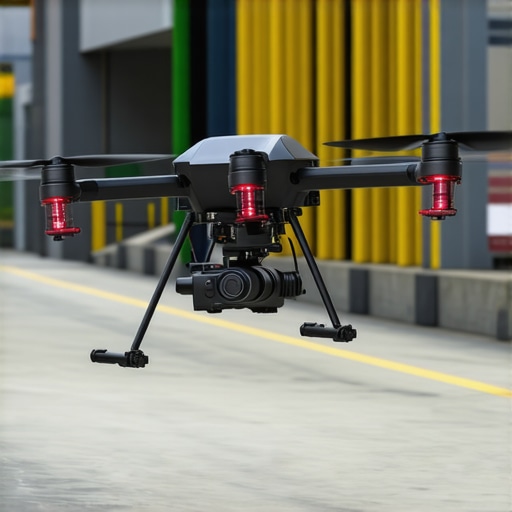
Image Title: Autonomous underground utility detection drone hovering over trench site. Image Alt: Drone equipped with multi-sensor array scanning underground utilities in urban trenching project.
Expert Insights & Advanced Considerations
Harness Multi-Method Detection Strategies
Combining ground-penetrating radar, resistivity imaging, and physical verification through vacuum excavation creates a layered approach that significantly reduces uncertainty and enhances accuracy in locating non-metallic utilities.
Prioritize Soil Condition Analysis for Accurate Results
Real-time soil assessment, including moisture and mineral content, allows technicians to adapt detection parameters dynamically, ensuring more reliable identification in challenging soil types and minimizing risks during crossing and trenching projects.
Invest in Emerging Sensor Technologies
Advanced acoustic, magnetic, and pulse-induction sensors, combined with AI-driven data interpretation, are paving the way for more precise, non-invasive utility detection, especially valuable when tracer wires are compromised or absent.
Adopt Strategic Verification Before Excavation
Implementing multi-layered validation workflows, integrating historical utility records, sensor data, and physical confirmation, mitigates risks, prevents service strikes, and enhances overall project safety and efficiency.
Stay Ahead with Continuous Education and Innovation
Engaging with industry-leading resources, participating in specialized training, and exploring cutting-edge tools ensure utility locating professionals remain at the forefront of technology and best practices in complex urban environments.
Curated Expert Resources
- Ultimate Guide to Utility Mapping – A comprehensive resource detailing layered detection methods, best practices, and case studies that exemplify high-precision non-metallic utility locating.
- Advanced Geophysical Sensing Technologies – Peer-reviewed articles and industry reports highlighting the latest sensor innovations and their application in underground utility detection.
- Soil Property Analysis Techniques – Technical manuals and field guides explaining soil testing methods that optimize geophysical survey outcomes.
- Machine Learning in Geophysics – Research papers and case studies demonstrating how AI algorithms improve interpretative accuracy for complex data sets.
- Safety Standards and Industry Protocols – Industry standards and best practice documents, such as those provided by utility safeguard organizations, to ensure compliance and safety during utility detection and excavation.
Final Perspective from the Experts
In the evolving landscape of underground utility detection, especially when tracer wires fail, employing a combination of layered geophysical methods and soil analysis elevates the reliability of locating non-metallic utilities. By leveraging cutting-edge sensor technology, continual education, and comprehensive verification strategies, industry professionals can confidently navigate urban underground complexities. Whether facing dense congestion or challenging soil types, these approaches ensure safer, more precise trenching operations. For those committed to excellence, embracing innovation and expert insights today sets the foundation for resilient, future-ready utility management. Engage with our advanced resources, share your expertise, and lead the industry toward smarter detection solutions.