Mitigating Phantom Signal Interference in Urban Excavation and Utility Mapping
In the complex tapestry of urban utility installation and maintenance, the precision of trenching, borehole, hydrovac, and vacuum excavation operations hinges on accurate subterranean mapping. Signal interference, often termed phantom signals, complicates these efforts, leading to potential safety hazards and costly errors. Recognizing and controlling interference sources demands a deep understanding of electromagnetic and acoustic signaling modalities intertwined with urban electrical infrastructure complexities.
Understanding the Underlying Causes of Signal Distortion and Noise
What Are the Common Origins of Phantom Signals in Urban Environments?
Phantom signals frequently originate from high-density electrical networks, metallic infrastructure, and various radio frequency sources pervasive in cityscapes. These generate electromagnetic noise that can mimic or obscure the signals emitted by ground-penetrating radar (GPR), acoustic locators, or electromagnetic induction tools. Urban materials like reinforced concrete, high-mineral soils, and buried metallic objects further exacerbate signal scattering and reflections, complicating accurate utility detection.
To tackle these challenges, experienced practitioners analyze signal signatures, distinguishing true utility pathways from artifacts by utilizing advanced filtering algorithms and multi-frequency approaches. Consultations with recent studies, such as the comprehensive work in the Journal of Construction Engineering and Management, reveal that integrating electromagnetic compatibility (EMC) mitigation techniques significantly enhances detection fidelity.
Strategic Deployment of Signal Mitigation Technologies
How Can Progressive Sensor Technologies Outperform Traditional Methods in Urban Trenching?
Modern sensor arrays equipped with adaptive filtering, real-time data processing, and noise-canceling capabilities allow for a refined discrimination of true signals amid urban electromagnetic chaos. For instance, pulse-induction magnetic locators combined with low-frequency GPR can adaptively calibrate to fluctuating interference levels, thereby enhancing accuracy in locating non-metallic pipes and fiber optics despite ambient electromagnetic pollution.
Furthermore, strategic operational planning—such as scheduling during low electrical activity periods and employing urban traffic management tools—can markedly reduce interference impact. Cross-referencing multiple data collection modalities, as detailed in our expert guide on utility exposure, bolsters detection confidence.
Operational Best Practices for Accurate Signal Detection
Field professionals should regularly calibrate equipment, verify signal integrity with control checks, and leverage high-fidelity data overlays during planning phases. Embracing an integrated approach—combining electromagnetic and acoustic methods with historical utility records—substantially mitigates the influence of phantom signals. Additionally, continuous knowledge sharing through industry forums enhances collective understanding of emergent interference challenges and solutions.
To deepen your technical expertise, explore detailed methodologies outlined in the best practices for vacuum excavation safety, which emphasize the importance of precise utility detection to prevent accidents.
Engage with Urban Utility Mapping Experts Today
Are you equipped to accurately interpret signals in electrically noisy urban sites? Contribute your insights or ask questions to refine best practices in this critical domain. To explore advanced detection technologies and their applications, consult our comprehensive borehole drilling guide.
Innovative Approaches to Signal Clarity in Complex Urban Landscapes
As cities evolve vertically and horizontally, the underground environment becomes increasingly cluttered with utilities, metallic reinforcements, and electromagnetic sources. Traditional detection tools often falter amid this complexity, prompting engineers to explore cutting-edge technologies such as multi-sensor fusion systems that combine electromagnetic, acoustic, and ground-penetrating radar data for superior accuracy. These systems, leveraging advanced algorithms and machine learning, can differentiate genuine utility signals from background noise, markedly reducing false positives and increasing operational confidence.
The Power of Data Integration in Reducing False Readings
What Are the Cutting-Edge Methods for Harmonizing Multi-Modal Utility Detection?
By integrating diverse sensing modalities, operators can cross-validate subterranean features. For example, pairing electromagnetic induction with ultrasonic imaging and 3D mapping creates a layered understanding of underground structures. This synergy not only improves detection precision but also helps identify anomalies caused by environmental interference. Recent studies, such as those published in the Journal of Construction Engineering and Management, emphasize that adopting holistic data approaches enhances site safety and reduces costly utility strikes.

Designing Interference-Resilient Detection Strategies for Urban Projects
Proactive planning plays a pivotal role in minimizing the impact of electromagnetic interference. Techniques include scheduling surveys during off-peak electrical usage periods, deploying shielded sensors, and implementing temporal filtering algorithms that adapt to changing interference patterns. Additionally, understanding the soil’s electromagnetic properties allows for tailored calibration, further improving the accuracy of utility locates. Continual staff training on emerging technologies and interference mitigation strategies ensures that crews can adapt quickly to evolving urban environments.
Implementing these advanced methodologies aligns with industry best practices, such as those detailed in our comprehensive trenching safety guide, which advocates for precision in utility detection to prevent accidents and service disruptions.
Are Classical Detection Methods Outdated in Urban Settings?
While traditional tools like single-frequency GPR and basic electromagnetic locators laid foundational work, their limitations in interference-heavy urban environments necessitate a reevaluation. Modern smart systems equipped with high-frequency agile sensors and AI-driven signal processing algorithms are setting new standards. These innovations, backed by research such as the comprehensive studies available at our resource hub, demonstrate that investing in sophisticated detection systems is paramount for minimizing risks and accelerating project timelines.
Engagement with industry experts and continuous technological upgrades enable teams to stay ahead in utility detection, safeguarding both infrastructure and personnel. For further insights, explore our detailed analysis on utility mapping innovations.
Wy: Embracing Machine Learning for Signal Discrimination in Urban Utility Mapping
In the quest for impeccable underground utility detection, the integration of machine learning algorithms has emerged as a game-changer. These intelligent systems are trained on vast datasets comprising various signal signatures, enabling them to differentiate between genuine utility indicators and artifacts caused by electromagnetic and acoustic noise. The adaptive nature of machine learning models allows for continuous learning from new data, effectively improving accuracy over time and facilitating real-time decision-making in complex urban settings.
This technological leap not only enhances precision but also reduces the dependency on manual interpretation, significantly mitigating human error. As a result, field crews can operate with greater confidence, especially when navigating densely populated underground environments laden with metallic obstructions and electromagnetic interference from surrounding infrastructure.
How Can Multi-Frequency and Multi-Modal Data Fusion Revolutionize Detection Strategies?
Combining data from multiple sensing modalities—such as electromagnetic induction, ground-penetrating radar, and ultrasonic imaging—creates a synergistic effect that amplifies detection fidelity. Multi-frequency approaches enable operators to select optimal frequency ranges tailored to specific subsurface conditions, balancing depth penetration and resolution. Data fusion algorithms synthesize this diverse information, reconciling discrepancies and highlighting true utility paths.
This multidimensional perspective significantly enhances reliability, particularly in challenging environments with intense interference. For instance, in regions with high mineral content or extensive metallic infrastructure, fused datasets can help untangle complex signal interactions, offering a clearer picture of underground utilities. Such a holistic approach aligns with emerging standards in geospatial intelligence and underground mapping, supported by recent research published in the Journal of Construction Engineering and Management.
Innovative Shielding and Signal Processing Techniques to Counteract Urban Noise
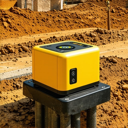
Progressive shielding methodologies, such as the deployment of electromagnetic shields and Faraday cages around sensitive sensors, help reduce external electromagnetic interference. Complemented by advanced signal processing techniques—including digital filtering, spectral analysis, and adaptive noise cancellation—these innovations enhance signal integrity and clarity.
Moreover, the development of algorithms capable of dynamically adjusting to fluctuating interference patterns offers a proactive defense mechanism. For example, time-frequency analysis methods like wavelet transforms can isolate transient noise spikes, allowing for their exclusion from the interpretative dataset. Integrating these approaches into field-ready equipment signifies a leap forward in operational resilience against the electromagnetic chaos endemic to modern urban landscapes.
Is There a Future Where AI Fully Eliminates Signal Ambiguities?
While current advancements suggest a promising trajectory toward near-complete mitigation of subterranean signal ambiguities, the prospect of AI systems wholly eliminating false positives remains aspirational. Challenges such as rare anomaly detection, unpredictable urban electromagnetic behavior, and the need for extensive high-quality training data pose ongoing hurdles. Nonetheless, continued research—particularly in deep learning and neural network architectures—aims to push this boundary.
Leading institutions, like the National Institute of Standards and Technology (NIST), are actively developing standards and validation frameworks for AI-driven utility detection systems. Researchers emphasize that combining AI with physical sensor innovations creates a robust, multi-layered defense against signal confusion, ultimately empowering urban excavators with unprecedented accuracy and safety assurance.
To stay at the forefront of this evolving landscape and leverage the latest in detection technologies, consider engaging with specialized training programs and industry consortia dedicated to underground infrastructural integrity. Deepening your understanding of these tools can markedly enhance project outcomes and safety protocols.
Harnessing the Power of Intelligent Signal Discrimination in Dense Urban Environments
In the labyrinth of underground utilities beneath bustling metropolises, the fidelity of detection is often compromised by relentless electromagnetic interference (EMI). To surmount this obstacle, engineers are increasingly turning to machine learning algorithms trained on extensive multi-modal datasets. These algorithms excel at distinguishing genuine utility signals from the cacophony of urban noise, enabling unprecedented levels of accuracy and operational confidence.
Employing supervised learning models, such as deep convolutional neural networks, allows for real-time classification of utility signatures, even amid complex interference patterns. This technological synergy not only accelerates decision-making but also significantly reduces costly misidentification, thus safeguarding infrastructure integrity and public safety.
Integrating Multi-Sensor Data for Unrivaled Utility Mapping Precision
How Can Fusion of Electromagnetic, Acoustic, and Ground-Penetrating Radar Data Revolutionize Detection?
Proactively combining multiple sensing modalities—namely electromagnetic induction, ultrasonic imaging, and ground-penetrating radar—creates a comprehensive subterranean landscape that single-method approaches cannot achieve. This fusion leverages the strengths of each modality: electromagnetic methods excel at metallic detection, acoustic sensors provide insights into non-metallic materials, and GPR offers spatial depth resolution. By employing advanced data fusion algorithms, operators can reconcile these diverse datasets into cohesive 3D models, dramatically improving the reliability of utility localization.
Reimagining Shielding Techniques for Interference Mitigation
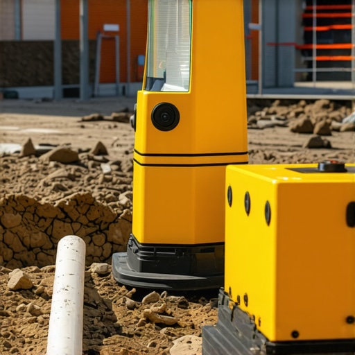
Cutting-edge shielding approaches are transforming the landscape of underground sensor deployment. Utilizing flexible electromagnetic shields and active noise-canceling protocols, modern sensors effectively create localized zones of electromagnetic silence, preserving signal integrity. Additionally, innovations in adaptive filtering, powered by real-time spectral analysis, dynamically suppress transient EMI spikes that traditionally hinder detection accuracy. This holistic shielding paradigm ensures high-fidelity data capture in even the most electromagnetically hostile environments.
Can Predictive Analytics Anticipate Interference Patterns?
Emerging research emphasizes the potential of predictive analytics integrated with sensor networks to forecast and adapt to interference fluctuations proactively. By analyzing historical EMI data and environmental variables, machine learning models can generate interference maps, enabling operators to schedule surveys strategically or adjust sensor parameters dynamically. This foresight minimizes downtime and optimizes resource deployment, elevating underground utility detection to a new echelon of precision.
Beyond Human Sight: Augmenting Detection with Augmented Reality Interfaces
Augmented reality (AR) platforms, powered by high-fidelity sensor data and 3D mapping, allow field crews to visualize underground utilities in real time overlaid onto physical environments. This immersive technology not only enhances spatial awareness but also facilitates immediate recognition of signal anomalies caused by interference or artifacts. Leveraging AR empowers technicians to make swift, informed decisions, reducing errors and accelerating project timelines in complex urban settings.
Strategic Prioritization: Focused Detection in High-Risk Zones
Advanced risk assessment models analyze infrastructure density, historical interference data, and layout complexities to identify high-priority zones where interference mitigation efforts should concentrate. Targeted deployment of shielded sensors, focused calibration, and intensive data analysis in these zones significantly improves detection reliability. Such strategic prioritization ensures optimal use of resources, effectively minimizing the risk of utility strikes and service disruptions.
Collaborating with Regulatory Bodies for Standardized Practices
Engagement with industry regulators and standards organizations is crucial in setting benchmarks for EMI mitigation and sensor performance validation. Initiatives like the American Society of Civil Engineers’ (ASCE) guidelines for underground utility detection advocate for consistent testing protocols, certification of shielding techniques, and data accuracy benchmarks. Active participation ensures that emerging technologies meet with regulatory approval, facilitating wider adoption and industry-wide enhancement of detection excellence.
Seize the Future: Elevate Your Utility Detection Capabilities Today
Are you prepared to harness these cutting-edge advancements to safeguard your underground projects? Embrace integrated sensor fusion, predictive analytics, and AR-enhanced workflows to transcend traditional limitations. For tailored insights and professional training in advanced detection methodologies, connect with our expert team or explore our comprehensive resource portal now.
Expert Insights & Advanced Considerations
Harness Multi-Modal Data Fusion
Integrating electromagnetic, acoustic, and ground-penetrating radar data creates a layered understanding of underground utilities, significantly reducing false positives and improving accuracy in interference-heavy environments.
Leverage Machine Learning at the Field Level
Deploying AI algorithms trained on diverse datasets can distinguish true utility signals from complex urban noise, enabling real-time decision-making and minimizing human error during excavation planning.
Prioritize Sensor Shielding and Adaptive Filtering
Advanced shielding techniques combined with dynamic noise-canceling algorithms enhance sensor resilience against electromagnetic interference, ensuring reliable data collection even in the most congested cityscapes.
Develop Proactive Interference Management Strategies
Scheduling surveys during low electrical activity periods and employing predictive analytics allow teams to anticipate interference spikes, optimizing detection conditions and safeguarding project timelines.
Integrate Augmented Reality for Visual Verification
Utilizing AR overlays of multisensor data enables field crews to instantly visualize underground utilities, improving accuracy amidst electromagnetic chaos and enhancing safety protocols.
Curated Expert Resources
- Journal of Construction Engineering and Management – In-depth studies on multi-sensor fusion and interference mitigation techniques.
- Ultimate Guide on Borehole Drilling Technologies – Advanced methodologies incorporating AI and multisensory data for precision drilling.
- AI Integration in Utility Mapping – Practical insights on deploying machine learning models in the field.
Final Perspective: Embrace Complexity for Safer, Smarter Excavation
In the realm of trenching, borehole, hydrovac, and vacuum excavation, mastering the art of accurate utility detection amidst urban electromagnetic interference demands a holistic, technologically advanced approach. The convergence of multi-modal data fusion, intelligent algorithms, and strategic planning not only mitigates risks but also propels industry standards forward. Engage with these innovations proactively—your projects, safety, and reputation depend on it. For deeper insights and ongoing collaboration, connect with industry leaders and explore cutting-edge resources that challenge conventional methods and redefine subterranean exploration.