
Streamlined Borehole & Hydrovac Drilling for Reliable Infrastructure
Elevating Infrastructure Reliability through Expert Borehole and Hydrovac Drilling Strategies
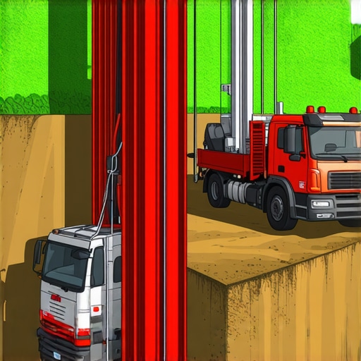
In the realm of civil engineering and underground infrastructure, the pursuit of accuracy, safety, and efficiency remains paramount. Streamlined borehole and hydrovac drilling exemplify the evolution of excavation technology, blending precision engineering with innovative methodologies to meet the rigorous demands of modern construction and maintenance projects. As infrastructure networks grow increasingly complex, the integration of expert drilling techniques becomes indispensable for ensuring long-term stability and operational excellence.
Harnessing the Power of Hydrovac Technology for Precise Site Preparation
Hydrovac excavation employs high-pressure water jets combined with vacuum systems to gently fragment soil and debris, facilitating accurate excavation around critical underground utilities. This technique minimizes risk to existing infrastructure, reduces environmental impact, and enhances site safety. Advanced hydrovac systems leverage real-time data and adaptive controls, allowing operators to fine-tune parameters for varying soil conditions. The result is a highly reliable method for borehole creation that supports precise soil sampling, trenching, and utility installation.
Innovative Borehole Techniques for Complex Subsurface Conditions
Modern borehole solutions extend beyond traditional rotary drilling, incorporating rotary-percussive, wireline coring, and hybrid techniques. These methods enable engineers to adapt swiftly to heterogeneous soil profiles, groundwater challenges, and underground obstructions. For instance, the use of diamond-tipped coring tools provides high-quality samples critical for geotechnical analysis, informing design decisions and risk assessments. In high-stakes environments, the synergy of borehole and hydrovac methods ensures that data collection and excavation are executed with unparalleled precision.
How Do Technological Advancements Improve Subsurface Safety and Data Integrity?
Emerging innovations in sensor integration, GPS guidance, and remote monitoring have revolutionized underground drilling. These enhancements facilitate real-time adjustments, reduce error margins, and ensure compliance with safety standards. For example, the deployment of ground-penetrating radar (GPR) and laser scanning creates detailed underground maps, enabling preemptive planning and risk mitigation. The combination of these technologies with expert drilling techniques significantly elevates the trustworthiness of underground infrastructure projects, aligning with the highest industry standards.
What are the key considerations when selecting between hydrovac and traditional drilling methods for sensitive environments?
Choosing the appropriate technique depends on soil composition, proximity to existing utilities, environmental constraints, and project scope. Hydrovac excels in scenarios requiring minimal disturbance and precision, especially in urban settings with dense utility networks. Conversely, traditional drilling may be preferable for deep or extensive boreholes where speed and volume are prioritized. Consulting with industry experts and analyzing site-specific data ensures optimal method selection, balancing safety, efficiency, and accuracy.
For further insights into advanced excavation strategies, visit trustworthy vacuum excavation techniques. Share your expertise or inquire about bespoke solutions to elevate your infrastructure projects to the next level.
Maximizing Accuracy with Cutting-Edge Drilling Innovations
To elevate the reliability of underground infrastructure, integrating state-of-the-art drilling technologies is imperative. Modern methods such as hybrid drilling systems combine the strengths of rotary and percussion techniques, allowing for faster, more precise borehole creation even in challenging soil conditions. These innovations reduce the risk of utility strikes and ensure data integrity, especially when combined with real-time sensor feedback and GPS guidance, as highlighted by industry experts (see best vacuum excavation practices). The strategic application of these tools results in safer, more efficient site preparation, crucial for complex projects.
How Can Emerging Sensor Technologies Transform Subsurface Data Collection?
Emerging sensor integration within borehole and hydrovac systems offers unprecedented insights into subsurface conditions. Devices like ground-penetrating radar (GPR), laser scanners, and advanced soil moisture sensors enable engineers to develop detailed underground maps before excavation begins. This proactive approach minimizes unforeseen complications, decreases project delays, and enhances safety protocols. For instance, real-time data allows operators to adjust drilling parameters dynamically, reducing environmental impact and improving site safety. As research indicates, these innovations are setting new standards for data accuracy and operational trustworthiness in underground projects (effective borehole methods).
What are the practical considerations for implementing sensor-rich drilling workflows in urban environments?
Urban settings pose unique challenges such as dense utility networks, limited space, and strict environmental regulations. Incorporating sensor-rich workflows requires careful planning, including selecting compact, non-intrusive equipment and ensuring compatibility with existing infrastructure monitoring systems. Additionally, training personnel to interpret sensor data accurately is vital for maximizing benefits. Collaborating with specialists in geotechnical analysis and environmental safety can optimize these workflows, ensuring projects meet safety standards and operational efficiency. For expert guidance, visiting trusted vacuum excavation tips can provide practical insights.
Engage with industry peers by sharing your experiences or exploring tailored solutions for your upcoming projects. Staying ahead with innovative drilling practices will solidify your reputation as a leader in reliable underground infrastructure development.
Transforming Subsurface Mapping with Next-Gen Sensor Technologies
In the quest for ultimate precision, integrating cutting-edge sensor technologies into borehole and hydrovac operations is revolutionizing underground mapping. Devices such as electromagnetic induction sensors, combined with ground-penetrating radar (GPR), enable engineers to generate high-resolution, three-dimensional models of subsurface conditions before any physical excavation begins. This proactive approach minimizes surprises, reduces project delays, and enhances safety by providing a comprehensive understanding of the underground environment, even in complex urban settings.
Harnessing Artificial Intelligence for Predictive Analytics in Drilling
The advent of artificial intelligence (AI) has opened new frontiers in subsurface exploration. Machine learning algorithms analyze vast datasets from sensor arrays and historical drilling records to predict soil behavior, groundwater movement, and potential obstacles. These insights allow engineers to optimize drilling parameters dynamically, adapt to changing conditions in real time, and prevent costly utility strikes or collapses. Industry leaders like GeoAI Solutions have demonstrated how AI-driven predictive analytics can significantly elevate project reliability and efficiency, setting new standards in underground construction safety.
Why Real-Time Data Integration Is the Future of Underground Construction
Real-time data collection during drilling operations is no longer a luxury but a necessity. Advanced sensor networks integrated with GPS and IoT (Internet of Things) platforms provide continuous feedback on soil stability, tool wear, and equipment health. This seamless data flow enables on-the-fly decision-making, immediate adjustments to drilling parameters, and early detection of potential issues. The result? Increased safety margins, minimized environmental impact, and maximized operational productivity. As noted by the Deep Foundations Institute (DFI), embracing real-time data is crucial for modern infrastructure projects aiming for zero accidents and optimal resource utilization.
What innovative approaches are emerging for integrating sensor data into urban drilling workflows?
Urban environments demand non-intrusive, highly coordinated sensor integration. Emerging solutions include miniaturized sensor modules embedded within drilling tools, wireless data transmission systems that operate in congested areas, and cloud-based platforms that facilitate collaborative decision-making among multidisciplinary teams. These innovations promise to streamline workflows, improve data accuracy, and ensure compliance with strict environmental and safety regulations. Collaborations between tech firms and civil engineering giants are already paving the way for scalable, sensor-rich urban drilling ecosystems. If you’re interested in exploring this frontier, industry reports from the American Society of Civil Engineers (ASCE) detail successful case studies and future trends.
Engage with your peers or consider partnering with specialized firms to incorporate these advanced technologies into your next project. Staying at the forefront of sensor integration will not only enhance safety but also position your organization as an innovator in underground infrastructure development.
Revolutionizing Subsurface Mapping with Multi-Sensor Integration
Integrating diverse sensor technologies such as electromagnetic induction, ground-penetrating radar (GPR), and advanced soil moisture sensors enables engineers to create highly detailed three-dimensional underground maps. This multi-sensor approach minimizes unforeseen obstacles, optimizes project planning, and enhances safety margins. By combining these data streams, specialists can develop comprehensive models that reveal complex underground conditions, even in densely built urban environments, thereby reducing risk and improving decision-making accuracy.
Deciphering the Impact of AI-Driven Predictive Models on Drilling Precision
Artificial intelligence (AI) algorithms analyze extensive datasets from sensor arrays and historical records to forecast subsurface behaviors, such as soil stability, groundwater flow, and obstacle presence. These predictive models allow for dynamic adjustment of drilling parameters, preemptively addressing potential issues like utility conflicts or collapses. Industry pioneers, including GeoAI Solutions, showcase how AI integration significantly elevates project reliability, safety, and cost-efficiency, setting new benchmarks in underground construction.
What Are the Most Effective Strategies for Urban Sensor Deployment During Drilling?
Implementing sensor-rich workflows in urban settings demands meticulous planning. Employing miniaturized, wireless sensors embedded directly into drilling equipment facilitates real-time data acquisition without disrupting dense utility networks. Compatibility with existing infrastructure monitoring systems and robust data management platforms ensure seamless integration. Training personnel in sensor interpretation and system calibration further maximizes these technologies’ benefits, enabling safer, faster, and more precise urban drilling operations. For practical insights, consult the latest case studies published by the American Society of Civil Engineers (ASCE).

High-resolution underground mapping using integrated multi-sensor systems enhances project accuracy.
Harnessing Remote Monitoring to Elevate Underground Excavation Safety
Implementing remote monitoring platforms equipped with IoT sensors provides continuous oversight of drilling conditions, equipment health, and environmental factors. This real-time oversight enables immediate intervention when anomalies are detected, significantly reducing safety hazards and environmental impacts. Advanced visualization dashboards and automated alerts facilitate proactive responses, ensuring compliance with safety standards and operational efficiency. As industry leaders emphasize, remote monitoring is integral to modern underground construction safety frameworks.
How Can Modular Sensor Systems Transform Routine Borehole Surveys?
Modular, plug-and-play sensor systems revolutionize borehole surveys by providing rapid deployment and versatile data collection capabilities. These systems can be customized to specific project requirements, enabling engineers to swiftly adapt to varying soil and groundwater conditions. The portability and scalability of modular sensors facilitate widespread adoption, reduce setup times, and foster consistent data quality. This approach propels borehole surveys into a new era of precision and efficiency, particularly valuable in complex or sensitive environments.
Unlocking the Power of Data Analytics for Subsurface Risk Management
Advanced data analytics platforms synthesize information from multiple sensors, historical data, and predictive models to identify potential subsurface risks proactively. This holistic view supports strategic decision-making, resource allocation, and contingency planning. For example, early detection of groundwater anomalies or soil instability allows engineers to modify design parameters before excavation begins, minimizing delays and safety incidents. Industry reports from the Deep Foundations Institute (DFI) underscore the transformative potential of data-driven risk management in underground infrastructure projects.
Why Is Cross-Disciplinary Collaboration Essential for Implementing Sensor Technologies?
Effective deployment of sensor technologies requires collaboration among geotechnical engineers, data scientists, environmental specialists, and construction managers. Each discipline provides critical insights, ensuring sensors are appropriately selected, calibrated, and interpreted within the broader project context. Such synergy enhances the reliability of data-driven decisions, accelerates problem resolution, and fosters innovation. For organizations aiming to lead in underground infrastructure development, establishing integrated teams and continuous knowledge exchange is vital. To explore successful models, review recent case studies published by industry associations and research institutions.
Engage with experts or industry peers to learn how to tailor sensor integration strategies to your specific project needs. Embracing these advanced techniques will not only mitigate risks but also position your organization at the forefront of sustainable and safe underground construction practices.
Refining Precision in Subsurface Work
Employing cutting-edge borehole and hydrovac techniques ensures unparalleled accuracy and safety in underground construction. Leveraging hybrid drilling systems and real-time sensor feedback allows engineers to adapt swiftly to complex soil conditions, minimizing utility strikes and project delays.
Integrating Sensor Technologies for Better Data
Advanced sensor integration, including ground-penetrating radar and soil moisture sensors, crafts detailed underground maps that inform decision-making. These technologies, combined with AI analytics, enable predictive insights that preempt potential issues, safeguarding both personnel and infrastructure.
Prioritizing Safety with Remote and Modular Monitoring
Remote monitoring platforms equipped with IoT sensors facilitate continuous oversight of drilling conditions, allowing for immediate responses to anomalies. Modular sensor systems enhance deployment flexibility, especially in urban environments with dense utility networks, ensuring safety and operational efficiency.
Expert-Recommended Resources for Deepening Knowledge
- Hydrovac Drilling Techniques: An authoritative guide on modern excavation methods, emphasizing safety and precision.
- Geotechnical Sensor Integration: Industry reports detailing successful sensor deployment in complex urban settings.
- AI in Subsurface Exploration: Cutting-edge research showcasing AI’s role in predictive analytics for underground work.
Final Perspective on Advanced Drilling Practices
In the fast-evolving world of underground infrastructure, mastering advanced borehole and hydrovac techniques is vital for achieving reliable, safe, and efficient results. Embracing innovative technologies and expert insights will position professionals at the forefront of industry excellence, fostering resilient and sustainable development. Engage with specialized communities or consult industry leaders to further elevate your project capabilities and contribute to shaping the future of underground construction.
I really appreciate how this article emphasizes the importance of integrating advanced sensor technologies and AI into underground drilling projects. In my experience working on urban infrastructure projects, real-time data has greatly increased safety and accuracy, especially when dealing with complex underground environments. One challenge we’ve faced is ensuring seamless data integration from diverse sensor systems, which requires meticulous planning and skilled personnel. I’m curious how others have addressed interoperability issues between different sensor platforms. Have any of you found specific tools or strategies that streamline this process? It seems that the future of underground excavation hinges on harmonizing these technologies effectively to mitigate risks and improve decision-making. I look forward to hearing about innovative solutions or best practices from the community.
This article offers a comprehensive overview of how advanced borehole and hydrovac techniques are transforming underground infrastructure projects. From my experience working on waterfront development in urban settings, I’ve seen firsthand how integrating multi-sensor systems—like ground-penetrating radar and soil moisture sensors—can dramatically reduce unforeseen issues during excavation. One aspect I find particularly promising is the potential for real-time data to not only improve safety but also optimize resource allocation and reduce project timelines.
In projects with dense utility networks, implementing modular sensor systems that are both wireless and scalable has been a game-changer for us. They allow for rapid deployment and provide the detailed underground maps needed for precise planning. I’m curious, for organizations just starting to adopt these technologies, what initial challenges have you encountered, and how did you overcome them? Also, what strategies do you suggest for ensuring seamless collaboration between geotechnical engineers, data scientists, and construction teams? It’s clear that the future lies in collaborative, sensor-rich workflows that prioritize safety, accuracy, and efficiency, but setting up such systems requires careful planning and cross-disciplinary coordination.