
Stop Digging Blind: 6 Vacuum Excavation Benefits for 2026
Elevating Subsurface Precision Through Integrated Trenching and Vacuum Excavation Technologies
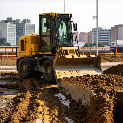
In the realm of underground infrastructure development, the convergence of trenching and vacuum excavation techniques is at the forefront of mitigating risks associated with utility strikes and ensuring project accuracy. As experts in the field recognize, deploying synergistic methods like hydrovac and borehole drilling enhances precision, particularly when combined with sophisticated utility mapping strategies.
How do modern hydrovac systems outperform traditional trenching in complex urban environments?
Contemporary hydrovac systems leverage high-pressure water and powerful vacuum extraction to delineate underground utilities with minimal surface disruption. Unlike conventional mechanical trenching, hydrovac minimizes accidental utility damage, a critical factor supported by recent studies published in ASHRAE Journal, which underscore the importance of non-invasive approaches for urban projects.
Achieving Reliability in Utility Mapping with Borehole Techniques
Ultrareliable underground explorations hinge on meticulous borehole drilling methodologies, integrating advanced equipment with targeted strategies. Precise borehole construction, as detailed in this expert guide, is vital for accurate subsurface data collection, enabling engineers to visualize and document underground assets effectively.
What innovations in borehole technology are set to redefine utility detection accuracy in 2026?
Emerging innovations include real-time geophysical sensing integrated within borehole drills, providing immediate feedback on underground conditions. These advancements enhance decision-making, reduce sampling errors, and align with the broader shift toward digital twin applications in infrastructure management.
Strategic Layering of Vacuum Excavation for Complex Sites
Vacuum excavation, particularly hydrovac, is praised for its safety and efficiency. The strategic application of trenchless techniques, such as directional boring combined with vacuum-assisted excavation, allows for multi-layered underground work without surface disturbance, crucial in densely developed zones.
Synchronizing Expertise for Future-Proof Infrastructure Development
Integrating these sophisticated methods demands a high level of skilled expertise. Professionals must be fluent in the latest techniques—such as streamlined borehole strategies and trenchless pipeline installation—to future-proof projects amidst evolving regulations and environmental considerations.
For further insights, explore this comprehensive resource on reliable underground utility detection strategies, which delves into cutting-edge practices transforming the industry.
Enhance Your Projects with Expert Knowledge
If you’re interested in elevating your underground development capabilities or contributing your professional insights on evolving trenching and vacuum excavation techniques, consider engaging with specialized forums and industry leader platforms for collaborative growth.
Elevate Your Utility Detection Accuracy with Emerging Technologies
In the rapidly evolving field of underground infrastructure development, reliance on traditional detection methods often leaves room for costly errors. To address this, professionals are turning to innovative solutions like real-time geophysical sensing integrated within borehole drills, which provide immediate underground condition feedback. These advancements are crucial for minimizing utility strikes and ensuring project efficiency, as highlighted by industry leaders at this expert guide. By adopting these technologies, engineers can achieve unprecedented precision, reduce subsurface uncertainties, and adapt more swiftly to complex urban environments.
Can advanced digital twin technology revolutionize underground utility mapping and maintenance?
Digital twin applications allow for comprehensive, 3D virtual replicas of underground assets, enabling real-time monitoring, simulation, and predictive maintenance. When integrated with borehole data and vacuum excavation insights, digital twins can significantly enhance accuracy, planning, and incident response capabilities. The synergy of these tools fosters a proactive approach to infrastructure management, reducing downtime and operational costs. For a deeper dive into the potential of digital twins in underground projects, visit this detailed resource.
Reimagining Safety Protocols with Multilayered Vacuum Excavation Strategies
As urban zones become denser, simple trenchless techniques need to evolve into layered, strategic applications. Combining directional boring with vacuum-assisted excavation enables the execution of multi-layered underground work without extensive surface disruption. Such methods not only enhance safety, by reducing accidental utility damage, but also improve project timelines. Implementing these layered strategies requires a keen understanding of soil mechanics, utility positioning, and environmental impact—areas where ongoing training and industry collaboration prove beneficial.
Challenge the Status Quo: How Might Industry Standards Adapt to Cutting-Edge Technologies?
Adapting existing standards to incorporate emerging technologies remains a significant challenge. Regulators and industry bodies must evaluate the safety, reliability, and cost-effectiveness of innovations like real-time borehole sensing and digital twin integration. An industry-wide shift toward these tools necessitates rigorous validation and pilot programs to establish best practices. Engaging with leading experts and participating in case studies can expedite this transition, ensuring that standards evolve in harmony with technological progress. For more insights into regulatory adaptations, explore this authoritative article.
Interested in staying at the forefront of underground detection innovations? Share your experiences or ask questions in our community forums—and stay connected with developments shaping the future of utility mapping and excavation techniques.
,
Harnessing Machine Learning to Elevate Utility Detection Precision
As urban infrastructure becomes increasingly intricate, traditional detection methods often struggle to keep pace with the complexity and density of underground assets. Enter machine learning—a revolutionary approach transforming utility mapping. By analyzing vast datasets from sensors, historical records, and geophysical surveys, machine learning algorithms can predict utility locations with unprecedented accuracy, proactively identifying potential conflicts before excavation begins. This technological leap, detailed in recent industry-focused publications such as IEEE Transactions on Geoscience and Remote Sensing, signifies a shift towards predictive analytics in underground utility detection, mitigating risk and streamlining project timelines.
What are the limitations of current AI-driven utility detection models, and how can they be addressed?
While AI models excel at pattern recognition, they can falter in scenarios with limited data, highly variable soil conditions, or unexpected underground anomalies. Addressing these issues requires multidisciplinary integration—combining AI insights with expert field validation, real-time geophysical sensing, and continuous data updating. Incorporating adaptive learning systems that evolve with new data ensures models remain robust across diverse project sites. For industry practitioners, investing in high-quality, annotated datasets and fostering cross-disciplinary collaborations are vital steps toward overcoming current limitations and unlocking AI’s full potential in subsurface exploration.
Digital Twins: Charting a New Course for Underground Asset Management
Digital twin technology offers a dynamic, virtual replica of subsurface environments that can simulate utility layouts, soil behavior, and even environmental factors. When integrated with real-time sensor data from boreholes and hydrovac operations, digital twins enable predictive maintenance, hazard forecasting, and scenario testing without risking surface integrity. According to a comprehensive analysis published in PLOS ONE, this approach enhances decision-making accuracy, reduces costs, and accelerates project delivery—particularly critical in dense urban settings where surface disruption must be minimized.
How might future digital twin developments leverage spatial AI to improve underground utility visualization?
Spatial AI integrates geospatial analytics with artificial intelligence, enabling digital twins to interpret complex underground data layers interactively. Future advancements could feature real-time updates from robotic sensors, remote operable drilling equipment, and even autonomous excavation systems, all feeding live data into the twin. This interconnected ecosystem would allow engineers to visualize utility assets in three dimensions, simulate excavation impacts, and dynamically plan interventions—effectively making underground management a proactive rather than reactive process. For visionary engineers and project managers, mastering spatial AI integration represents a strategic imperative for next-generation infrastructure resilience.
Innovations in Soil Stratification Analysis for Precise Utility Placement
Accurate soil characterization is fundamental to optimizing utility installation depths and minimizing settlement risks. Advancements in geotechnical sensing technologies—such as high-resolution ground-penetrating radar coupled with seismic tomography—are providing granular insights into soil stratification. These methods facilitate tailored trenchless techniques, allowing for precise borehole drilling and pipeline placement aligned with soil mechanics. An authoritative case study from the Geotech Journal highlights how integrating these technologies reduces unforeseen subsurface issues, saving time and costs while enhancing safety.
What role does real-time soil behavior monitoring play in adaptive underground construction?
Real-time soil monitoring employs sensor networks embedded within boreholes and excavation sites to track moisture content, stress levels, and deformation patterns during construction. This continuous feedback loop enables dynamic adjustments—such as altering excavation rates, modifying support structures, or recalibrating boring paths—in response to evolving soil conditions. Such adaptive methods significantly mitigate risks associated with soil instability, especially in challenging urban environments with heterogeneous geologies. Incorporating these innovations requires a collaborative approach between geotechnical experts, geophysicists, and construction teams to develop robust monitoring protocols and data integration platforms, ensuring adaptive responses are swift and effective.
,
From Static Surveys to Dynamic Data Ecosystems: The Future of Utility Mapping
Traditional underground utility detection methods, while foundational, are increasingly giving way to integrated data-driven ecosystems that blend sensor technologies, geophysical surveys, and advanced data analytics. This evolution empowers industry professionals to preemptively identify potential conflicts and streamline construction workflows, a shift underscored by recent case studies published in the American Society of Civil Engineers’ Infrastructure Journal. As urban environments grow more complex, such holistic approaches serve as indispensable tools for precision and risk mitigation.
How does the fusion of borehole geophysical sensing and real-time analytics transform underground asset management?
This synergy enables continuous, up-to-date mapping of subsurface conditions, revealing hidden utilities and soil anomalies with a level of accuracy previously unattainable. Integrating sensor data within a centralized platform allows engineers to create dynamic 3D models that can adapt to real-time changes, facilitating proactive decision-making. These innovations are crucial in dense urban sites, where surface disruptions must be minimized without compromising safety or accuracy.

Supercharging Utility Detection with Machine Intelligence and Predictive Modeling
The application of machine learning algorithms to subsurface data streams revolutionizes predictive accuracy, enabling anticipation of utility locations and soil behaviors under varying conditions. By leveraging large datasets—comprising sensor outputs, historical records, and geophysical survey results—these models can identify patterns and anomalies, essentially ‘learning’ from past excavation challenges. Industry-specific analyses, such as those documented in IEEE Transactions on Geoscience and Remote Sensing, demonstrate how AI-driven approaches significantly reduce utility strikes, saving time and resources.
What are the critical hurdles in deploying machine learning models across diverse geotechnical environments, and how can they be surmounted?
Challenges include data heterogeneity, limited labeled datasets, and site-specific soil conditions that vary widely. Addressing these requires developing robust transfer learning frameworks, fostering cross-disciplinary collaboration to curate comprehensive datasets, and employing adaptive algorithms tuned to local geotechnical profiles. Establishing open-data repositories and encouraging standardized data collection practices can accelerate the refinement and validation of these models, ensuring their reliable application across a broad spectrum of urban settings.
Innovative Soil Profiling Synergies Drive Precision in Utility Placement
Next-generation soil characterization employs high-resolution seismic and electromagnetic sensing technologies, offering detailed stratigraphic insights essential for optimal utility installation. Coupled with geostatistical modeling, these tools identify zones with heightened risk of settlement or utility damage, guiding tailored trenchless methods and depth specifications. A seminal study from the Geotech Journal elaborates on how integrating these techniques enhances project reliability while minimizing surface impact.
How do adaptive soil models facilitate real-time adjustments during underground construction?
Real-time soil behavior monitoring integrates sensor arrays within boreholes and excavation zones, tracking parameters such as moisture, stress, and deformation. This data feeds into adaptive modeling platforms that inform immediate operational decisions—altering boring trajectories, adjusting support systems, or modifying excavation parameters—to counteract unforeseen geotechnical issues dynamically. Embedding such responsive systems demands cross-disciplinary expertise and iterative calibration but promises markedly improved safety and efficiency outcomes in challenging urban terrains.
Expert Insights & Advanced Considerations
Embracing Automation to Reduce Human Error
Integrating automated borehole drilling and vacuum excavation systems enhances precision and minimizes onsite risks, setting new industry standards for efficiency and safety.
Prioritizing Multi-Modal Data Collection
Combining geophysical surveys, real-time sensor data, and machine learning models creates a comprehensive approach that anticipates underground challenges before excavation, saving time and resources.
Adapting Strategies for Urban Density
In densely built environments, layered trenchless techniques, such as directional boring combined with vacuum excavation, enable complex underground work with minimal surface impact, maintaining urban functionality.
Fostering Skilled Workforce Development
Training professionals on next-generation tools like digital twins and adaptive soil models ensures optimized decision-making and seamless integration of advanced technologies in projects.
Shaping Future Regulations and Standards
Proactive engagement with industry bodies to update standards reflecting emerging technologies ensures safety, reliability, and innovation remain aligned for underground infrastructure projects.
Curated Expert Resources
- Hydrovac Drilling Best Practice Guides: Comprehensive resources detailing latest techniques for reliable utility detection and trenchless installation, crucial for minimizing utility strikes.
- IEEE Transactions on Geoscience and Remote Sensing: Cutting-edge research on geophysical sensing and machine learning applications transforming subsurface exploration.
- Geotech Journal Publications: In-depth analyses on soil characterization advances aiding precise utility placement and infrastructure resilience.
- Industry Standards Updates: Official documentation and proposals shaping future regulations in underground construction and excavation safety.
- Digital Twins Integration Tutorials: Step-by-step guides to implement real-time virtual models for optimized underground utility management.
Final Expert Perspective
Elevating subterranean accuracy through innovative trenching and vacuum excavation techniques embodies the future of underground infrastructure development. By embracing automation, complex data integration, and adaptive strategies, industry professionals can achieve unparalleled precision, safety, and efficiency. Staying well-versed in these emerging methodologies and actively contributing to evolving standards ensures a resilient and forward-looking approach to underground projects. Engage with industry peers, share your insights, and continually explore advanced resources to remain at the forefront of this transformative field.
This post underscores the remarkable progress in integrated trenching and vacuum excavation technologies, illustrating a clear shift toward more precise and safer underground construction practices. I’ve worked on several urban projects where traditional trenching posed significant risks to existing utilities, often causing costly delays. The adoption of hydrovac and advanced borehole sensing tools has been a game-changer, especially when combined with real-time data analytics. I’m curious about how industry standards are evolving to encapsulate these innovations—are we seeing formal updates to protocols that specify the use of digital twins or AI-driven sensors? It seems crucial for regulators to stay ahead of technological advancements to ensure safety and consistency across projects. What strategies have others seen that effectively expedite the integration of these new tools into everyday practice, especially in dense city environments? Sharing experiences could help streamline adoption and set new benchmarks for underground utility management.