
Hydrovac & Trenching Expertise for Safer Underground Projects
Elevating Underground Construction: A Deep Dive into Modern Excavation Strategies
In today’s complex infrastructure landscape, the precision and safety of underground projects hinge on employing cutting-edge excavation methodologies. Techniques such as hydrovac excavation and vacuum-assisted trenching are transforming how engineers and contractors approach subterranean work, emphasizing reliability, accuracy, and risk mitigation. Understanding the nuances of these approaches not only enhances project outcomes but also aligns with evolving safety standards and technological advancements.
The Strategic Advantage of Hydrovac Systems in Ensuring Infrastructure Integrity
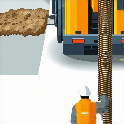
Hydrovac excavation integrates high-pressure water and industrial-strength vacuuming to precisely remove soil without damaging existing utilities or structures. This non-invasive method enables operators to safely expose underground assets, critical in densely populated urban settings. Moreover, hydrovac’s versatility allows for borehole creation in challenging terrains, providing a reliable foundation for utility installations and inspections. The strategic deployment of hydrovac systems, as detailed in recent industry analyses, significantly reduces the likelihood of costly utility strikes and project delays.
Vacuum Excavation and Trenching: Synergistic Technologies for Safer Excavation
The integration of vacuum excavation with traditional trenching techniques offers a compelling blend of speed and safety. Vacuum-assisted trenching enhances the precision of diagnostic and preparatory work, especially when mapping complex underground utility networks. This synergy fosters a proactive approach to risk management, ensuring that both the construction process and post-installation maintenance adhere to stringent safety protocols. As highlighted by industry leaders, adopting these combined approaches is critical for compliance with increasingly rigorous safety regulations.
What Are the Limitations of Current Borehole Techniques in Utility Mapping?
How Can Emerging Innovations Address the Challenges of Depth Accuracy and Soil Variability?
Borehole drilling remains a cornerstone for utility mapping, environmental assessments, and foundation work. However, the intricacies of soil heterogeneity and the need for precise depth control pose ongoing challenges. Innovations such as real-time geophysical sensing and adaptive drilling algorithms are beginning to mitigate these issues, offering enhanced accuracy and adaptability. Industry reports suggest that integrating these technologies fosters more reliable underground data acquisition, ultimately reducing project ambiguities and expansion costs.
Implementing Expert-Level Strategies for Future-Ready Infrastructure Projects
As urban landscapes evolve, so too must the methodologies underpinning underground construction. Emphasizing strategic planning through advanced tools like 3D subsurface modeling and laser-guided drilling ensures that projects are executed with maximum precision. For professionals eager to deepen their expertise, exploring comprehensive resources such as top borehole and hydrovac techniques for 2025 provides valuable insights into emerging trends and best practices. Sharing field experiences and technological innovations remains essential for advancing industry standards and fostering safety-driven progress across underground engineering disciplines.
Maximizing Accuracy with Modern Borehole Drilling Methods
In the quest for flawless utility mapping and underground infrastructure installation, selecting the optimal borehole drilling technique is paramount. Advances like rotary core drilling and guided electromagnetic sensing have revolutionized how engineers achieve unparalleled depth control and soil characterization. By integrating real-time data collection systems, contractors can adapt drilling parameters instantaneously, reducing errors and avoiding utility strikes. Industry analyses underscore that investing in innovative borehole methods directly translates to safer, more reliable projects, as detailed in these leading techniques for 2025.
The Critical Role of Soil Variable Management in Deep Excavation
One often overlooked aspect in subterranean work is the unpredictable nature of soil composition and moisture content, which can compromise the stability and safety of any excavation. Advanced geotechnical assessment tools, such as 3D subsurface imaging and soil resistivity measurements, allow for detailed analysis before drilling commences. These insights inform decision-making, enabling tailored excavation strategies that accommodate heterogenous soil profiles, thereby minimizing settlement risks or collapse hazards. As industry experts note, understanding soil variability through precise data is essential for designing resilient foundations and safe trenching operations.
What innovations are shaping the future of underground utility detection capabilities?
Emerging technologies like drone-based subterranean scanning and AI-driven predictive modeling are redefining utility detection. These tools can identify underground assets with unprecedented accuracy, even in complex urban environments. Incorporating such innovations reduces excavation errors, saves costs, and enhances worker safety. To explore the latest on these evolving capabilities, consult trenching and vacuum excavation tips for 2025. Sharing insights and field experiences within industry forums accelerates adoption and hones best practices across construction disciplines.
Interested in learning more about cutting-edge underground excavation methods? Join the discussion or share your insights in the comments below to help push the industry toward safer and more precise practices.
,
Revolutionize Your Utility Detection with Next-Gen Subsurface Imaging
In the realm of underground construction, the ability to accurately detect and map existing utilities can dramatically influence project success. Traditional electromagnetic surveys, while effective in certain scenarios, struggle with densely packed urban environments or soils with high mineral content. Enter innovative ground penetrating technologies such as ultra-wideband radar and advanced electromagnetic induction systems, which provide high-resolution subsurface images even in challenging conditions. These cutting-edge tools enable engineers to visualize underground assets with unprecedented clarity, reducing the risk of utility strikes, costly delays, and safety incidents.
Integrating Multiple Sensing Modalities for a Holistic Subsurface Perspective
Multisensor data fusion amplifies the strengths of individual techniques, offering a comprehensive view of subterranean landscapes. For instance, pairing GPR (Ground Penetrating Radar) with seismic reflection data can distinguish between different utility types, depths, and even avoid false positives caused by soil heterogeneity. Sophisticated algorithms process these datasets in real time, presenting an integrated 3D model that vastly improves planning accuracy. This synergy not only aids in immediate project execution but also establishes a baseline for ongoing maintenance and future upgrades.
Considerations for Operational Efficiency and Data Security in Advanced Detection Systems
Adopting state-of-the-art detection technology necessitates meticulous attention to operational protocols and data management. High-resolution sensors generate substantial data volumes, requiring robust storage solutions and secure transmission channels. Furthermore, ensuring interoperability between various devices and software platforms is vital for seamless workflow integration. Implementing standardized data formats and encryption protocols enhances collaboration among stakeholders while safeguarding sensitive infrastructure information. As industry standards evolve, investing in these considerations ensures that technological advancements translate into tangible project gains and resilient asset management.
How Can Artificial Intelligence Elevate Subsurface Utility Mapping?
AI-driven analysis models, especially deep learning algorithms, are transforming underground utility detection by automatically identifying patterns and anomalies within large datasets. These systems can learn from extensive repositories of surveyed sites to predict utility locations with remarkable accuracy, even in environments with complex underground clutter. Moreover, AI can optimize survey parameters, dynamically adjusting sensor configurations based on immediate feedback, thereby improving efficiency and reducing survey times. For construction companies and engineers, embracing AI integration promises a strategic edge—delivering faster, safer, and more reliable subsurface mapping solutions. For further insights, explore research detailed in the authoritative publication Enhancing Utility Detection with Artificial Intelligence—a comprehensive resource that delineates practical applications and future trends.
Are you leveraging the latest in underground detection technology? Share your experiences or inquire about integrating these advanced methods into your projects—collaborative innovation drives industry progress.
Mastering the Art of Soil Characterization for Deep Excavations
Successful underground trenching hinges upon accurate soil profiling, which significantly impacts stability assessments and safety protocols. Leveraging advanced geotechnical evaluation methods, such as cone penetration testing (CPT) combined with high-resolution soil impedance imaging, allows engineers to delineate heterogeneity with heightened precision. These insights enable tailored excavation approaches, minimizing settlement risks and ensuring structural integrity for future infill or lining procedures.
How Do Emerging Soil Sensing Technologies Refine Subsurface Data Acquisition?
Innovations like acoustic spectroscopy and electromagnetic induction offer unprecedented detail in characterizing subsurface layers. These tools facilitate real-time monitoring of soil moisture variations and density changes, which are critical factors in planning excavation sequences. Incorporating these technologies into routine site assessments enhances predictive accuracy, leading to safer and more economical trenching operations, as emphasized by recent geotechnical research from the International Journal of Geotechnical Engineering.
Smart Borehole Drilling: Precision and Adaptability in Utility Mapping
Borehole drilling has long served as a cornerstone for underground utility detection; however, traditional methods often falter amid complex soil conditions. The advent of smart drilling systems equipped with adaptive control algorithms and real-time soil feedback has revolutionized accuracy. These systems adjust parameters dynamically, accommodating soil variability, and providing reliable depth data essential for avoiding utility conflicts and environmental contamination.
Adopting Integrated Sensor Suites for Enhanced Utility Localization
Deploying multisensor arrays—merging resistivity sensors, ground-penetrating radar (GPR), and seismic sensors—produces a comprehensive subsurface map. Data fusion techniques synthesize diverse sensory inputs into coherent, high-resolution images of underground utility networks. This integrated approach reduces false positives and improves detection confidence, especially in urban densification projects where utility corridors are densely packed.

Visualize the current state-of-the-art sensor fusion system deployed in urban utility detection, highlighting the convergence of GPR, seismic, and resistivity sensing technologies for precise underground mapping.
How Can Industry Leaders Exploit Intelligent Data Analytics for Groundbreaking Precision?
Harnessing the power of artificial intelligence and machine learning to analyze vast datasets collected from subsurface surveys unlocks new levels of precision. AI models can identify subtle anomalies indicative of utility presence or soil anomalies that escape conventional analysis. By deploying predictive analytics, project managers can optimize excavation sequences, reduce unintended utility strikes, and improve project timelines—propelled forward by leading research from the Global Geotechnical Innovators.
Join the vanguard of underground construction by integrating these advanced methods into your next project. Contact us today to explore how cutting-edge soil characterization and borehole technologies can elevate your operational accuracy and safety standards.
,
Expert Innovations Reshaping Subsurface Work
Professionals in underground construction recognize that integrating cutting-edge technologies like real-time geophysical sensing and AI-enhanced utility detection elevates project accuracy and safety. Embracing multisensor data fusion and adaptive drilling techniques allows for unprecedented soil understanding and utility mapping, reducing risks associated with complex subterranean environments.
Prime Resources for Mastery and Latest Trends
- International Journal of Geotechnical Engineering: Offers advanced research on soil variable assessment and innovative sensing technologies.
- GEOTECHTECH Solutions: Provides industry-leading insights into machine learning applications for underground utility detection.
- HydroVac Drilling’s Resource Hub: Features comprehensive guides on integrated borehole and hydrovac techniques for precise infrastructure development.
Harnessing Complexity for Superior Outcomes
The significance of combining high-resolution subsurface imaging with intelligent analytics cannot be overstated; these synergistic approaches empower engineers to execute projects with greater confidence and minimized disruption. For industry leaders committed to excellence, exploring these advanced methodologies offers a crucial competitive advantage. Engage with top-tier resources and contribute your expertise to shape the future of underground construction—because the real breakthrough lies in our collective pursuit of precision and safety.