
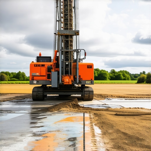
Borehole Drilling Techniques for Accurate Utility Mapping in 2025
Precision and Safety in Underground Infrastructure: The Evolution of Trenching and Borehole Strategies
As urban landscapes become increasingly complex and subterranean utility networks expand, the demand for innovative trenching, borehole, and hydrovac excavation methods has intensified. Industry experts recognize that integrating advanced vacuum excavation techniques with traditional trenching strategies is pivotal for maintaining infrastructure integrity and ensuring personnel safety. In this context, understanding the latest technological developments and their application within the broader framework of subterranean utility mapping is essential for professionals striving for operational excellence in 2025.
Synergizing Vacuum Excavation and Trenching for Optimal Utility Detection
The convergence of hydrovac and vacuum excavation solutions with conventional trenching approaches offers a transformative pathway toward more accurate underground utility detection. For instance, hydrovac excavation reduces the risk of damaging existing lines by providing precise site preconditioning, especially in congested urban settings. When combined with advanced borehole drilling techniques, such as rotary or percussion methods, these strategies bolster the reliability of utility mapping efforts, ultimately leading to decreased project delays and expense.
Challenges in Implementing Integrated Excavation Solutions
Despite significant benefits, integrating these methodologies requires overcoming technical and logistical hurdles. Material variability and subsurface complexity can influence excavation precision, necessitating adaptive strategies that leverage real-time data analytics and machine learning. In addition, aligning safety standards with emerging technologies mandates rigorous training and process standardization. Consequently, infrastructure developers must consider these dimensions when designing trenching campaigns to maximize accuracy and minimize risks.
Emerging Technologies Transforming Utility Mapping
Emerging innovations such as ground-penetrating radar (GPR) and electromagnetic induction complement trenchless technology advancements, enhancing subsurface imaging precision. The application of borehole drilling methods tailored for superlative utility detection enables a reliable overlay of mapped utilities, reducing unintentional damage. Similarly, integration of artificial intelligence streamlines decision-making processes, elevating the standard of underground operations in urban development projects.
How can practitioners optimize the synchronization of hydrovac and traditional trenching within complex urban environments?
To maximize efficiency, professionals should adopt an iterative approach that combines real-time geophysical surveys with adaptive excavation plans. Deploying multidisciplinary teams trained in both traditional and modern techniques can bridge knowledge gaps, fostering a responsive and precise operational workflow. Continuous data collection and analysis facilitate proactive adjustments, ultimately safeguarding existing infrastructure and enhancing project outcomes.
If you are interested in exploring detailed strategic frameworks for integrating vacuum excavation with trenching in challenging environments, consult our comprehensive resource on hydrovac vacuum excavation strategies for safer infrastructure. For professionals seeking to contribute insights or share field experiences, engaging with specialized forums and industry groups will be invaluable.
As documented in recent white papers from the American Society of Civil Engineers, the continuous advancement of trenching and borehole techniques remains central to urban infrastructure resilience. Integrating these strategies allows for precise, safe, and cost-effective underground work—cornerstones of sustainable city development.
Embracing Intelligent Technologies for Safer Subsurface Operations
As urban underground environments grow increasingly complex, leveraging intelligent technologies becomes essential to enhance safety and accuracy in trenching and borehole activities. Integration of real-time data analytics, sensor deployment, and machine learning algorithms allows operators to adapt dynamically to unpredictable subsurface conditions. For example, ground-penetrating radar (GPR) combined with artificial intelligence not only accelerates utility detection but also reduces the risk of unexpected utility strikes, aligning with the strategic insights provided by advanced borehole drilling techniques for utility mapping.
Reevaluating Conventional Wisdom: Is Manual Excavation Still Relevant?
While modern machinery and automation dominate current practices, the role of manual excavation techniques persists in highly sensitive sites or areas with minimal disturbance requirements. Experts argue that, when combined with advanced detection tools, traditional manual methods can still provide precision in delicate environments—particularly where technological blank spots exist or where power sources are limited. Balancing traditional expertise with cutting-edge solutions enhances operational versatility and ensures comprehensive risk mitigation strategies.
Can integrated technology create a new standard for underground utility planning and maintenance?
Absolutely. The convergence of various technological solutions fosters a paradigm shift—moving toward predictive maintenance models and proactive infrastructure management. By utilizing a combination of vacuum excavation, borehole imaging, and predictive analytics, professionals can anticipate issues before they manifest, significantly reducing emergency repairs and service interruptions. To explore these strategies in detail, review our insights on hydrovac vacuum excavation strategies for reliable infrastructure.
Engaging with industry forums and participating in pilot programs that test these integrated approaches can accelerate adoption and improve overall project outcomes. As noted by leading infrastructure researchers in the latest white papers on vacuum excavation, such forward-thinking strategies are vital to adapting to evolving urban demands.
,
Unlocking the Power of Data-Driven Excavation Operations
As infrastructure projects grow increasingly complex, integrating data analytics into excavation practices propels project accuracy and safety to unprecedented levels. Employing real-time sensor feedback combined with machine learning algorithms enables operators to predict subsurface conditions more accurately, thus tailoring excavation approaches dynamically. This approach minimizes environmental disturbance and reduces unforeseen utility encounters, which have historically caused project delays and safety incidents. For example, integrating Internet of Things (IoT) sensors within hydrovac systems allows continuous monitoring of soil stability and utility proximity, enabling instant decision-making and operational adjustments.
Refined Techniques for High-Precision Utility Detection in Dense Urban Fabrics
In dense urban environments, traditional utility mapping often encounters limitations due to congested subsurface networks and confined working spaces. To surmount these challenges, combining ground-penetrating radar (GPR) with electromagnetic induction technology—supported by sophisticated signal processing—is proving transformative. Recent advancements indicate that automated interpretation of GPR data, facilitated by AI-driven software, can delineate utility paths with centimeter-level precision. Such technological synergy not only enhances detection reliability but also considerably decreases the risk of service disruptions or catastrophic utility strikes during excavation.

Visual representation of integrated underground utility detection technologies using GPR and electromagnetic induction methods in a complex urban setting.
Strategic Training Paradigms for Next-Generation Excavation Teams
Given the rapid technological evolution, developing comprehensive training modules that encompass both traditional manual skills and modern digital competencies is critical. Advanced virtual reality (VR) simulations mimic intricate excavation scenarios, allowing personnel to hone their decision-making abilities in a risk-free environment. By fostering a hybrid skill set that balances seasoned craftsmanship with cutting-edge technological fluency, organizations can ensure a resilient workforce capable of executing complex projects efficiently and safely. Additionally, establishing continuous professional development programs encourages adaptation to emerging tools and methodologies, creating a proactive culture of safety and innovation.
Pioneering the Future of Subsurface Operations through Industry Collaboration
Collaboration among industry leaders, academia, and government agencies accelerates the development and deployment of innovative underground management solutions. Initiatives such as demonstration projects and standardized data sharing platforms promote best practices and facilitate cross-disciplinary learning. For example, the recent consortium led by the American Society of Civil Engineers exemplifies how open innovation accelerates adoption of integrated trenchless technologies, ultimately transforming the landscape of underground utility maintenance. Stakeholders are encouraged to participate actively, contributing field insights and embracing shared data repositories to optimize operational strategies.
What role will emerging AI technologies play in future underground infrastructure projects?
Artificial intelligence is poised to become the cornerstone of intelligent infrastructure management, enabling predictive diagnostics, autonomous excavation control, and adaptive planning. By analyzing vast datasets from sensors, historical records, and geophysical surveys, AI algorithms can identify patterns indicative of potential subsurface issues, allowing preemptive interventions. This proactive approach significantly reduces emergency repairs, enhances safety, and improves resource allocation. As this technology matures, embracing AI-driven decision-making will likely become the industry standard for minimizing risks and maximizing efficiency in underground operations.
To stay ahead in this evolving landscape, industry professionals are encouraged to explore collaborations with AI developers and participate in pilot projects that test these innovative solutions. As emphasized by leading research in the field, integrating artificial intelligence into underground utility management will fundamentally change how projects are planned, executed, and maintained—ushering in a new era of smart, resilient infrastructure systems.
Leverage Multi-Layered Data Integration for Precision Depth Sensing
In dense urban environments, the fusion of geophysical survey data with real-time sensor analytics is transforming subterranean mapping accuracy. By employing advanced algorithms that synthesize ground-penetrating radar (GPR), electromagnetic induction, and sensor feedback, professionals can construct high-fidelity 3D models of underground utilities, overcoming traditional resolution limitations. This integrative approach minimizes unintentional strikes and accelerates project timelines, establishing a new industry standard.
Advance Your Utility Detection Arsenal with AI-Driven Signal Processing
Artificial intelligence is now pivotal in interpreting complex signals from multiple detection modalities. Machine learning models trained on extensive datasets identify utility patterns with centimetric confidence, even amidst signal noise and infrastructure congestion. Incorporating AI not only enhances detection reliability but also provides predictive insights into potential utility shifts, allowing proactive excavation planning. This technological leap supports safer operations and cost savings in multifaceted urban projects.
How does Subsurface Holography Revolutionize Underground Navigation?
Emerging techniques like subsurface holography produce real-time, volumetric visualizations that map underground features with microscopic precision. By projecting laser or acoustic waves in layered sequences, this method captures a comprehensive view of utility networks entrenched beneath complex soil strata. When integrated with traditional detection systems, subsurface holography empowers operators to navigate congested sites confidently, significantly reducing accidental damages and operational hazards.
Engage with an Industry at the Forefront of Excavation Innovation
Adopting these advanced methodologies demands both strategic planning and a culture committed to continuous learning. Participating in specialized training workshops, pilot projects, and industry consortia accelerates expertise development. By sharing insights through professional forums and collaboration networks, practitioners contribute to a collective knowledge base that shapes future standards and best practices. Embrace these innovations today to pioneer safer, more precise underground operations tomorrow.
Optimize Excavation Strategies with Context-Aware Adaptive Planning
Context-aware systems utilize environmental and infrastructural data to dynamically adjust excavation parameters. Leveraging machine learning-enabled decision support tools, teams can interpret soil conditions, utility proximity, and spatial constraints in real time, enabling adaptive actions that enhance safety and efficiency. For example, predictive modeling guides the selection of vacuum pressures and excavation angles tailored to localized conditions, drastically reducing risks and improving throughput.

Illustration of adaptive excavation planning integrating environmental sensors and predictive analytics in an urban setting.
Implement Drone-Assisted Subsurface Reconnaissance for Challenging Terrains
Unmanned aerial vehicles equipped with LIDAR and advanced imaging technologies unlock new possibilities for preliminary site assessments. Operating above congested zones or inaccessible underground cavities, drones gather high-resolution spatial data that inform precise excavation strategies. This approach minimizes ground disruption, expedites decision-making, and enhances safety protocols—especially critical in sensitive or hazardous locations.
Refine Your Skillset with Virtual Reality Excavation Simulations
Next-generation training incorporates immersive VR environments that replicate complex subterranean scenarios. These simulations allow operators to develop intuition for underground navigation, utility identification, and emergency response without risking real infrastructure. Blending tactile feedback with realistic visuals cultivates a highly skilled workforce prepared to handle intricate projects efficiently, fostering a proactive safety culture and operational excellence.
Foster Cross-Disciplinary Collaboration for Innovative Solutions
Innovations in underground work flourish through synergistic efforts among civil engineers, data scientists, geophysicists, and technology developers. Initiatives such as shared data repositories and joint research programs accelerate the translation of cutting-edge research into practical applications. For instance, collaboration between academic institutions and industry giants has led to the development of AI-powered predictive maintenance models that preempt utility failures, safeguarding urban infrastructure and ensuring service continuity.
Can Next-Gen Technologies Redefine the Future of Subsurface Infrastructure Maintenance?
Indeed, integrating IoT sensors, AI analytics, and robotic automation foreshadows a paradigm where maintenance becomes predictive rather than reactive. Enabling autonomous inspection drones, smart utility meters, and machine learning-driven diagnostics, the industry moves toward a resilient, self-healing subterranean ecosystem. Delve into the latest developments through specialized industry reports and join pioneering pilot programs actively shaping this future landscape.
Expert Insights & Advanced Considerations
Invest in Multidisciplinary Training
Bridging the gap between traditional skills and modern technology is crucial. Developing comprehensive training programs that integrate virtual simulations with hands-on experience ensures teams are prepared to navigate complex underground environments effectively.
Prioritize Data Integration for Real-Time Decision-Making
Harnessing the power of sensor networks, AI algorithms, and geophysical data creates a dynamic operational picture. This enables proactive adjustments, reducing hazards and improving efficiency during excavation and utility mapping.
Embrace Hybrid Technologies for Maximum Precision
Combining ground-penetrating radar, electromagnetic induction, and advanced borehole drilling offers unparalleled utility detection accuracy. Such integrated approaches minimize risks, particularly in congested urban settings with dense utility networks.
Anticipate the Future with AI and Automation
Artificial intelligence and autonomous systems are poised to transform subterranean operations. Predictive analytics and robotic excavation are leading the shift toward safer, faster, and smarter infrastructure maintenance.
Curated Expert Resources
- HydroVac Drilling Insights: Comprehensive strategies on vacuum excavation methods that enhance safety and accuracy in underground work—accessible at this resource.
- Industrial White Papers: Latest publications from the American Society of Civil Engineers discussing advancements in trenchless technology and underground mapping techniques.
- AI Integration Guides: Practical insights into deploying AI-driven decision support systems in utility detection and excavation planning, available at industry-specific tech portals.
- Advanced Geophysical Surveys: Research articles highlighting the efficacy of GPR and electromagnetic methods combined with signal processing, guiding precise utility detection.
- Collaborative Industry Reports: Summaries of initiatives promoting data sharing and joint R&D efforts among stakeholders, fostering industry-wide progress.
Final Perspective: Elevate Your Underground Operations
The future of trenching, borehole, and hydrovac strategies hinges on embracing interdisciplinary expertise, cutting-edge technology, and data-driven decision-making. Integrating these elements not only enhances safety and precision but also sets a new standard for sustainable urban infrastructure development. To lead this transformation, professionals must stay engaged with evolving resources, contribute insights, and advocate for continuous innovation—ensuring underground projects are safer, smarter, and more efficient than ever before.
I found the discussion on integrating vacuum excavation with traditional trenching particularly insightful, especially when it comes to safeguarding complex underground utility networks in dense urban environments. In my experience working on city projects, combining real-time geophysical surveys with adaptive excavation planning has significantly minimized utility strikes and project delays. The use of AI and sensor technology to predict subsurface conditions is transforming how we approach these challenges, but I wonder—how do organizations balance the costs of adopting such advanced tech with the immediate project budgets? Has anyone seen a clear ROI from this investment that can encourage wider industry adoption? I believe that as these technologies become more affordable and standardized, we’ll see a real shift toward smarter, safer underground construction practices.
This post highlights some exciting advances in underground utility detection, especially the integration of vacuum excavation with traditional trenching methods. From my own experience working in urban infrastructure, I’ve found that combining real-time geophysical data with adaptive excavation strategies really does make a difference in minimizing both risks and delays. The collaboration between different technologies, like GPR and electromagnetic induction, offers a more detailed picture of what’s underground, which is crucial when dealing with congested city networks. However, I wonder how smaller firms or projects with limited budgets can effectively adopt these high-tech solutions without significantly stretching their resources. Are there scalable approaches or phased implementations that produce tangible safety and efficiency benefits early on? It seems that demonstrating clear ROI—perhaps through case studies or pilot programs—could accelerate adoption across the industry. Overall, these innovations are shaping the future of safe, precise underground construction, but more accessible entry points will help broader industry uptake.