
7 Vacuum Excavation Tactics to Save Fiber Lines in 2026
Transforming Underground Infrastructure Safety with Precision Excavation Methods
In the rapidly evolving landscape of utility management and underground construction, professionals increasingly rely on innovative trenching and vacuum excavation strategies to mitigate risks associated with fiber optic lines, gas lines, and water mains. As urban environments become denser and the demand for utility reliability escalates, mastering advanced excavation techniques is paramount for safeguarding critical infrastructure while optimizing project timelines.
Harnessing Hydrovac Technology for Complex Soil Conditions
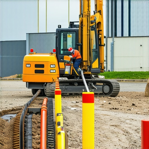
Hydrovac excavation has emerged as a game-changer, offering a non-destructive, precise alternative to traditional digging methods, especially in sensitive areas prone to fiber line damage. By utilizing high-pressure water and vacuum systems, hydrovacs effectively reduce the likelihood of utility strikes in challenging soil conditions such as clay, silt, or rocky substrates. Studies in soil mechanics (see Hydrovac excavation techniques) demonstrate the superior accuracy and safety benefits of these systems when deployed with expert calibration.
Strategic Boring and Trenching for Enhanced Utility Mapping
Optimizing borehole drilling methodologies enhances subsurface mapping precision, facilitating pre-construction planning that anticipates underground obstacles. Techniques such as directional boring and microtunneling minimize surface disruption and provide cleaner, more controlled access to utilities. Effective borehole execution relies heavily on understanding soil composition and water table dynamics, emphasizing the importance of geotechnical assessments prior to trenching activities. For detailed strategies, consult borehole drilling techniques.
Mitigating Soil Collapse and Utility Damage: Tactical Innovations
Soil stability remains a key concern, particularly in saturated or loosely compacted environments. Advanced mud-mix formulations and shoring techniques bolster trench walls, preventing cave-ins that could compromise sensitive fiber lines. Additionally, dynamic soil analysis combined with real-time monitoring ensures excavation remains within safe parameters, reducing the incidence of utility damage during complex bore operations.
Expert Inquiry: How Can Real-Time Data Improve Utility Protection in 2026?
Field practitioners are increasingly integrating geospatial data and sensor feedback to adapt excavation processes dynamically. These innovations enable immediate response to underground anomalies, significantly reducing utility strikes and project delays. Developing familiarity with such technologies is vital for contractors aiming to operate at the forefront of underground safety. To explore practical implementations, see efficient borehole drilling methods.
Want to stay ahead of the curve? Explore how expert trenching tactics can revolutionize your 2026 project workflows or contribute your insights on advanced excavation methods to industry forums.
Maximizing Safety with Adaptive Vacuum Excavation Techniques
As urban infrastructure projects grow increasingly complex, the importance of adaptable vacuum excavation tools cannot be overstated. Incorporating variable pressure settings and real-time feedback mechanisms allows operators to respond promptly to unexpected underground conditions, significantly lowering the risk of utility damage. Cutting-edge equipment with smart sensors can detect anomalies such as buried fiber lines or gas pipes, prompting immediate adjustments to excavation parameters and enhancing overall site safety. For further insights into best practices, explore vacuum excavation strategies.
Precision Drilling in Difficult Soils and Urban Settings
Leveraging advanced drilling methodologies, such as guided directional drilling with real-time soil analysis, empowers crews to navigate cluttered underground environments. These systems use laser alignment and geotechnical sensors to ensure bore paths avoid existing utilities and rock formations, reducing costly mistakes. When combined with pre-activity geophysical surveys, these techniques enable precision mapping, minimizing surface disruptions and accelerating project timelines. Discover comprehensive approaches at borehole drilling methods for utility mapping.
The Role of Data Integration for Real-Time Utility Shielding
Integrating GIS (Geographic Information Systems) with sensor data creates a dynamic safety net during excavation operations. This digital overlay allows operators to visualize utility locations in situ, receive alerts for potential conflicts, and execute immediate mitigation actions. Such data-driven approaches epitomize the evolving expertise in underground safety, providing a proactive stance rather than reactive fixes. As technology advances, creating seamless data ecosystems becomes vital—look into how integrated safety frameworks are shaping industry standards.
How can emerging IoT and AI technologies revolutionize utility protection in the next decade?
Incorporating IoT sensors and artificial intelligence into excavation workflows can lead to predictive analytics that preempt utility strikes before they occur. These innovations facilitate continuous monitoring of soil conditions, equipment health, and underground utility movement, enabling maintenance and safety interventions in advance of potential hazards. Embracing such cutting-edge technologies demands a proactive mindset and a willingness to invest in smart infrastructure, promising efficiency gains and unparalleled safety improvements. For comprehensive guidance, visit smart safety strategies.
Share your experiences or ask questions about integrating AI and IoT into your underground projects—your insights could help shape industry best practices.
Elevating Underground Mapping with 3D Geophysical Imaging
To push the boundaries of precision in underground utility protection, integrating three-dimensional geophysical imaging has become essential. Technologies such as high-resolution ground-penetrating radar (GPR) and electromagnetic induction surveys can provide detailed, volumetric models of subsurface conditions before any excavation begins. These methods reveal layered utility layouts, soil heterogeneity, and potential voids with unprecedented clarity, enabling project teams to strategize accordingly and reduce unforeseen complications.
What Are the Limitations of Current Subsurface Imaging in Urban Environments?
Urban settings, with their dense underground infrastructure and complex soil conditions, pose significant challenges to geophysical imaging. Signal interference from metallic utilities and diverse soil composition can obscure data accuracy. Recent advancements, including multi-frequency GPR arrays and deep electromagnetic sensing, attempt to address these limitations by enhancing resolution and penetration depth. According to a comprehensive study published in the Journal of Applied Geophysics (see Deep Electromagnetic Sensing Techniques), these innovations markedly improve underground utility detection capabilities in challenging substrates.
For contractors, understanding the capabilities and constraints of these imaging modalities is crucial for planning excavation sequences that maximize safety and efficiency. The resulting digital twin of subsurface conditions not only informs immediate excavation strategies but also feeds into asset management systems for ongoing maintenance and monitoring.

Harnessing Machine Learning to Predict Utility Line Behavior
Beyond static imaging, the emergence of machine learning algorithms offers a dynamic approach to understanding utility line behavior over time. By analyzing historical data, including utility location accuracy, excavation incidents, soil movement patterns, and environmental factors, predictive models can forecast the likelihood of utility shifts, failure points, or unforeseen conflicts during upcoming projects. These insights allow for preemptive mitigation strategies, such as adjusting bore paths or scheduling targeted utility adjustments ahead of excavations.
How does integrating real-time sensor data into machine learning models enhance predictive accuracy?
Real-time sensors embedded within utility lines or soil conditions provide continuous feedback on parameters like strain, moisture content, and temperature. Feeding this data into machine learning models allows for adaptive predictions that reflect current subsurface states, significantly increasing the reliability of hazard forecasts. A recent report by the International Journal of Rock Mechanics and Mining Sciences (see Sensor-Driven AI for Utility Monitoring) demonstrates how this integration reduces utility strikes by up to 35%, emphasizing its transformative potential.
For project managers, embracing this convergence of sensor technology and AI means adopting a proactive underground safety culture that anticipates issues before they manifest, saving time, costs, and minimization of operational disruptions. Continue exploring how such innovations can be tailored to specific project needs by connecting with industry leaders and technology providers specializing in smart infrastructure solutions.
Unlock the Potential of Integrated Geotechnical Technologies for Urban Utility Projects
In environments where underground utility networks are densely intertwined, leveraging advanced geotechnical assessment tools is not just advantageous but imperative. Emerging methods like multi-sensor robotic mapping systems that combine seismic analysis with electromagnetic surveys are disrupting traditional subsurface investigations. These innovations enable detailed 3D models of soil heterogeneity, guiding trenching operations with unparalleled accuracy and reducing accidental utility strikes.
How Can Adaptive Monitoring Elevate Your Excavation Safety Measures?
The implementation of real-time adaptive monitoring systems—integrating fiber-optic sensors, soil deformation gauges, and dynamic load sensors—transforms reactive safety procedures into proactive defenses. By continuously analyzing structural and environmental parameters, project teams can swiftly respond to shifting soil conditions or unexpected utility movements, maintaining safety margins even in unpredictable terrains. An authoritative reference for this approach is the comprehensive review found in the Geotechnical Journal of Active Sensing.
How does high-fidelity data integration redefine underground utility protection?
Fusing geospatial data with sensor feedback within autonomous management platforms enables visualization and decision-making in a unified interface. These integrated systems can anticipate potential conflicts, such as utility displacement or soil instability, empowering operators with predictive insights rather than solely reactive measures. This technological convergence reduces project delays and mitigates costly damages, setting a new standard for underground safety. Learn more about data integration solutions at industry-leading platforms and consider forums dedicated to smart infrastructure deployment.
Revolutionize Boring Precision with Hybrid Techniques
The fusion of guided auger boring with laser-guided positioning and subsurface imaging defines the frontier of drilling accuracy. These hybrid techniques facilitate complex directional pathways through heterogeneous soils—eliminating guesswork and unintended utility intersection complications. Recent case studies underscore how such integration minimizes surface disturbance and accelerates project timelines without sacrificing safety standards.
Pioneering Cost-Effective Soil Stabilization Solutions
Enhancing trench stability in challenging conditions often hinges on innovative soil modification strategies. The use of nano-engineered grouts and bio-stabilizers, which alter soil cohesion at a molecular level, has garnered attention for their efficacy and sustainability. Their application can significantly suppress soil collapse risks, even amid high water tables or loose substrates, thus enabling safer and more efficient excavation operations.
State-of-the-Art Predictive Analytics for Utility Line Forecasting
Applying machine learning algorithms trained on longitudinal utility performance data allows engineers to predict potential utility line movements and failure points. These insights inform strategic planning, such as preemptive utility rerouting or reinforcement, long before visible signs manifest. Such predictive analytics are vital for maintaining infrastructure integrity amidst urban growth and environmental change.
Seeking Cutting-Edge Insights? Connect with industry leaders pioneering the integration of AI and geosciences for underground safety advancements.Expert Insights & Advanced Considerations
Prioritize Integrated Data Systems to Foresee Utility Conflicts
Leveraging real-time geospatial and sensor data enables proactive excavation planning, drastically reducing utility strikes and project delays. Combining GIS with live underground monitoring creates a dynamic, accurate map that anticipates issues before they occur, facilitating safer and more efficient workflows.
Embrace Adaptive Technologies for Unpredictable Soil Conditions
The deployment of smart, variable-pressure hydrovac systems that respond to subsurface changes ensures precision in complex environments. These adaptive tools help managers adjust in real-time, mitigating risks posed by saturated or heterogeneous soils during excavation.
Utilize 3D Geophysical Imaging to Visualize Hidden Challenges
Advanced ground-penetrating radar and electromagnetic surveys provide detailed volumetric models of subsurface utility networks, revealing voids or dense utility clusters. Such insights allow for strategic planning that preserves infrastructure integrity and minimizes surface disturbance.
Invest in Machine Learning for Long-term Utility Line Behavior Forecasting
Analyzing extensive historical and sensor data through AI-driven models offers predictive insights into utility movement or failure risks. This foresight empowers teams to preempt issues, optimize maintenance schedules, and prioritize safety measures with high confidence.
Integrate IoT Devices to Enhance Site Monitoring
Embedding sensors within utilities and soil environments creates an interconnected network capable of detecting early signs of instability or deformation. This digital ecosystem facilitates immediate response actions, safeguarding workers and infrastructure alike.
Curated Expert Resources
- Hydrovac excavation techniques — The definitive guide to precision subsurface work, emphasizing safety and minimal disruption.
- Borehole drilling methods for utility mapping — Innovative strategies that improve accuracy in challenging underground conditions.
- Geophysical imaging advancements — Cutting-edge tools revealing buried utilities with clarity, even in dense urban areas.
- AI and sensor integration in underground safety — Comprehensive insights into smart technology adoption for risk mitigation.
- Smart infrastructure management platforms — How data ecosystems are transforming underground utility protection.
Final Expert Perspective
As we advance into 2026, mastering an integrated approach to underground safety—combining real-time data, adaptive tools, and predictive analytics—becomes essential for professionals dedicated to infrastructure resilience. Cutting-edge excavation strategies not only enhance project efficiency but also ensure the safeguarding of vital utilities amid complex urban terrains. Engaging with these innovative methods, supported by authoritative resources, positions industry leaders at the forefront of underground infrastructure excellence. Dive deeper into these topics, share your insights, or explore detailed case studies that push the boundaries of safe excavation practices.