
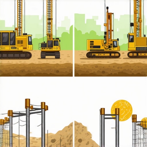
Borehole Drilling Methods: Effective Strategies for Precise Utility Mapping
Advanced Perspectives on Borehole and Trenching Methodologies in Utility Infrastructure
In the realm of complex underground utility infrastructure, precision and safety are paramount. As field practitioners encounter increasingly congested subsurface environments, mastering sophisticated borehole, trenching, and vacuum excavation techniques becomes critical. These methodologies not only enhance accuracy in utility mapping but also mitigate risks associated with traditional excavation methods.
Innovative Strategies in Vacuum Excavation for Enhanced Subsurface Accuracy
Vacuum excavation has emerged as a transformative approach, enabling precise, minimally invasive exposure of underground utilities. By integrating hydro-vac technology with trenching operations, professionals can achieve safer outcomes and reduce surface disruption. The deployment of hydrovac excavation strategies exemplifies this evolution, emphasizing control, speed, and accuracy. The challenge lies in tailoring these advanced solutions to complex site conditions, demanding a nuanced understanding of soil behavior, equipment calibration, and environmental factors.
How can integrating real-time subsurface imaging improve the efficacy of vacuum excavation techniques?
From a practical standpoint, leveraging technologies like ground-penetrating radar (GPR) and electromagnetic detection can significantly augment vacuum excavation precision. Coupling these insights with expert knowledge in hydro-vac systems allows for proactive identification of underground utilities, thereby preventing accidental damages and service outages. The synergy between technological innovation and field expertise defines the modern approach to reliable utility mapping.
Synergizing Trenching and Borehole Methods for Robust Infrastructure Development
Effective trenching techniques underpin the foundational stages of infrastructure projects. When combined with meticulously executed borehole drilling, the resulting data fidelity enhances the integrity of utility layouts. The integration of borehole drilling techniques allows for the detailed characterization of subsurface conditions, informing trench design and reducing unforeseen complications.
Embracing the Future: How Innovations Will Redefine Underground Construction
Looking ahead, developments in automated drilling systems, real-time data analytics, and machine learning promise to revolutionize the discipline. The application of these frontier innovations will further enhance the safety and reliability of underground work, particularly in complex urban environments. Thought leaders and practitioners are encouraged to contribute insights, facilitating a collective evolution towards smarter, more resilient infrastructure practices.
For a comprehensive understanding of the latest industry standards and technical advancements, consult the latest hydrovac excavation guide and engage with expert communities dedicated to underground utility safety and innovation.
Optimizing borehole, trenching, and vacuum excavation strategies is a continuous pursuit that demands a blend of cutting-edge technology, expert insight, and adaptive methodologies—components essential for safe, efficient, and precise utility mapping today and into the future.
Harnessing Intelligent Analytics to Boost Subsurface Work Precision
In the evolving landscape of underground infrastructure, incorporating intelligent data analytics transforms traditional methods, offering unprecedented accuracy and safety. Advanced sensors and real-time monitoring systems, when integrated with hydro-vacuum and borehole techniques, enable dynamic decision-making and proactive risk mitigation. This synergy provides field teams with immediate feedback on soil conditions and utility positions, significantly reducing the chances of accidental strikes and surface disruptions. For further insights into integrating such technologies, review the comprehensive guide on hydrovac excavation strategies that focus on safety and precision.
What role will machine learning and AI play in shaping the future of underground utility mapping?
Emerging innovations in machine learning and artificial intelligence are poised to revolutionize underground exploration. These technologies can analyze vast datasets from geophysical surveys, historical utility records, and sensor inputs to predict subsurface conditions with remarkable accuracy. Combining AI-driven predictive models with hydro-vac techniques enhances site planning, minimizes land disturbance, and optimizes resource allocation. As the industry advances, adopting AI-powered solutions will be pivotal in achieving safer, faster, and more reliable infrastructure projects.
Revitalizing Site Preparation with Adaptive Trenching Technologies
Modern trenching methods are shifting from static routines to adaptive, sensor-guided operations. Tools equipped with adaptive control systems can adjust cutting parameters in real-time based on soil resistance, moisture content, and obstacle detection. This agility ensures cleaner cuts, reduces equipment wear, and shortens project timelines. For organizations seeking to enhance their trenching efficiency, exploring innovative trenching and vacuum excavation strategies remains essential.
How can underground construction teams prepare for the integration of automation and robotics?
Preparation hinges on training, data management, and technology adoption. Teams must develop skills in operating autonomous machinery, interpreting complex sensor data, and maintaining integrated systems. Establishing collaborative frameworks between field personnel and AI developers fosters continuous improvement. As the industry progresses, proactive adaptation to these technologies will unlock efficiencies and elevate safety standards across projects, aligning with the trending shift towards next-gen underground work practices.
If you’re interested in staying at the forefront of underground infrastructure innovation, consider joining professional networks and subscribing to industry publications dedicated to technological advancements in excavation and utility mapping.
Harnessing Sensor Fusion for Unparalleled Subsurface Clarity
The fusion of multiple sensing modalities—such as ground-penetrating radar (GPR), electromagnetic induction, and acoustic sensing—has paved the way for a holistic view of underground utilities. By integrating diverse data streams through sophisticated algorithms, experts can generate high-resolution, real-time subsurface maps. This multisensory approach addresses the limitations inherent in single-technology systems, like soil heterogeneity or interference, creating a layered understanding that is crucial in urban environments riddled with obstructions and legacy infrastructure.
Recent advancements in sensor fusion algorithms leverage machine learning to weight data inputs dynamically, prioritizing the most reliable signals based on environmental conditions. For example, in highly conductive soils, electromagnetic methods may struggle, but when combined with GPR, the combined dataset compensates for individual deficiencies, improving detection reliability. As these integrated systems become more accessible, field teams equipped with portable, multi-sensor arrays will significantly mitigate excavation risks, ensuring utility protection with minimal surface disturbance.
What are the main challenges in deploying sensor fusion technologies in dense urban settings?
Deploying these advanced systems in dense urban centers presents unique obstacles: electromagnetic interference from existing structures, complex underground layouts, and GPS signal attenuation. Mitigating these challenges requires bespoke calibration procedures, robust signal processing algorithms, and often, supplementary reference data from historical utility records. Understanding and overcoming these barriers necessitates a combination of technical expertise, environmental awareness, and strategic planning—skills that define industry leaders committed to pioneering safer underground construction practices.

Revolutionizing Data Management through Cloud-Based Collaboration
As subsurface detection technology evolves, so does the need for seamless data sharing and analysis. Cloud platforms are emerging as vital tools, enabling real-time collaboration among surveyors, engineers, and project managers worldwide. These platforms facilitate centralized data repositories, version control, and instant updates—eliminating delays that could compromise project timelines or safety protocols.
Advanced cloud solutions incorporate AI-driven analytics, automating the interpretation of complex geophysical datasets. This accelerates decision-making processes and enhances predictive accuracy. Moreover, cloud-based visualization tools allow stakeholders to manipulate 3D models interactively, fostering a shared understanding and coordinated response to subsurface challenges.
How can these digital innovations influence litigation and insurance processes in underground utility projects?
Documented, immutable digital records of subsurface conditions and excavation activities enhance transparency and accountability, reducing disputes and claims. Courts and insurers increasingly recognize digital twins and geospatial data logs as authoritative evidence of due diligence and compliance. Consequently, integrating advanced data management solutions not only improves project safety but also plays a pivotal role in risk mitigation and legal clarity. For industry practitioners eager to leverage these benefits, active engagement with emerging standards and certification bodies is essential to ensure data integrity and acceptance.
To delve deeper into implementing these transformative technologies, professionals should consider participating in specialized training programs and industry workshops. Staying abreast of evolving standards ensures that your projects not only meet regulatory expectations but also set new benchmarks in safety and innovation.
Harnessing Multidisciplinary Expertise to Elevate Subsurface Integrity
In an industry where precision correlates directly with safety and efficiency, integrating diverse scientific disciplines—geophysics, soil mechanics, and advanced materials engineering—becomes essential. The convergence of these fields fosters novel methodologies, such as responsive borehole sensing systems that adapt in real-time to soil variability, enabling more accurate utility localization and minimal surface disruption. Emphasizing interdisciplinary collaboration enhances the robustness of underground mapping strategies, ensuring infrastructural resilience amidst evolving urban landscapes.
Can Adaptive Borehole Technologies Revolutionize Asset Preservation?
Emerging adaptive borehole systems employ smart sensors and machine learning algorithms to monitor subsurface conditions dynamically. These innovations facilitate predictive maintenance, early detection of subsurface anomalies, and tailored drilling parameters that minimize environmental impact. By harnessing these intelligent systems, utility installers can mitigate risks of unintended utility strikes, prolong asset longevity, and streamline the decision-making process during critical planning phases. The integration of such technologies requires careful calibration and industry-specific training to unlock their full potential.

Unlocking Urban Expansion Potential Through Modular Trenching Solutions
As cities expand vertically and horizontally, traditional trenching methods often hinder development timelines and elevate costs. Modular trenching systems—designed with plug-and-play components and mechanized deployment—offer scalable, swift solutions tailored for congested environments. Their ability to adapt on-site to unexpected subsurface conditions exemplifies innovative problem-solving that aligns with smart city initiatives, reducing surface disturbance and fostering urban density without compromising existing infrastructure.
What Role Does Real-Time Soil Analytics Play in Precision Excavation?
Integrating real-time soil analytics—including moisture content, compaction levels, and particulate analysis—into excavation workflows empowers crews to make instant adjustments. This granular insight reduces material over-excavation, conserves resources, and enhances safety by predicting potential hazards such as unstable zones or contaminant presence. Advanced sensor arrays and data integration platforms make this possible, yet their successful deployment necessitates rigorous calibration protocols and expertise in geotechnical data interpretation.
Driving Industry Standards with Evidence-Based Best Practices
Establishing and adhering to high-fidelity standards grounded in empirical research elevates project outcomes. Evidence-based practices—such as adaptive boring protocols tested through randomized controlled trials—provide benchmarks for safety, cost-effectiveness, and environmental stewardship. Industry leaders must actively contribute to and utilize repositories of validated data, ensuring that innovations are both scientifically sound and practically applicable. Engagement with authoritative bodies like the American Society of Civil Engineers (ASCE) fosters a culture of continuous improvement and standardization across the sector.
How Does Incorporating AI-Driven Data Validation Transform Risk Management?
Artificial intelligence enhances data validation by cross-referencing diverse datasets—geophysical surveys, historical utility maps, sensor inputs—to identify discrepancies and predict anomalies before excavation. This layered validation minimizes uncertainties, thereby reducing risk exposure and project delays. For practitioners, integrating AI models requires infrastructure investment and expertise in data science, but the long-term gains in safety, accuracy, and operational efficiency are substantial. Embracing these tools positions companies at the forefront of technological innovation in underground construction.
Exploring the Impact of Virtual Reality in Planning and Training
Virtual reality (VR) offers immersive simulation environments for planning complex underground projects and training personnel in safe, condition-specific procedures. By visualizing subsurface conditions and potential obstructions in three dimensions, teams can preemptively identify challenges, optimize trench alignments, and fine-tune borehole paths. Furthermore, VR-based training accelerates skill acquisition, enhances safety awareness, and ensures protocol adherence in real-world scenarios. As hardware becomes more accessible, integrating VR into standard workflows promises to revolutionize industry training and project planning.
Are Emerging Sensor Fusion Techniques Setting a New Standard?
Modern sensor fusion methodologies combine electromagnetic, acoustic, and thermal sensing to provide comprehensive subsurface insights. These multimodal systems, powered by sophisticated algorithms, compensate for individual sensor limitations and mitigate interference effects typical in dense urban environments. The resultant high-definition maps of underground utilities enable preemptive planning and reduce unforeseen conflicts. The main challenges involve the high initial cost, data processing complexity, and field calibration, demanding specialized expertise for successful implementation.
Engage with experts and stay informed about the latest sensor fusion innovations—advancing your projects with these transformative capabilities ensures safety, efficiency, and a competitive edge in underground utility management.
Leveraging Cutting-Edge Technology for Subsurface Mastery
For industry leaders aiming to elevate underground utility projects, integrating advanced sensor fusion and real-time data analytics transforms traditional excavation methodologies. Embracing these innovations ensures unprecedented accuracy, safety, and efficiency, setting new benchmarks in the field.
Trust in Data Fusion to Minimize Risks
Combining electromagnetic, acoustic, and GPR sensors provides a multidimensional view of the underground environment. This multisensory approach addresses soil heterogeneity and interference issues, empowering professionals to make informed decisions that prevent utility strikes.
Harnessing AI for Predictive Utility Mapping
Artificial intelligence analyzes extensive geophysical datasets, enhancing predictive accuracy of utility locations. This proactive insight reduces project delays and safeguards critical infrastructure, illustrating a paradigm shift toward intelligent underground mapping.
Adaptive Borehole Technologies for Resilient Infrastructure
Smart borehole systems equipped with responsive sensors adapt in real-time to soil conditions, facilitating precise utility localization while minimizing environmental impact. Mastery of these tools is essential for future-proof project execution.
Sharpening Skills Through Critical Industry Resources
To remain at the forefront, professionals should engage with authoritative materials such as the Hydrovac Excavation Guide 2025, which encapsulates the latest standards and innovations. Additionally, specialized training modules on borehole drilling methods and sensor integration are vital for skill enhancement.
Synthesizing Insights for Strategic Advantage
The convergence of advanced sensing, AI-driven analytics, and adaptive borehole systems signifies a new era in underground utility management. Experts must lead this evolution by continuously refining techniques and sharing knowledge, ensuring safer, more reliable infrastructure development. Engage proactively with these technologies and resources to forge a resilient, forward-thinking industry landscape.
This article highlights some of the most exciting advances in underground utility detection and mapping. I’ve personally seen how integrating sensor fusion techniques, like combining GPR with electromagnetic sensors, can significantly improve detection in dense urban areas where underground clutter is intense. It’s impressive how machine learning algorithms now help prioritize signals, especially in challenging soil conditions.
One challenge I’ve encountered is calibrating these high-tech systems in real-world scenarios. Proper calibration and environmental understanding are critical for accurate results. I wonder, what are some best practices or tools that teams use to streamline calibration procedures in varied urban terrains? Sharing insights might help all of us achieve more consistent outcomes with these transformative technologies.
This post raises some compelling points about the integration of real-time subsurface imaging with vacuum excavation and trenching methods. Having worked on urban construction sites, I’ve seen firsthand how combining technologies like ground-penetrating radar (GPR) with electromagnetic sensors can dramatically decrease utility strikes. However, I’ve noticed that calibration remains a key hurdle—especially in areas with dense infrastructure and variable soil conditions.
In my experience, developing standardized calibration protocols that incorporate environmental data—such as soil moisture levels and historical utility records—can streamline this process. Additionally, ongoing training in sensor calibration and system diagnostics is crucial, particularly when deploying multi-sensor fusion systems in complex urban settings.
What are some innovative calibration tools or software solutions that others have found effective in reducing calibration time and improving accuracy? Sharing these best practices could significantly enhance the reliability and efficiency of underground utility mapping.
This post provides a comprehensive overview of the latest advancements in underground utility mapping and the integration of innovative technologies like sensor fusion, AI, and VR. I’ve personally worked on projects where combining GPR with electromagnetic sensors dramatically improved detection accuracy in urban environments. One aspect I find particularly intriguing is how machine learning can help optimize data interpretation and reduce false positives, which historically have been a significant challenge.
I’ve noticed that calibration remains a complex issue, especially in sites with dense underground infrastructure. Developing standardized calibration protocols, as mentioned, is essential, but I wonder if there are emerging software tools or hardware solutions that can further streamline this process. Have others explored automated calibration systems or real-time calibration adjustment techniques?
Additionally, how do you see the role of real-time soil analytics evolving in routine excavation work? In my experience, integrating comprehensive soil data can preempt potential hazards, but it requires precise calibration and interpretation. Would love to hear others’ insights or experiences in implementing these cutting-edge methods effectively.