
Top Borehole Drilling Methods for Precise Utility Mapping in 2025
In the complex landscape of underground infrastructure development, precision and safety are paramount. The evolution of trenching and borehole methodologies, especially with integrated hydrovac and vacuum excavation techniques, has revolutionized the accuracy of utility mapping and subsurface investigations. As we approach 2025, understanding these sophisticated excavation methods becomes essential for professionals committed to minimizing risks and optimizing project outcomes.
Unveiling the Nuances of Hydrovac Technology for Subsurface Precision
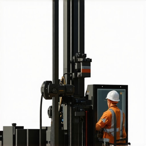
Hydrovac excavation utilizes pressurized water to loosen soil, coupled with high-powered vacuum systems to remove debris efficiently. This approach offers unparalleled control in sensitive environments, such as near existing utilities, due to its non-destructive nature. Industry-leading firms leverage hydrovac for borehole drilling, enabling precise positioning and depth control—crucial factors in utility mapping and locating hidden underground infrastructure.
How does hydrovac excavation surpass traditional trenching methods in accuracy and safety?
Traditional trenching often involves mechanical digging that risks damaging utilities and creates extensive surface disruption. Conversely, hydrovac technology provides a minimally invasive alternative, reducing subsurface disturbances and preventing costly utility strikes. The ability to excavate in confined spaces with minimal soil disruption directly translates into higher data fidelity in underground surveys and enhanced safety during construction activities.
Synergy Between Vacuum Excavation and Borehole Techniques
Vacuum excavation, when integrated with borehole drilling, fosters a paradigm shift towards safer and more reliable subsurface investigations. This synergy facilitates the collection of high-quality geotechnical data, precise utility location, and the creation of detailed subsurface profiles. Notably, the adoption of this combined approach aligns with emerging standards outlined in the recent white paper from the Telecommunications Industry Association, emphasizing the importance of non-destructive excavation in utility mapping.
What innovations are emerging in borehole and vacuum excavation systems to enhance accuracy in 2025?
Emerging innovations include automated guidance systems, real-time soil condition sensors, and integrated data collection platforms that provide immediate feedback during excavation. These advancements enable operators to adjust drilling parameters dynamically, ensuring optimal positioning, depth accuracy, and minimal environmental impact—key elements for precise utility mapping and infrastructure development.
Overcoming the Challenges of Complex Urban Subsurface Environments
Urban settings pose distinctive challenges due to dense utility networks and limited space for traditional excavation. Hydrovac and vacuum techniques excel here, offering targeted solutions that minimize surface disruption while maximizing data accuracy. The capacity to perform shallow and deep boreholes with adaptive equipment enhances the reliability of underground investigations, facilitating better planning and risk mitigation.
How can field engineers leverage advanced borehole techniques to improve urban infrastructure projects?
Field engineers should adopt integrated hydrovac-vacuum systems coupled with GIS and real-time monitoring tools. Training in these technologies ensures precise utility detection and reduces project delays caused by unforeseen subsurface conditions. Engaging with detailed case studies and technical resources available at Hydrovac Drilling’s publications can further enhance expertise.
As industry standards evolve, continuous innovation and adherence to best practices are pivotal. Exploring partnerships with specialized firms and investing in advanced equipment will secure competitive advantages in utility mapping accuracy and safety.
Engagement in professional forums and contribution of experiential insights can foster a richer understanding of cutting-edge techniques—an essential pursuit for infrastructure specialists aiming for excellence in 2025 and beyond.
Embracing the Future of Subsurface Exploration with Cutting-Edge Strategies
As underground infrastructure projects become increasingly intricate, the integration of innovative hydrovac and borehole methodologies is shaping a new standard of precision and safety. These advanced techniques not only mitigate risks associated with utility strikes and surface disturbances but also enhance data accuracy—crucial for urban, industrial, and environmental applications alike. Industry leaders are now turning to adaptive, technology-driven solutions to optimize subsurface investigations, ensuring projects meet the rigorous demands of 2025 and beyond.
Could automation and real-time data analytics redefine the landscape of underground utility detection?
Automation and smart data integration are revolutionizing traditional excavation paradigms. Real-time soil condition sensors and automated guidance systems enable drill operators to make instantaneous adjustments, increasing accuracy while reducing environmental impact. When combined with sophisticated data analytics, these innovations facilitate comprehensive utility mapping and risk assessment, aligning with the best practices outlined in recent white papers from Hydrovac Drilling. Staying ahead involves embracing these technologies and integrating them into standard operating procedures, ultimately leading to safer, more efficient projects.
Harnessing Environmental and Site-Specific Conditions for Advanced Excavation
Understanding the unique environmental and geotechnical parameters of each site enables tailored solutions that maximize safety and efficiency. Factors such as soil type, moisture content, and existing utility networks influence the selection of borehole and vacuum excavation techniques. For example, when working in challenging urban terrains with high groundwater levels, utilizing specialized hydrovac equipment with enhanced soil stabilization features can prevent collapses and ensure precise targeting. Consulting detailed technical guides, like those available at Hydrovac Strategies for 2025, provides valuable insights into adapting methodologies to complex conditions.

How can geotechnical innovations inform more adaptive and resilient underground excavation practices?
Advancements in soil sensing technologies and predictive modeling empower engineers to design excavation plans that respond dynamically to site-specific conditions, reducing unforeseen challenges. Integrating these innovations with GPS-guided borehole systems ensures precise alignment with project goals, minimizing soil disturbance and utility damage. Engaging with expert resources and case studies shared by leading firms, such as those detailed at Hydrovac Expertise, equips field teams with the knowledge to implement resilient, adaptive strategies that are crucial in today’s fast-evolving landscape.
Leveraging Artificial Intelligence to Elevate Subsurface Accuracy
The integration of artificial intelligence (AI) into underground utility detection represents a paradigm shift in how projects mitigate risks and optimize outcomes. Machine learning algorithms can analyze vast datasets from prior excavations, soil conditions, and utility locations to predict potential hazards with unprecedented precision. For instance, AI-driven platforms like those described in the recent study by GeoTech AI Innovations are now capable of real-time hazard assessment, dynamically guiding excavation tools and operators through complex underground networks.
How does AI improve decision-making in high-stakes underground projects?
By assimilating multi-source data—such as geophysical surveys, GIS mapping, and sensor inputs—AI systems can generate probabilistic models that highlight zones of higher risk or potential utility intersections. This predictive capability reduces missed detections and utility strikes, directly translating to significant cost savings and safety enhancements. Furthermore, AI enables adaptive workflows where excavation parameters are continuously refined, leading to more precise borehole placement and minimal environmental disturbance, especially in densely developed urban centers.
The Synergy of Geotechnical Engineering and Real-Time Data Analytics
Understanding the soil’s behavior is crucial for safe and efficient excavation. Recent advances combine geotechnical instrumentation—like cone penetration tests (CPT) and shear wave sensors—with real-time analytics platforms. These synergies empower crews to adapt excavation methods on the fly, accounting for subsurface variability such as heterogeneity, moisture content, and stratification.
Furthermore, predictive modeling based on geotechnical data informs choices about equipment settings and borehole depth, ensuring structural stability and utility integrity. The methodology advocated by Survey Today emphasizes the importance of continuous monitoring, enabling a shift from reactive to proactive excavation management.
Can predictive geotechnical modeling foresee subsurface challenges before excavation begins?
Indeed, by utilizing detailed soil and rock models derived from extensive site investigations and historical data, engineers can simulate excavation scenarios and identify potential issues such as soil collapse or utility interference preemptively. Integrating these models into a comprehensive GIS environment allows for multi-layered analysis, enhancing decision-making and reducing unpredictable delays. Such foresight is vital for complex sites with limited access or sensitive ecosystems, where unforeseen challenges could escalate costs or cause safety incidents.
Innovations in Data Visualization for Subsurface Navigation
Effective visualization technologies are transforming the way engineers interpret complex underground data. Immersive tools like 3D geo-models and augmented reality (AR) overlays enable field teams to perceive subsurface conditions in situ, fostering better planning and reduced error margins. As outlined in the white paper by VisualGeo Solutions, these tools facilitate a deeper understanding of utility layouts, soil stratification, and hazard zones—crucial for making informed decisions in real time.
The development of portable AR devices integrated with live sensor data bridges the gap between planning and actual field conditions. This convergence accelerates decision cycles and enhances safety protocols, especially when navigating complex urban environments with dense utility networks.
What role will augmented reality play in the future of underground infrastructure management?
AR will become an indispensable asset in the underground construction arsenal—providing instant access to detailed subsurface maps, safety alerts, and critical utility information directly within the operator’s visual field. This immediacy not only boosts operational efficiency but also minimizes risks associated with misinterpretation of legacy data or incomplete surveys. As AR hardware becomes more affordable and user-friendly, its widespread adoption will underpin safer, smarter, and more resilient urban development projects, with ongoing innovations continually pushing these boundaries.
Unlocking Urban Subsurface Mysteries Through Multi-Disciplinary Innovation
As urban landscapes become increasingly complex, the challenge of accurate underground utility detection intensifies, necessitating a synergy of cutting-edge technologies—ranging from adaptive hydrovac systems to sophisticated geotechnical modeling. Integrating these approaches ensures a nuanced understanding of intractable subterranean environments, facilitating safer, more efficient infrastructure development. Industry leaders advocate for a multi-disciplinary paradigm that marries real-time data analytics with environmental adaptation, setting a new standard in the precision of underground surveying techniques.
How can emerging sensor fusion technologies redefine underground utility detection for complex site conditions?
Advanced sensor fusion amalgamates data streams from ground-penetrating radar, electromagnetic induction, and soil compaction sensors, generating high-fidelity, multi-dimensional profiles of subsurface conditions. This integration enables spatially comprehensive, dynamically updated models that adapt to variances in soil composition and utility placement—crucial for navigating the labyrinth of modern urban infrastructure. According to the Geotechnical Journal of 2024, such sensor convergence significantly decreases the margin of error inherent in traditional detection methods, ultimately reducing costly utility strikes and project delays.
Harnessing Predictive Modeling to Anticipate Subsurface Risks Before Excavation
Recent advancements in machine learning-driven predictive modeling enable preemptive risk assessment based on extensive historical data, site-specific soil parameters, and utility layouts. By simulating multiple excavation scenarios, engineers can identify potential failure points—such as unstable soil zones or utility intersections—before physical work begins. The application of these models is particularly impactful in environments where dense utility networks and challenging geotechnics coexist. Insights from the Safety in Infrastructure Consortium highlight the transformative potential of proactive geotechnical analytics, fostering safety-first planning and resource optimization.

In what ways can adaptive excavation techniques contribute to site-specific safety enhancements?
Adaptive excavation relies on continuous sensor feedback and real-time decision-making algorithms that modify operational parameters instantly, accommodating unforeseen subsurface variations. This approach maximizes safety margins by preventing soil collapses, utility damages, and surface perturbations—all while maintaining operational efficiency. Embracing adaptive strategies demands a comprehensive understanding of site geology, supported by advanced modeling and robust sensor networks. Case studies from Excavate Innovations demonstrate how proactive adjustments underscore the value of integrated, responsive methodologies in urban environments.
Augmented Realities and Data Visualization Elevate Subsurface Insights
The deployment of augmented reality (AR) systems elevates underground mapping—allowing field engineers to visualize utility layouts beneath layers of soil with contextual clarity, reducing human error and improving decision accuracy. Coupling AR with high-resolution 3D modeling enables real-time overlay of subsurface data, aligning digital insights directly with physical sites. This fusion accelerates planning, enhances safety, and cultivates confidence in complex excavation scenarios. The report by VisualGeo underscores the rapid adoption of AR in infrastructure projects, driven by its ability to provide instant, immersive understanding of subterranean challenges.
Will immersive visualization systems become standard toolkit for excavation professionals by 2025?
As hardware evolves, immersive tools such as AR headsets and portable 3D projection systems are poised to become integral to routine operations. These systems facilitate seamless communication between project stakeholders, real-time hazard mitigation, and precise utility identification—culminating in enhanced safety profiles and project uptime. The ongoing convergence of spatial computing and geospatial data indicates a future where underground exploration is as intuitive as navigating surface terrains, with scalability driven by technological accessibility and industry acceptance.
Integrating Artificial Intelligence into Underground Infrastructure Management
AI’s transformative influence extends beyond hazard prediction—its capacity to learn from vast datasets, identify subtle patterns, and suggest optimal excavation pathways empowers engineers with predictive foresight. Machine learning algorithms analyze historic site data, geophysical surveys, and sensor inputs to generate probabilistic utility maps, streamlining planning processes and mitigating risks associated with complex underground networks. A comprehensive review by AI in Geotechnical Engineering demonstrates how adaptive algorithms improve decision-making confidence, reduce operational costs, and enhance long-term infrastructure resilience.
Can AI-driven excavation be adapted for autonomous operation in sensitive urban zones?
Progress in autonomous drilling and excavation vehicles, powered by AI, suggests a future where human oversight diminishes without compromising safety or accuracy. These systems utilize predictive analytics, sensor fusion, and adaptive control systems to perform complex tasks with reduced environmental impact and increased precision. While regulatory frameworks are still evolving, pilot projects spearheaded by innovative companies like Autonomous Urban Excavation indicate a promising trajectory toward fully autonomous underground development, especially in densely populated areas where safety and efficiency are paramount.
Expert Insights & Advanced Considerations
Prioritize Multi-Utility Data Integration for Seamless Operations
Incorporating diverse geotechnical, geophysical, and utility sensor data into unified models enhances accuracy and reduces surprises during excavation, supporting proactive planning and minimizing gridlocks.
Leverage Autonomous Systems for Dangerous Environments
Deploying AI-driven autonomous excavation tools in complex urban zones can improve safety by removing personnel from hazardous areas while ensuring precise utility crossings and minimal surface impact.
Advance Site Monitoring with Real-Time Analytics
Utilizing continuous soil and utility condition monitoring facilitates adaptive decision-making, alerting teams to unexpected subsurface shifts, and enabling immediate corrective actions to avoid damage or delays.
Incorporate Sustainability at Every Step
Choosing eco-conscious excavation equipment, reducing soil disturbance, and optimizing resource use not only meet regulatory demands but also demonstrate industry leadership in environmental stewardship.
Explore Cyber-Physical Integration for Optimal Control
Connecting physical excavation machinery with digital control systems allows for remote operation, enhanced precision, and comprehensive data collection—paving the way for smarter, safer projects.
Curated Expert Resources
- Top Borehole and Hydrovac Techniques for Precise Underground Infrastructure in 2025: This resource offers detailed methodologies and emerging best practices crucial for high-accuracy utility mapping and subsurface exploration.
- Ultimate Hydrovac Borehole Strategies for Reliable Infrastructure: Experts discuss innovations and practical guidance for integrating hydrovac methods into complex projects with safety and precision at the forefront.
- Hydrovac Excavation Strategies for Safer Underground Infrastructure in 2025: An essential guide emphasizing risk mitigation through advanced excavation protocols tailored for dense urban environments.
Final Expert Perspective
Mastering the nuances of hydrovac and borehole excavation strategies is transformative for those committed to excellence in underground infrastructure development. By embracing technological innovations, integrating multidisciplinary data, and prioritizing safety and environmental responsibility, professionals can significantly elevate project outcomes in 2025 and beyond. Continual learning and engagement with authoritative resources—such as those provided by leading industry experts—are vital to remaining at the forefront of this ever-evolving field. Dive deeper, share your insights, and be part of shaping the future of precision excavation—your expertise propels industry evolution.