Revolutionizing Underground Utility Mapping for Precise Trenching and Excavation
In modern construction and infrastructure maintenance, the ability to accurately locate and identify underground utilities, particularly metallic pipes, is paramount. Ground-penetrating technologies have evolved from traditional electromagnetic methods to sophisticated high-accuracy mapping tools that significantly enhance safety, reduce project delays, and prevent costly damages. This article explores how these cutting-edge systems are transforming trenching and hydro-vac excavation practices, offering professionals a new level of confidence and precision.
The Intersection of Trenching and Precision Mapping: A New Paradigm
Traditional trenching operations often relied on outdated site sketches, tracer wires, or mere guesswork, increasing the risk of striking hidden utilities. The integration of advanced mapping technologies—such as electromagnetic inductive sensors and 3D underground imaging—provides a comprehensive view of subsurface conditions, enabling operators to tailor excavation strategies proactively. By combining these tools with vacuum excavation techniques, site safety and operational efficiency are markedly improved.
Why High-Accuracy Mapping Outperforms Conventional Methods
Conventional detection methods are susceptible to interference from soil conditions, metallic clutter, and operator error, leading to false positives or missed utilities. High-precision mapping solutions employ real-time data processing, multi-sensor fusion, and GPS integration to offer centimeter-level accuracy. This precision minimizes non-productive excavation, reduces the risk of utility strikes, and supports compliance with safety standards such as OSHA regulations, ultimately contributing to project cost savings and community safety.
Field Applications: Identifying Metallic Pipes with Expert-Level Confidence
In complex urban environments where utility networks are dense and poorly documented, deploying high-accuracy mapping systems becomes a strategic necessity. Professionals utilize these tools during pre-excavation surveys, enabling them to map ghost pipes, detect abandoned lines, or verify the presence of critical metallic utilities before breaking ground. For example, when working near high-voltage cables or existing pipelines, precise identification prevents service disruptions and environmental hazards. Leveraging technological advances detailed in [HydrovacDrilling’s guide](https://hydrovacdrilling.com/how-we-map-ghost-utilities-in-high-interference-zones), construction teams can ensure their operations harmonize with existing underground infrastructure.
How can high-accuracy mapping technologies mitigate risks inherent to complex trenching projects involving metallic utilities?
Implementing these sophisticated detection systems allows for proactive planning, minimizes unexpected utility interactions, and optimizes route selection. As terrain complexities increase, the capacity for real-time, high-precision data becomes indispensable in advancing trenching safety and efficiency.
Embracing innovative mapping solutions exemplifies a commitment to safety and operational excellence. For professionals seeking to deepen their expertise, exploring resources like advanced borehole and vacuum excavation strategies can provide further insights into integrated site management.
Interested in contributing your field expertise or exploring more about technological innovations? Connect with industry peers or consult leading research to stay at the forefront of underground utility detection advancements.
Unveiling the Power of Hydrovac Technology in Soil Preservation
As infrastructure projects become more ambitious, the importance of preserving soil integrity cannot be overstated. Hydrovac excavation, with its minimally invasive approach, is revolutionizing how professionals safeguard soil structures while conducting necessary digging operations. Advanced hydrovac innovations now incorporate real-time monitoring and adaptive control systems, reducing the risk of soil disturbance and ensuring compliance with environmental standards.
Integrating Soil Safety Protocols into Modern Hydrovac Practices
Implementing rigorous soil safety protocols involves understanding soil composition, moisture content, and load-bearing capacity. Modern hydrovac units equipped with smart sensors can analyze soil conditions dynamically, adjusting water pressure and vacuum settings accordingly. This precision minimizes soil compaction, prevents unnecessary drilling or trenching, and maintains the stability of surrounding ground—factors critical for urban construction and sensitive ecological zones.
The Role of Soil Compatibility in Choosing the Right Hydrovac Method
Not all soil types respond equally to hydrovac techniques. For instance, loose gravel or soft clay requires different operational parameters compared to compacted silt or frozen ground. Selecting the optimal hydrovac method involves evaluating soil properties through comprehensive site assessments, often aided by geotechnical surveys. Resources like this detailed guide shed light on how science-backed approaches enhance safety and accuracy in soil-sensitive environments.
Can real-time soil analytics integrated into hydrovac units truly reduce excavation-related soil disturbances and environmental impact?
By leveraging sensor-driven data and machine learning algorithms, these systems can adapt operations instantaneously, optimizing soil preservation. This technological synergy ensures that excavation proceeds with minimal disruption, fostering sustainable development practices and safeguarding underground ecosystems. For more comprehensive insights into how these advancements are shaping the future, reviewing industry reports and case studies can be invaluable.
Share your experiences or ask questions about soil-safe excavation techniques in the comments below, and explore more at our resource hub for expert guidance on maintaining equipment longevity and soil safety standards.
Maximize Safety with Multi-Sensor Data Fusion in Utility Surveys
In the pursuit of pinpoint accuracy, integrating multiple sensing modalities—such as electromagnetic induction, ground Penetrating radar (gPr), and acoustic sensors—creates a comprehensive subsurface profile. This fusion of data not only corroborates findings but also compensates for soil or interference challenges, enabling a high-confidence mapping of utilities. By harnessing real-time analysis and machine learning algorithms, operators can distinguish between active, abandoned, and ghost utilities with unprecedented precision, reducing the risk of costly strikes during trenching operations.
Could AI-Driven Predictive Models Revolutionize Utility Detection?
Emerging research suggests that artificial intelligence can predict potential utility locations based on historical data, soil properties, and construction patterns—transforming reactive detection into proactive planning. For example, predictive analytics can identify likely sites of undocumented or mislocated utilities, prompting targeted surveys and preemptive measures. According to a recent study published in the Journal of Construction Engineering and Management, AI-enhanced modeling increases detection accuracy by up to 35%, significantly lowering excavation risks (source).
How does soil heterogeneity influence the performance of underground detection technologies?
Soil composition, moisture levels, and mineral content substantially impact electromagnetic and radar signals. Heterogeneous soils can cause signal attenuation, reflections, and noise, complicating utility identification. Advanced systems mitigate these issues through adaptive calibration, multi-frequency approaches, and sensor array configurations, enhancing reliability even in challenging terrains. For instance, integrating soil property data derived from geotechnical surveys allows detection systems to adjust parameters dynamically, improving accuracy and reducing false positives in complex subsurface conditions.
Seizing this technological edge requires ongoing education and specialized training. Engaging with industry-led certification programs—like those offered by the National Utility Locating Contractors Association—ensures professionals remain adept at deploying these sophisticated tools effectively.
Emphasizing the Role of Documentation and Data Management in Complex Environments
High-precision utility detection is only as effective as the data management systems backing it. Cloud-based records, spatial databases, and 3D modeling platforms facilitate the storage, analysis, and sharing of utility maps, ensuring traceability and compliance with standards. Moreover, integrating detection results into Building Information Modeling (BIM) workflows enhances coordination, reduces duplication, and improves project scheduling.
As the industry moves towards digital twins—virtual replicas of physical sites—real-time utility data can be synchronized with BIM to enable dynamic updates, predictive maintenance, and risk assessments. Such integration exemplifies the frontier of underground asset management, pushing the envelope of safety and efficiency in trenching projects.
Integrating Multi-Layered Data for Unparalleled Utility Mapping Precision
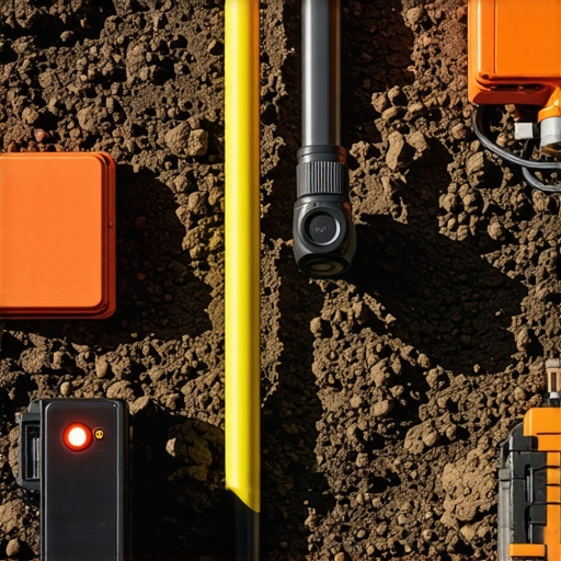
As underground excavation projects grow in complexity, relying solely on singular detection modalities becomes increasingly insufficient. The fusion of electromagnetic, ground-penetrating radar, and acoustic data—processed through advanced algorithms—creates a multi-dimensional subsurface blueprint. This synergy not only enhances accuracy but also empowers operators to differentiate between active, dormant, or mislocated utilities with high confidence, thereby minimizing costly strikes and service disruptions.
Can Innovations in Sensor Fusion Revolutionize Your Site Safety Protocols?
By adopting sensor fusion techniques, construction teams can dynamically adapt to varied soil conditions and interference sources. Real-time cross-verification of multiple sensing methods mitigates false positives, illuminates hidden hazards, and streamlines decision-making processes. As data integration algorithms become more sophisticated, these systems will evolve into predictive tools capable of preempting underground conflicts before they materialize on-site.
What Are the Limitations of AI in Anticipating Utility Placement Anomalies?
While artificial intelligence offers promising predictive capabilities—analyzing historical data, construction patterns, and soil compositions—its effectiveness hinges on data quality and model training. In heterogeneous terrains or regions with poor documentation, AI models may produce unreliable outputs. Therefore, integrating AI with traditional detection methods and expert judgment remains essential to prevent overreliance on potentially flawed predictions.
How Soil Variability Shapes the Efficacy of Detection Technologies
Soil heterogeneity—comprising mineral content, moisture levels, and compaction—directly influences signal propagation. For instance, high clay content dampens electromagnetic signals, while sandy soils may pose challenges for radar-based detection. Advanced systems compensate for these factors through adaptive calibration, multi-frequency operations, and supplementary geotechnical assessments, ensuring reliability across diverse terrains. Developing site-specific calibration protocols enhances the robustness of utility detection endeavors.
Elevate Your Excavation Strategy with Dynamic Soil Management
Progressing beyond static assessments, innovative soil management integrates real-time sensor feedback into excavation controls. By continuously monitoring soil parameters—such as moisture and load-bearing capacity—operators can optimize water pressure, vacuum strength, and cutting parameters. This adaptive approach preserves soil integrity, reduces environmental footprint, and aligns with sustainable construction practices, ultimately fostering a safer and more efficient worksite.
Expert Insights & Advanced Considerations
Embrace Multi-Modal Sensor Integration for Confidence
Combining electromagnetic, radar, and acoustic sensing modalities creates a comprehensive subsurface profile, substantially reducing detection uncertainties and enabling precise utility mapping even in complex underground environments.
Leverage AI to Anticipate Hard-to-Detect Utilities
Artificial intelligence models trained on extensive data sets can forecast likely locations of undocumented lines, giving excavation teams a strategic advantage in avoiding costly utility strikes before they occur.
Prioritize Real-Time Data Fusion for Dynamic Operations
Integrating live sensor data into unified platforms allows for adaptive decision-making during trenching, ensuring safety measures evolve with ground conditions and interference challenges.
Recognize Soil Variability’s Impact on Detection Accuracy
Understanding soil heterogeneity is crucial; advanced calibration protocols that account for moisture, mineral content, and density can significantly improve utility detection reliability across diverse terrains.
Invest in Digital Asset Management for Long-Term Benefits
Proper documentation, cloud storage, and integration with BIM facilitate ongoing site safety, facilitate future maintenance, and provide an audit trail for compliance purposes.