
Hydrovac & Vacuum Excavation for Safe, Precise Infrastructure in 2025
Elevating Infrastructure Projects: The Transformative Power of Hydrovac and Vacuum Excavation in 2025
As infrastructure development accelerates in 2025, the reliance on advanced excavation techniques like hydrovac and vacuum excavation becomes crucial for ensuring safety, precision, and efficiency. These innovative methods are reshaping site preparation, underground utility installation, and soil testing, providing a sophisticated toolkit for engineers and contractors committed to excellence. This article explores the nuanced techniques, emerging trends, and expert insights that define the future of underground excavation.
Why Hydrovac and Vacuum Excavation Are Game-Changers for Modern Infrastructure
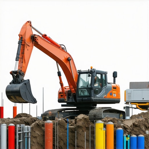
Hydrovac and vacuum excavation techniques leverage high-pressure water streams combined with powerful vacuum systems to excavate soil without damaging existing underground utilities. Unlike traditional mechanical digging, these methods minimize risk to critical infrastructure, reduce environmental impact, and improve accuracy. As urban areas become denser and underground networks more complex, the need for such precise excavation solutions intensifies.
Key Challenges Addressed by Advanced Excavation Methods
One of the most pressing issues in underground infrastructure development is avoiding accidental strikes on vital utilities. This challenge necessitates sophisticated site assessment and meticulous excavation strategies. Hydrovac’s ability to precisely target soil layers while preserving existing conduits is instrumental in mitigating risks. Furthermore, these techniques support regulatory compliance and environmental standards, reducing project delays and liability concerns.
What Makes a Hydrovac Strategy Truly Expert-Level in 2025?
Developing a reliable hydrovac and vacuum excavation strategy involves understanding soil composition, utility mapping, and equipment calibration. Experts emphasize the importance of integrating real-time data analytics and geospatial information systems (GIS) to optimize excavation paths. For instance, utilizing advanced borehole techniques, as discussed in this authoritative resource, enhances soil stability assessments and project reliability.
How Can Excavation Teams Adapt to the Increasing Complexity of Underground Networks?
Addressing this question requires a multidisciplinary approach combining high-precision machinery, skilled operators, and innovative monitoring technologies. Continuous training in the latest hydrovac techniques and leveraging AI-driven predictive analytics can preempt potential issues. Open forums and professional networks serve as valuable platforms where industry leaders share insights and refine best practices.
For contractors seeking to refine their excavation processes, exploring effective vacuum excavation trenching methods can provide practical guidance. Additionally, consulting expert content on trenching strategies ensures alignment with industry standards and safety regulations.
In conclusion, the evolution of hydrovac and vacuum excavation techniques in 2025 underscores a paradigm shift towards safer, more reliable underground infrastructure development. As technology advances, so does the capacity for precision and risk mitigation—an essential evolution for modern civil engineering projects.
Unlocking the Potential of Hybrid Techniques for Ultimate Precision
While hydrovac and vacuum excavation have established themselves as critical tools, the future lies in integrating these methods into hybrid strategies that maximize efficiency and accuracy. Combining hydrovac’s precision water jetting with robotic automation and real-time data analytics can dramatically reduce project timelines and mitigate risks. For example, employing machine learning algorithms to analyze soil conditions and utility maps in real-time, as discussed in this authoritative resource, empowers crews to make data-driven decisions, resulting in safer, more reliable excavations.
Why Expertise in Soil and Utility Mapping Continues to Define Success
Understanding soil heterogeneity and underground utility layouts remains a cornerstone of expert excavation. Advanced techniques like ground-penetrating radar (GPR) and electromagnetic surveys are becoming standard, offering detailed subsurface imaging. These technologies, when paired with hydrovac operations, facilitate meticulous excavation planning, especially in complex urban environments. Trustworthy information about soil stability and utility locations, as outlined in this comprehensive guide, ensures that projects stay on schedule and within safety parameters.
Could AI-Driven Monitoring Revolutionize Hydrovac Safety?
The integration of artificial intelligence into excavation monitoring systems promises to revolutionize safety standards. AI sensors can continuously analyze soil movement, utility proximity, and equipment performance, alerting operators to potential hazards before they escalate. This proactive approach can prevent costly accidents and environmental damage. Experts argue that adopting such innovations will be essential for future-proofing infrastructure projects, as noted by industry leaders in this authoritative resource.
Would you like to see more innovative tools shaping the future of underground excavation? Share your thoughts or suggest topics for deeper exploration in the comments. For detailed insights on cutting-edge trenching strategies, visit this expert guide and stay ahead in the evolving field of safe, precise infrastructure development.
Why Mastering Soil Variability Elevates Excavation Safety
In the realm of underground infrastructure, the ability to accurately interpret soil heterogeneity is a cornerstone of expert excavation. Variations in soil composition—ranging from clay and silt to gravel and rock—pose significant challenges that demand sophisticated detection techniques. Advanced geotechnical assessments, such as cone penetration testing (CPT) and resistivity imaging, enable engineers to develop detailed soil profiles, reducing the risk of unexpected collapses or utility strikes. Incorporating these data points into hydrovac planning ensures that excavation paths are optimized not only for safety but also for efficiency.
Revolutionizing Utility Detection with Cutting-Edge Technologies
Traditional utility location methods, such as electromagnetic induction, often fall short in complex urban environments. Today’s industry leaders rely on ground-penetrating radar (GPR) and electromagnetic surveys to produce high-resolution subsurface images, revealing the precise layout of conduits and cables. These technologies, when integrated with GIS platforms, facilitate real-time decision-making and dynamic adjustment of excavation strategies. As noted in the comprehensive study by the National Utility Detection Association (NUDA), these tools significantly lower the incidence of utility strikes, thereby minimizing costly delays and safety incidents.
What Are the Limitations of Current Subsurface Imaging Techniques?
Despite their advancements, tools like GPR have limitations in soils with high moisture content or mineralization, which can obscure signals. Combining multiple sensing modalities—such as resistivity, seismic refraction, and electromagnetic induction—can overcome these hurdles, providing a more holistic understanding of the subsurface. Researchers advocate for integrated sensor arrays and machine learning algorithms that synthesize data, enhancing accuracy in complex conditions. For further insights, see the detailed analysis in the Journal of Geotechnical and Geoenvironmental Engineering’s 2024 publication.
Progressing Toward Autonomous Utility Detection and Soil Analysis
Looking ahead, automation and AI-driven systems are transforming subsurface mapping from a manual, time-consuming task into a seamless, real-time process. Autonomous robotic probes equipped with multi-sensor arrays can traverse a site, collecting and analyzing data on-the-fly. These systems use machine learning algorithms to identify utility pathways and soil anomalies with unprecedented speed and precision. Implementing such innovations enables excavation teams to preemptively adjust their approach, drastically reducing the likelihood of errors.

Imagine a compact robotic surveyor equipped with multi-modal sensors autonomously scanning an urban construction site, generating detailed 3D maps of soil conditions and utility placements, all in real time. This vision is rapidly becoming a practical reality as industry R&D accelerates.
Why Deep Expertise in Geotechnical and Utility Data Is Non-Negotiable
In complex urban environments, superficial assessments are no longer sufficient. The most successful projects depend on granular data—soil strength parameters, utility material composition, and precise spatial locations. Technologies such as electromagnetic induction coupled with borehole logging and fiber optic sensors open new frontiers in subsurface characterization. As highlighted in the 2023 report by the International Society for Soil Mechanics and Geotechnical Engineering, integrating these data streams into a cohesive model markedly improves excavation safety and operational efficiency.
Can AI and Machine Learning Fully Replace Human Expertise in Subsurface Planning?
While AI and machine learning are revolutionizing data analysis, they complement rather than replace human expertise. Skilled geotechnical engineers interpret sensor outputs, validate models, and make strategic decisions based on contextual knowledge. The synergy of advanced technology and seasoned judgment ensures that excavation operations are both innovative and safe, setting a new standard for industry excellence. For more on this integration, consult recent articles in the Journal of Construction Engineering and Management.
Interested in pushing the boundaries of underground excavation? Dive deeper into the latest technological breakthroughs and best practices by connecting with industry leaders and exploring specialized training programs. The future of precise, safe, and efficient infrastructure development depends on your commitment to mastering these advanced tools and techniques.
Revolutionizing Soil Stabilization for Urban Foundations
As cities grow vertically and infrastructure demands become more sophisticated, the importance of soil stabilization techniques integrated with advanced excavation methods cannot be overstated. Incorporating hydrovac and vacuum excavations with soil treatment solutions like chemical grouting and soil mixing enhances ground integrity, especially in problematic zones prone to settlement or liquefaction. The synergy between these methods reduces the risk of subsidence, ensuring safer and more durable urban foundations. For detailed case studies, consult the latest research published in the Journal of Geotechnical Engineering.
How Are Emerging Technologies Refining Utility Mapping Accuracy?
Innovations such as multi-sensor arrays, drone-based surveys, and augmented reality overlays are transforming utility detection. These tools allow for high-resolution imaging of underground networks, even in densely built environments with complex utility layouts. By combining electromagnetic induction, ground-penetrating radar, and real-time data analytics, engineers can generate comprehensive subsurface models. This precision minimizes utility strikes, saving costs and preventing service disruptions. External source for reference: National Utility Detection Association.
Can Artificial Intelligence Fully Automate Subsurface Site Assessment?
While AI-driven algorithms and machine learning models significantly expedite data processing and anomaly detection, expert interpretation remains vital. AI tools can synthesize sensor data, predict soil behaviors, and flag potential hazards, but seasoned geotechnical engineers provide contextual insights essential for decision-making. The integration of AI with human expertise forms a resilient framework for complex underground projects. For insights into current AI applications, see the recent publication in the International Journal of Geotechnical AI.

Imagine an autonomous robotic system equipped with multi-modal sensors, seamlessly scanning and analyzing subsurface conditions in real-time, guiding excavation with unprecedented accuracy and safety. This technological leap is rapidly approaching practical deployment, promising a new era of underground construction excellence.
Advancing Soil Characterization Techniques for Precise Excavation
The complexity of subsurface conditions demands advanced characterization methods such as seismic refraction, resistivity imaging, and cone penetration testing. These techniques provide granular data on soil strength, layering, and potential hazards, informing tailored excavation strategies. Integrating these insights with hydrovac operations allows for adaptive planning, optimizing efficiency while mitigating risks associated with heterogeneous soil profiles. For an in-depth analysis, refer to the recent comprehensive review by the International Society for Soil Mechanics.
How Will Autonomous Systems Transform Utility Detection?
The advent of autonomous probes and robotic surveyors armed with multi-sensor arrays facilitates rapid, high-fidelity subsurface mapping. These systems can operate continuously, collecting, analyzing, and transmitting data in real time, drastically reducing project timelines. As machine learning algorithms refine, the accuracy and reliability of these autonomous systems will improve, reducing human error and enhancing safety protocols. For further exploration, see the latest technical report by the Robotics in Construction Consortium.
Unlock Precision with Advanced Excavation Techniques
In 2025, industry leaders recognize that integrating hydrovac and vacuum excavation methods significantly enhances safety, accuracy, and efficiency in underground projects. These techniques, driven by high-pressure water and powerful vacuum systems, allow for meticulous soil removal while safeguarding existing utilities, reducing environmental impact, and accelerating project timelines.
Leverage Data-Driven Insights for Superior Outcomes
Experts emphasize the importance of real-time data analytics, geospatial information systems (GIS), and soil characterization tools such as ground-penetrating radar (GPR) and electromagnetic surveys. These advancements enable precise utility mapping and soil assessment, minimizing the risk of utility strikes and ensuring regulatory compliance.
Embrace Automation and AI for Next-Level Safety
Autonomous robotic probes and AI-integrated monitoring systems are transforming subsurface mapping. These innovations facilitate continuous site assessment, predictive hazard detection, and adaptive excavation strategies, leading to safer, more reliable infrastructure development.
Expert Resources for Deepening Knowledge
- Hydrovac Drilling Official Website: A comprehensive platform offering industry-leading insights, case studies, and technical guides on hydrovac and vacuum excavation techniques.
- National Utility Detection Association (NUDA): An authoritative source specializing in utility detection technologies, best practices, and safety standards.
- International Society for Soil Mechanics: Provides advanced research and guidelines on soil characterization, stabilization, and geotechnical analysis.
- Journal of Geotechnical and Geoenvironmental Engineering: Publishes cutting-edge studies on subsurface imaging, soil analysis, and innovative excavation methodologies.
Reflections from the Forefront of Infrastructure Innovation
As the landscape of underground excavation evolves, mastery of sophisticated tools, data analytics, and automation becomes essential for industry professionals aiming for excellence. The integration of expert knowledge and emerging technologies positions us to build safer, more durable infrastructure in 2025 and beyond. Engaging with specialized resources, sharing insights, and continuously refining techniques will define the future of underground construction. Stay proactive, prioritize safety, and lead innovation in your projects—your expertise shapes tomorrow’s infrastructure.
The post provides a comprehensive overview of how hydrovac and vacuum excavation are truly transforming infrastructure projects in 2025. I’ve personally seen how integrating real-time data analytics with these techniques can significantly reduce project timelines and enhance safety. What I find intriguing is the potential for AI-driven monitoring systems to pre-empt issues before they escalate, especially in complex urban environments. However, I wonder how accessible these cutting-edge technologies are for smaller contractors or projects in less urbanized areas. Are there scalable solutions that maintain high safety and efficiency standards without requiring massive investment? I’d love to hear others’ experiences with adopting these innovations in diverse project contexts. It’s an exciting time for the industry, and continuing education on these emerging tools seems essential for staying ahead of the curve.
I really appreciate this detailed overview of how hydrovac and vacuum excavation are shaping infrastructure projects in 2025. From my experience working in urban utility maintenance, these techniques have drastically improved our safety standards and operational efficiency. The integration of real-time data analytics and GIS platforms has been a game-changer, allowing us to adapt quickly to unexpected subsurface conditions. What’s fascinating to me is the role of AI-driven systems in proactively identifying potential hazards before they turn into costly issues. However, considering smaller contractors or projects in rural areas, I wonder if there are scalable, cost-effective solutions that can deliver similar safety and precision benefits without a hefty investment. Have any of you encountered practical approaches or innovations that make these advanced tools accessible beyond large urban centers? It seems that ongoing training and technology transfer are key to democratizing these advancements across different project scales, which could truly revolutionize underground construction practices everywhere.