
5 Borehole Mapping Fixes for 2026 Urban Utility Grids
Pioneering the Next Generation of Urban Utility Mapping with Boreholes
As cities evolve toward smarter, more resilient infrastructure systems, the precision of underground utility mapping becomes a linchpin for sustainable development. Borehole technology, complemented by vacuum excavation and trenching innovations, is at the forefront of overcoming the complex challenges faced in 2026 urban grids. These sophisticated techniques require expert calibration, robust process controls, and strategic adjustments to maintain data integrity and operational safety.
Why Traditional Borehole Surveying Fails in the Age of Dense Urban Environments
Conventional borehole mapping methods often fall short in high-density settings due to soil variability, existing utility congestion, and regulatory pressures. Advances in borehole drill bit design, such as high-psi bedrock bits and sonic head technology, are critical in pushing through these dense strata effectively. The integration of real-time sensor data and adaptive mud weighting strategies enhances accuracy and reduces the risk of line strikes or borehole deviation, which are major causes of costly project delays.
Implementing Vacuum Excavation Tweaks for Elevated Precision
Vacuum excavation’s agility offers unmatched benefits for safe utility exposure, yet it demands meticulous airflow control. Tweaking pressure settings and airflow seals minimizes the risk of utility damage. Industry leaders emphasize that vigorous adherence to vacuum excavation rules and regular equipment optimization prevent common pitfalls such as line strikes and hose clogs, which can compromise project timelines. Additional insights can be gained from smart city regulations favoring hydrovac usage.
Unearthing Untapped Potential: Borehole Mapping in Difficult Soil Conditions
In challenging soil environments like sandy or clay-rich substrates, the risk of borehole collapse or casing failure escalates. Addressing this requires expert application of soil stabilization techniques and specialized mud mixes, along with innovative casing stabilization solutions. For instance, custom mud weights and soil testing directly influence borehole stability, facilitating deeper and more accurate mapping in complex terrains.
How can advanced borehole sensor technology mitigate the risks of drift and deviation in dense urban zones?
This question underscores the importance of integrating high-precision sensors and real-time logging systems in borehole operations. Field tests have demonstrated that sensor hacks, coupled with adaptive drilling parameters, significantly reduce misalignment. Such technical enhancements are instrumental when mapping utilities in congested zones with narrow tolerances, ensuring data fidelity and safety compliance.
To enhance your project outcomes, explore our detailed guide on borehole bit optimization in high-psi environments. For ongoing professional development, consider engaging with industry forums or contributing your insights on emerging challenges in underground utility mapping.
Enhancing Soil Stabilization Strategies for Deep Urban Boreholes
Deep underground boreholes in urban environments pose significant challenges, especially when dealing with unstable or variable soils. Implementing advanced soil stabilization techniques, such as specialized clay additives or chemical grouts, can dramatically improve borehole integrity. Field testing shows that selecting appropriate stabilization agents based on soil characterization not only prevents collapse but also reduces drilling fatigue and equipment wear. Staying ahead in this domain requires continuous adaptation of stabilization protocols, aligning with emerging standards and expert recommendations.
How do Cutting-Edge Sensor Technologies Transform Borehole Accuracy
Sensor innovations are revolutionizing underground utility mapping by providing real-time data that guides precise drilling and reduces deviations. High-accuracy sensors, integrated with digital logging systems, enable operators to detect minute deviations or formation anomalies instantly. This feedback loop allows for immediate adjustments, minimizing costly errors. Industry insiders highlight that deploying such sensor technology ensures compliance with complex urban regulations and optimizes project timelines, as supported by authoritative sources like expert insights on sensor application in dense urban settings. Interpreting sensor data effectively requires specialized training and experience, underscoring the need for continuous professional development.
Can adaptive drilling algorithms reduce borehole deviation in challenging urban terrains?
This question emphasizes the potential of integrating automation and AI-driven algorithms into drilling operations. Adaptive algorithms, based on real-time sensor feedback and soil data, can autonomously adjust drilling parameters such as rate of penetration, mud weight, and bit rotation. Recent case studies confirm that such systems can significantly decrease deviation rates, improving the accuracy of utility mapping and reducing the risk of utility line strikes. These advancements are especially crucial for projects constrained by tight schedules and regulatory hurdles. For further reading on precision drilling techniques, explore our comprehensive guide on precision tactics to prevent borehole deviation in urban sites.
If you’re eager to stay at the forefront of underground utility innovation, consider sharing your experiences or joining professional forums dedicated to hydrovac advancements and trenchless technology. Engaging with industry peers can provide practical insights and foster collaborative problem-solving in complex projects.
Elevating Data Fidelity: Precision Calibration and Instrumentation Advances
Achieving impeccable data quality in underground utility mapping hinges on meticulous calibration of borehole instruments. Recent developments involve dynamic calibration protocols that adapt to fluctuating subsurface conditions, ensuring that sensor readings remain accurate over prolonged drilling operations. Multi-sensor arrays, integrating resistivity, gamma-ray, and sonic measurements, provide a comprehensive subsurface profile, minimizing interpretational ambiguities. Professionals deploying such advanced systems report significant reductions in data noise and ambiguities, leading to more reliable utility maps in intricate urban grids.
Innovative Strategies for Overcoming Subsurface Hurdles
Urban terrains are often complicated by heterogeneous soil layers, buried obstructions, and variable moisture content. To navigate these challenges, integration of geostatistical modeling with real-time data collection facilitates adaptive decision-making. Techniques like machine learning algorithms analyze sensor data patterns to predict upcoming geotechnical anomalies, enabling preemptive adjustments in drilling parameters. This proactive approach prevents deviations and ensures borehole trajectory compliance, bolstering overall project safety and precision.

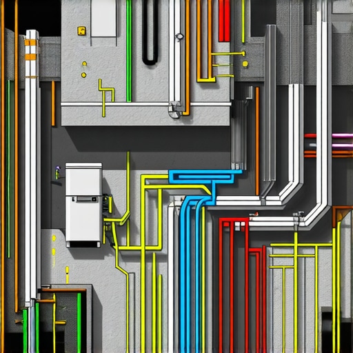
Image prompt: High-resolution illustration of a borehole in dense urban environment showing sensor arrays and geostatistical overlays, highlighting advanced data collection techniques.
Bridging Technology Gaps with Customized Solutions
One size rarely fits all when it comes to underground utility mapping. Addressing unique challenges posed by specific urban contexts demands tailored instrument configurations and process workflows. Collaborations between equipment manufacturers and site engineers result in bespoke toolsets optimized for distinct soil compositions, utility congestion levels, and regulatory standards. Implementing modular sensor suites and flexible data acquisition protocols allows for adaptability, leading to increased accuracy and operational efficiency in complex conditions.
How does Integrating Data from Multiple Acquisition Modes Revolutionize Utility Detection?
This question highlights the burgeoning field of multi-modal data fusion in underground mapping. Combining seismic, electromagnetic, and acoustic data acquired through synchronized sensors yields a multi-faceted view of subsurface anomalies. Fusion algorithms synthesize these datasets, improving the resolution of utility locations and reducing false positives. Literature from the International Society of Excavation and Trenching (ISET) demonstrates that such integrated approaches vastly outperform single-method surveys, particularly in congested urban landscapes where precision is paramount. Adopting these techniques requires expertise in data science and geophysics, emphasizing the need for specialized training and continuous learning.
Harnessing Subsurface Data Fusion for Hyper-Accurate Utility Detecting
Emerging sophisticated data fusion techniques amalgamate electromagnetic, seismic, and acoustic signals, creating multidimensional subsurface models. This integration enables precise localization of utilities, even amidst high-density congestion. Recent studies emphasize that multi-modal data synergization not only improves detection accuracy but also accelerates survey timelines, critical for urban planning under tight regulatory constraints.
How Can Machine Learning Elevate Borehole Trajectory Precision?
Advanced algorithms analyze real-time sensor inputs to predict potential deviations proactively. These AI-driven adjustments optimize drilling parameters such as bit rotation and mud flow, significantly reducing borehole deviation—especially in heterogeneous soil conditions typical of complex urban landscapes. Leveraging machine learning thus transforms reactive operations into anticipatory, highly controlled processes.
What are the Top Innovations in Soil Stabilization for Deep Urban Boreholes?
Innovative chemically reactive grout formulations and geo-synthetic stabilization mats have emerged as game changers. Such materials facilitate boreholes in unstable soils like sandy or clay-rich substrates, preventing collapse and ensuring data fidelity at greater depths. Integrating geotechnical analytics with real-time monitoring allows practitioners to tailor stabilization strategies dynamically, boosting confidence in subterranean mapping accuracy.

Image prompt: Cross-sectional visualization of underground soil layers with embedded sensor arrays, highlighting data fusion channels in urban utility mapping.
Breaking Barriers with Adaptive Vacuum Excavation Tactics
Beyond basic airflow adjustments, deploying variable-pressure nozzles and real-time hose integrity sensors elevates safety margins. Such innovations minimize utility line strikes and dust dispersion while maintaining efficient excavation rates. Adaptive tactics informed by sensor feedback optimize both safety and operational speed, critical in congested urban corridors with sensitive infrastructure.
Are Precision Calibration Protocols the Unsung Heroes of Data Reliability?
Dynamic calibration techniques, synchronized with changing subsurface conditions, are revolutionizing data confidence levels. Incorporating multi-sensor calibration rigs that automatically adjust measurement baselines ensures sensor readings remain accurate over prolonged operations. This approach effectively mitigates errors caused by thermal variances, sensor drift, and environmental factors common in dense city environments.
In What Ways Do Expert Collaborations Drive Custom Solutions for Urban Borehole Challenges?
Close cooperation between geotechnical engineers, equipment manufacturers, and urban planners spurs innovative, customized toolsets. By customizing sensor suites, drill bits, and stabilization agents based on thorough site assessments, teams develop tailored solutions that enhance data accuracy and drilling efficiency. Such bespoke strategies are increasingly vital for projects with stringent regulatory and safety standards, positioning experts at the forefront of underground utility innovation.
Expert Insights & Advanced Considerations
Prioritize Sensor Integration for Real-Time Accuracy
In complex urban environments, integrating high-precision sensors with adaptive drilling algorithms ensures immediate detection of subsurface anomalies, minimizing deviations and enhancing data fidelity. This approach elevates the precision of utility mapping, reducing costly line strikes and safety risks.
Embrace Multi-Modal Data Fusion for Comprehensive Detection
Combining electromagnetic, seismic, and acoustic data streams through advanced fusion algorithms creates a multidimensional view of underground assets. Such synergy significantly outperforms single-method surveys, especially in congested zones, leading to faster, more reliable utility identification.
Leverage Customized Solutions to Overcome Site-Specific Challenges
Collaborating with equipment manufacturers to develop bespoke tools—such as specialized drill bits and sensor suites—addresses unique soil conditions and utility congestion, ensuring operational efficiency and mapping accuracy in diverse urban settings.
Implement Automated Calibration for Consistent Data Quality
Dynamic calibration protocols that adjust to temperature fluctuations and environmental factors maintain sensor accuracy throughout extended operations, crucial for maintaining high data integrity in fluctuating subsurface conditions.
Integrate Data from Multiple Acquisition Techniques
Employing synchronized seismic, electromagnetic, and acoustic sensors generates a comprehensive subsurface profile. Data fusion from these modalities improves utility detection resolution and reduces false positives, streamlining urban planning processes.